

Adina Sommer
Antique and Contemporary Art
Winzerer Str. 154
80797 München
telephone
+49 89 304714
business hours:
by appointment
Email
![]()


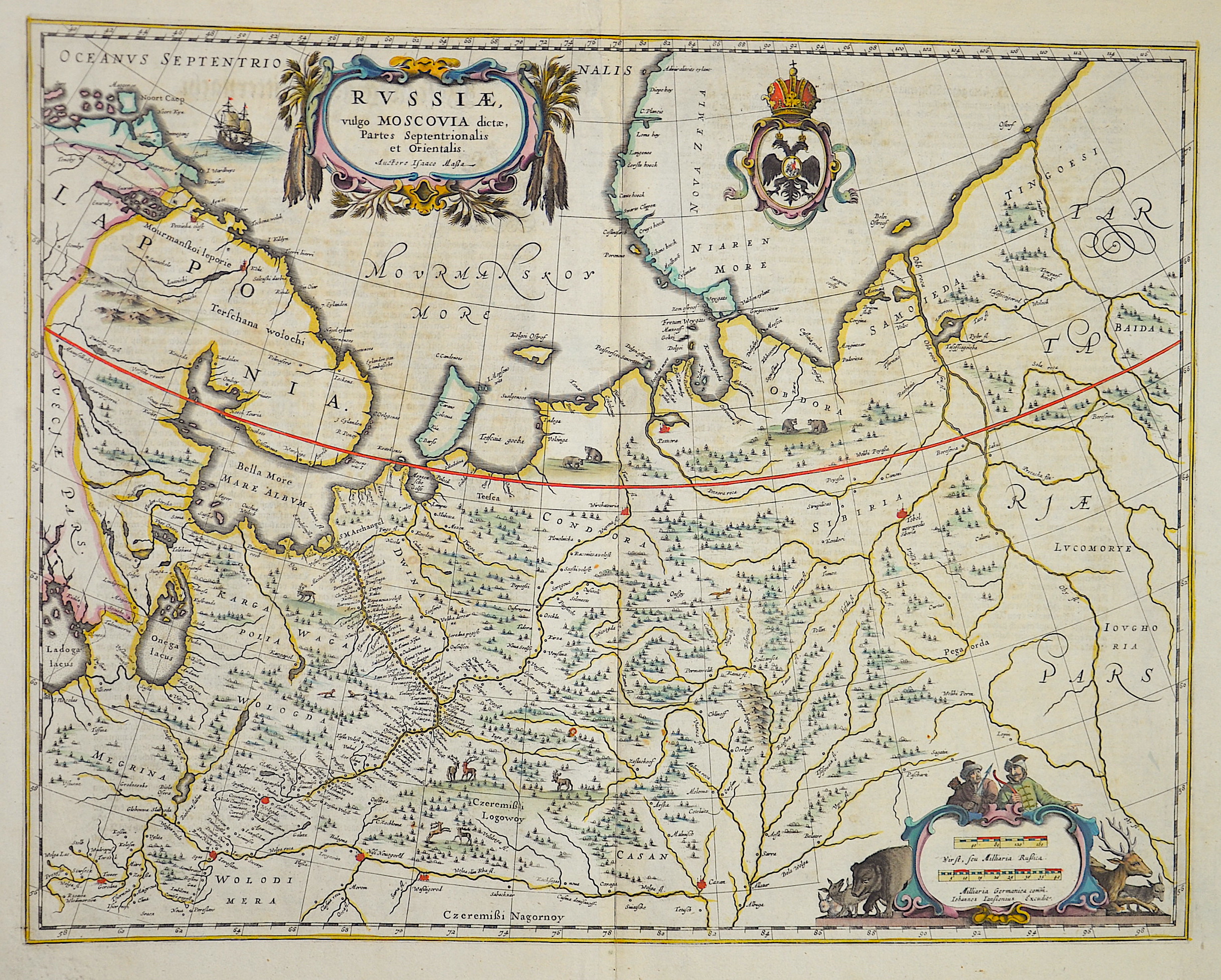
Russiae vulgo Moscovia dictae, Partes Septentrionalis et Orientalis

| Article ID | EUO1342 |
Title | Russiae vulgo Moscovia dictae, Partes Septentrionalis et Orientalis |
Description | Map shows the north west part of Russia with partly Lapland. |
| Year | ca. 1653 |
Artist | Janssonius (1588-1664) |
Johannes Janssonius (Jansson)( 1588- 1664) Amsterdam, was born in Arnhem, the son of Jan Janszoon the Elder, a publisher and bookseller. In 1612 he married Elisabeth de Hondt, the daughter of Jodocus Hondius. He produced his first maps in 1616 of France and Italy. In 1623 Janssonius owned a bookstore in Frankfurt am Main, later also in Danzig, Stockholm, Copenhagen, Berlin, Königsberg, Geneva and Lyon. In the 1630s he formed a partnership with his brother in law Henricus Hondius, and together they published atlases as Mercator/Hondius/Janssonius. Under the leadership of Janssonius the Hondius Atlas was steadily enlarged. Renamed Atlas Novus, it had three volumes in 1638, one fully dedicated to Italy. 1646 a fourth volume came out with ""English County Maps"", a year after a similar issue by Willem Blaeu. Janssonius' maps are similar to those of Blaeu, and he is often accused of copying from his rival, but many of his maps predate those of Blaeu and/or covered different regions. By 1660, at which point the atlas bore the appropriate name ""Atlas Major"", there were 11 volumes, containing the work of about a hundred credited authors and engravers. It included a description of ""most of the cities of the world"" (Townatlas), of the waterworld (Atlas Maritimus in 33 maps), and of the Ancient World (60 maps). The eleventh volume was the Atlas of the Heavens by Andreas Cellarius. Editions were printed in Dutch, Latin, French, and a few times in German. | |
Historical Description | The Eastern European Plain occupies most of European Russia. It consists of wide lowlands interrupted by weakly indented ridges. Only a few elevations reach heights of more than 300 m. In Karelia and on the Kola Peninsula, which geologically belong to the Baltic Shield, the relief is more differentiated in the north. There, in the Chibines of the central Kola Peninsula, a maximum height of 1191 m is reached. In the south, the East European lowlands merge into the Caspian depression, which lies below sea level. During the last ice age a chain of terminal moraines was formed, which runs from the border area with Belarus eastward and north of Moscow to the Arctic coast west of the Pechora River. The region north of it consists of many lakes and swamps. The European part of the territory is much more densely populated and urbanized than the Asian part, which is over three times larger. The capital, Moscow, is one of the largest cities and metropolitan areas in the world. The second most important center is Saint Petersburg, which was the capital from 1712 to 1918 and is today an important cultural center. The next largest cities with over a million inhabitants are Novosibirsk, Yekaterinburg, Kazan and Nizhny Novgorod. In the European part of Russia, the most important river is the Volga. It is the longest river in Europe and runs exclusively through Russia. Together with its two tributaries Kama and Oka, it drains a large part of the East European Plain after 3534 km to the Caspian Sea in the southeast. As a waterway, the Volga has special significance, as it connects Eastern Europe with Central Asia. |
| Place of Publication | Amsterdam |
| Dimensions (cm) | 42 x 54 cm |
| Condition | Very good |
| Coloring | original colored |
| Technique | Copper print |