

Adina Sommer
Antique and Contemporary Art
Winzerer Str. 154
80797 München
telephone
+49 89 304714
business hours:
by appointment
Email
![]()


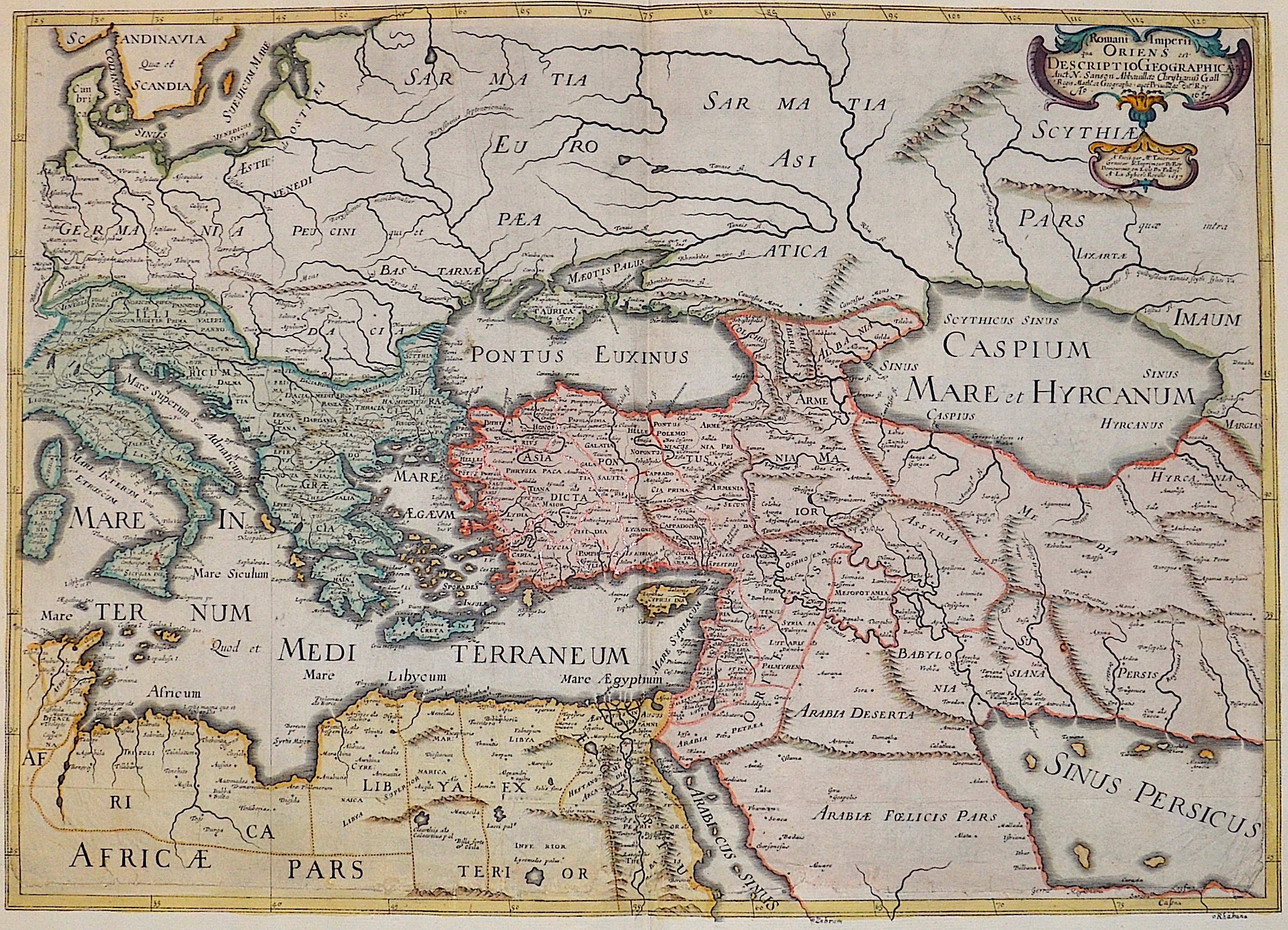
Romani Imperii qua Oriens est Descriptio Geographica.

| Article ID | AST1003 |
Title | Romani Imperii qua Oriens est Descriptio Geographica. |
Description | Maps hows the eastern part of the Roman Empire with Turkey, Hollyland, Greece, Italy, Egypt, Lybia etc., the Blacksea and the Caspain sea. |
| Year | dated 1637 |
Artist | Sanson (1600-1667) |
Nicolas Sanson (1600–1667) was a French cartographer, termed by some the creator of French geography, in which he's been called the father of French cartography. Active from 1627, Sanson issued his first map of importance, the ""Postes de France"", which was published by Melchior Tavernier in 1632. After publishing several general atlases himself he became the associate of Pierre Mariette, a publisher of prints. In 1647 Sanson accused the Jesuit Philippe Labbe of plagiarizing him in his Pharus Galliae Antiquae; in 1648 he lost his eldest son Nicolas, killed during the Fronde. Among the friends of his later years was the great Condé. He died in Paris on 7 July 1667. Two younger sons, Adrien (d. 1708) and Guillaume (d. 1703), succeeded him as geographers to the king. In 1692 Hubert Jaillot collected Sanson's maps in an Atlas nouveau. See also the 18th century editions of some of Sanson's works on Delamarche under the titles of Atlas de géographie ancienne and Atlas britannique; and the Catalogue des cartes et livres de géographie de Sanson (1702). | |
Historical Description | The area of today's Turkey has been populated since the Paleolithic. The name of the Turks comes from Central Asia. The immigrants from whom Turkey got its name were the Oghusen and came from the area around the Aral Sea. The Turkish settlement of Anatolia began with the arrival of the Seljuks in the 11th century AD. Around 1299, Osman I, Gazi (1259–1326) founded the Ottoman dynasty named after him, from which the name of the Ottoman Empire (also called the Turkish Empire) ) derives. After the conquest of Constantinople in 1453, the Ottomans ruled over large parts of the Middle East, North Africa, the Crimea, the Caucasus and the Balkans. After the expansion of the Ottoman Empire into Europe was brought to a standstill near Vienna and the Ottoman army was defeated there on Kahlenberg in 1683, the empire was pushed back further and further from its European territories to the tip west of the Marmara Sea, between Istanbul and Edirne. The national movements that emerged from the 19th century onwards led to a gradual fragmentation of the empire, the occupation of Turkish North Africa by European powers and finally the defeat in the First World War resulted in its ultimate decline. |
| Place of Publication | Paris |
| Dimensions (cm) | 39,5 x 55 |
| Condition | Margins replaced, missing parts upper, right and left side replaced. |
| Coloring | colored |
| Technique | Copper print |