

Adina Sommer
Antique and Contemporary Art
Winzerer Str. 154
80797 München
telephone
+49 89 304714
business hours:
by appointment
Email
![]()


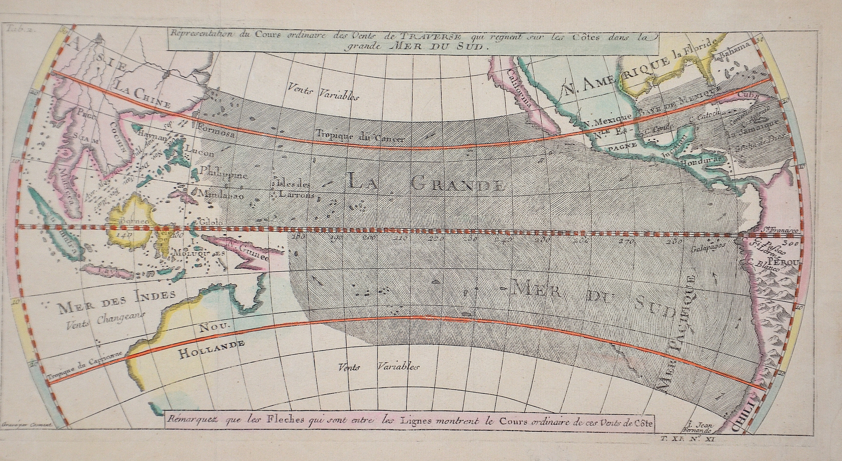
Répresentation du Cours ordinaire des Vents de Traverse qui regnent sur les Cotes dans la grande Mer du Sud

| Article ID | SE00312 |
Title | Répresentation du Cours ordinaire des Vents de Traverse qui regnent sur les Cotes dans la grande Mer du Sud |
Description | Large nautical chart of the entire Pacific with North, Central and South America. Japan, Southeast Asia and Australia. Australia was not completely surveyed at the time, so the coasts to the east are missing. |
| Year | ca. 1790 |
Artist | Bellin (1703-1772) |
Jacques-Nicolas Bellin (1703 Paris -1772 Versailles) was a French cartographer, engineer-geographer, marine hydrographer. As a contributor to the Encyclopédie, he wrote more than a thousand articles on maritime topics. As a cartographer, Bellin distinguished himself primarily in the field of sea cartography. From 1721 he worked for the Dépot des Cartes et Plans de la Marine, from 1741 until his death as an engineer-hydrograph of the Navy. In 1753 his atlas Neptune français, which covered all the coasts of France, was published, and in 1756 the hydrography françoise covering all seas of the earth. In 1764 the five-volume Petit Atlas maritime was published, which Bellin prepared on the orders of the Minister of the Navy, Choiseul. In addition, he wrote a number of geographical works and with Nouvelle méthode pour apprendre la geographie (1769) a geographic textbook for teaching. His maps illustrated, among other things, Bougainville's work Voyage autour du monde, published in 1771. As a co-author of the Encyclopédie edited by Diderot and d'Alembert, Bellin wrote more than a thousand articles in the field of shipping and navy. | |
Historical Description | The Pacific Ocean is the largest and deepest of Earth's oceanic divisions. Though the peoples of Asia and Oceania have traveled the Pacific Ocean since prehistoric times, the eastern Pacific was first sighted by Europeans in the early 16th century when Spanish explorer Vasco Núñez de Balboa crossed the Isthmus of Panama in 1513 and discovered the great "southern sea" which he named Mar del Sur (in Spanish). In 1519, Portuguese explorer Ferdinand Magellan sailed the Pacific East to West on a Spanish expedition to the Spice Islands that would eventually result in the first world circumnavigation. Magellan called the ocean Pacífico (or "Pacific" meaning, "peaceful") because, after sailing through the stormy seas off Cape Horn, the expedition found calm waters. The ocean was often called the Sea of Magellan in his honor until the eighteenth century. |
| Place of Publication | Paris |
| Dimensions (cm) | 15 x 30 cm |
| Condition | Perfect condition |
| Coloring | colored |
| Technique | Copper print |