

Adina Sommer
Antique and Contemporary Art
Winzerer Str. 154
80797 München
telephone
+49 89 304714
business hours:
by appointment
Email
![]()


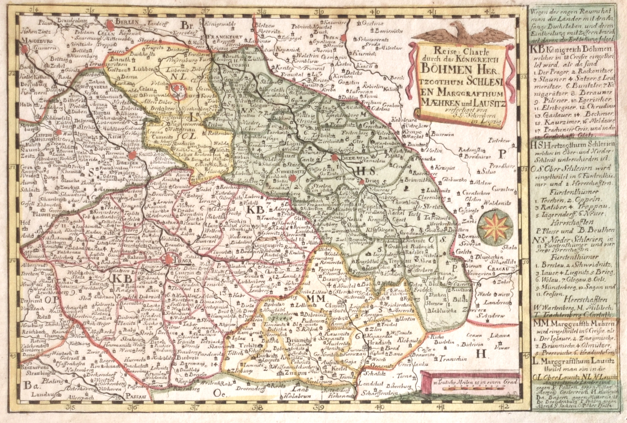
Reise-Carte durch das Königreich Böhmen Herzogthum Schlesien Marggrafthum Maehren und Lausitz

| Article ID | EUT4095 |
Title | Reise-Carte durch das Königreich Böhmen Herzogthum Schlesien Marggrafthum Maehren und Lausitz |
Description | Map shows Bohemia, Silesia, Maehren, Lausitz and the pricipality Teschen. Decorative and detailed map with a title cartouche and Index. It shows the cities Olmütz, Hradisch, Breslau, Żagań (dt. Sagan), Swidnica (dt. Schweidnitz) etc. |
| Year | ca. 1700 |
Artist | Schreiber (1676-1750) |
Johann George Schreiber (1676 - 1750) Leipzig. He was a german carthographer, mapmaker, printer and publisher. He was the first german carthographer who issued a map of Saxonia. | |
Historical Description | Bohemia is the westernmost and largest historical region of the Czech lands in the present-day Czech Republic. In a broader meaning, Bohemia sometimes refers to the entire Czech territory, including Moravia and Czech Silesia, especially in a historical context, such as the Lands of the Bohemian Crown ruled by Bohemian kings. Bohemia was a duchy of Great Moravia, later an independent principality, a kingdom in the Holy Roman Empire, and subsequently a part of the Habsburg Monarchy and the Austrian Empire. After World War I and the establishment of an independent Czechoslovak state, Bohemia became a part of Czechoslovakia. Between 1938 and 1945, border regions with sizeable German-speaking minorities of all three Czech lands were joined to Nazi Germany as the Sudetenland. |
| Place of Publication | Leipzig |
| Dimensions (cm) | 17 x 25,5 |
| Condition | Perfect condition |
| Coloring | original colored |
| Technique | Copper print |