

Adina Sommer
Antique and Contemporary Art
Winzerer Str. 154
80797 München
telephone
+49 89 304714
business hours:
by appointment
Email
![]()


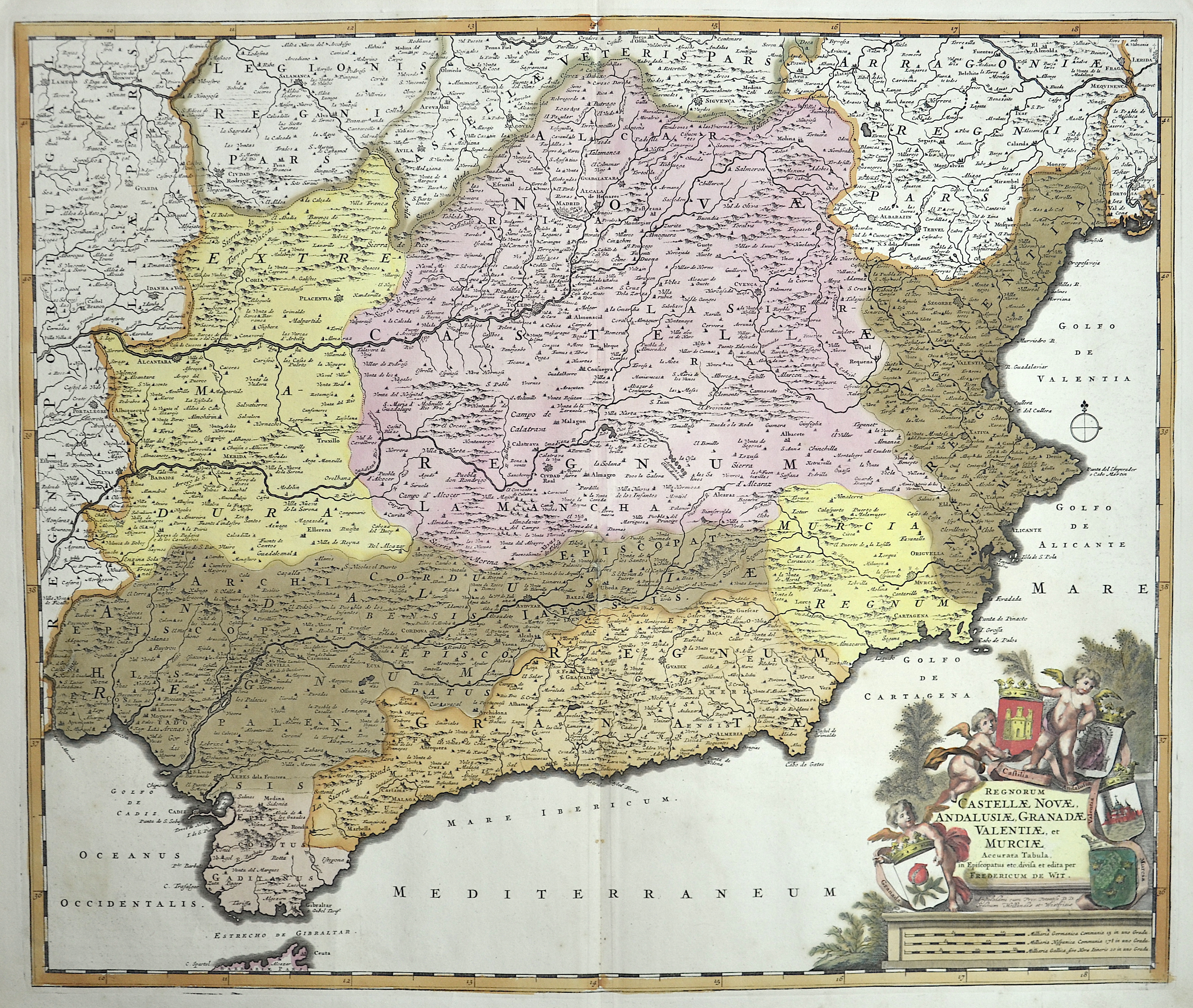
Regnorum Castellae Novae, Andalusiae, Granadae Valentiae, et Murciae

| Article ID | EUE4468 |
Title | Regnorum Castellae Novae, Andalusiae, Granadae Valentiae, et Murciae |
Description | MVery decorative map shows southern Spain with the whole of Andalusia, Castile, Granada, Valentia, Murcia and Gibraltar. Furthermore, a splendid title cartouche decorated with the corresponding coats of arms held by three putti. In prehistoric and early historical times, Iberians, Celts and Basques settled on the Iberian Peninsula, named after the former. In the 11th century BC, the Phoenicians settled on the south coast; the most famous of their colonies was Cádiz. |
| Year | ca. 1690 |
Artist | Wit, de (1610-1698) |
Frederik de Wit (1610 – 1698). His Atlas began to appear around 1662 and by 1671 included anywhere from 17 to 151 maps each. In the 1690s he began to use a new title page "Atlas Maior" but continued to use his old title page. His atlas of the Low Countries first published in 1667,was named Nieuw Kaertboeck van de XVII Nederlandse Provinciën and contained 14 to 25 maps. Frederik de Wit quickly expanded upon his first small folio atlas which contained mostly maps printed from plates that he had acquired, to an atlas with 27 maps engraved by or for him. By 1671 he was publishing a large folio atlas with as many as 100 maps. Smaller atlases of 17 or 27 or 51 maps could still be purchased and by the mid-1670s an atlas of as many as 151 maps and charts could be purchased from his shop. In ca.1675 Frederik de Wit released a new nautical atlas. The charts in this atlas replaced the earlier charts from 1664 that are known today in only four bound examples and a few loose copies. Frederik de Wit new charts were sold in a chart book and as part of his atlases. Frederik de Wit published no fewer than 158 land maps and 43 charts on separate folio sheets. In 1695 Frederik de Wit began to publish a town atlas of the Netherlands after he acquired a large number of city plans at the auction of the famous Blaeu publishing firm’s printing plates. Dating Frederik de Wit atlases is considered difficult because usually no dates were recorded on the maps and their dates of publication extended over many years. | |
Historical Description | In the early 8th century, the Moors destroyed the Visigoth Empire and conquered the entire Iberian Peninsula. Their centuries of rule shaped the country. The Arabic heritage was reflected in both the architecture and the language. However, the Moors were unable to establish themselves permanently in the northern outskirts of the peninsula. From there the "Reconquest" (Reconquista) started. In this process, which spanned several centuries (722–1492) and was not continuous, the Muslim empires were gradually pushed back by the Christian empires until the fall of Granada in 1492, the last Moorish state structure on the peninsula also disappeared. In the 15th century, the kingdoms of Castile and Aragon were united. Aragon was an important maritime power in the Mediterranean at that time. The Spanish colonial empire extended around 1600 across large parts of South and Central America, the southern part of today's USA and the Philippines. As the English and French also intensified their colonial efforts, Spain gradually lost its supremacy. The liberation wars of the American states, particularly the Mexican and South American wars of independence in the early 19th century, brought independence to most of the colonies. In 1898, the last major properties were lost to the United States during the Spanish-American War, which meant the end of the colonial empire. The African colonies that followed later (Spanish-Morocco, Spanish-Sahara and Equatorial Guinea) finally became independent in the 20th century. |
| Place of Publication | Amsterdam |
| Dimensions (cm) | 49,5 x 59 cm |
| Condition | old coloring deposited |
| Coloring | original colored |
| Technique | Copper print |