

Adina Sommer
Antique and Contemporary Art
Winzerer Str. 154
80797 München
telephone
+49 89 304714
business hours:
by appointment
Email
![]()


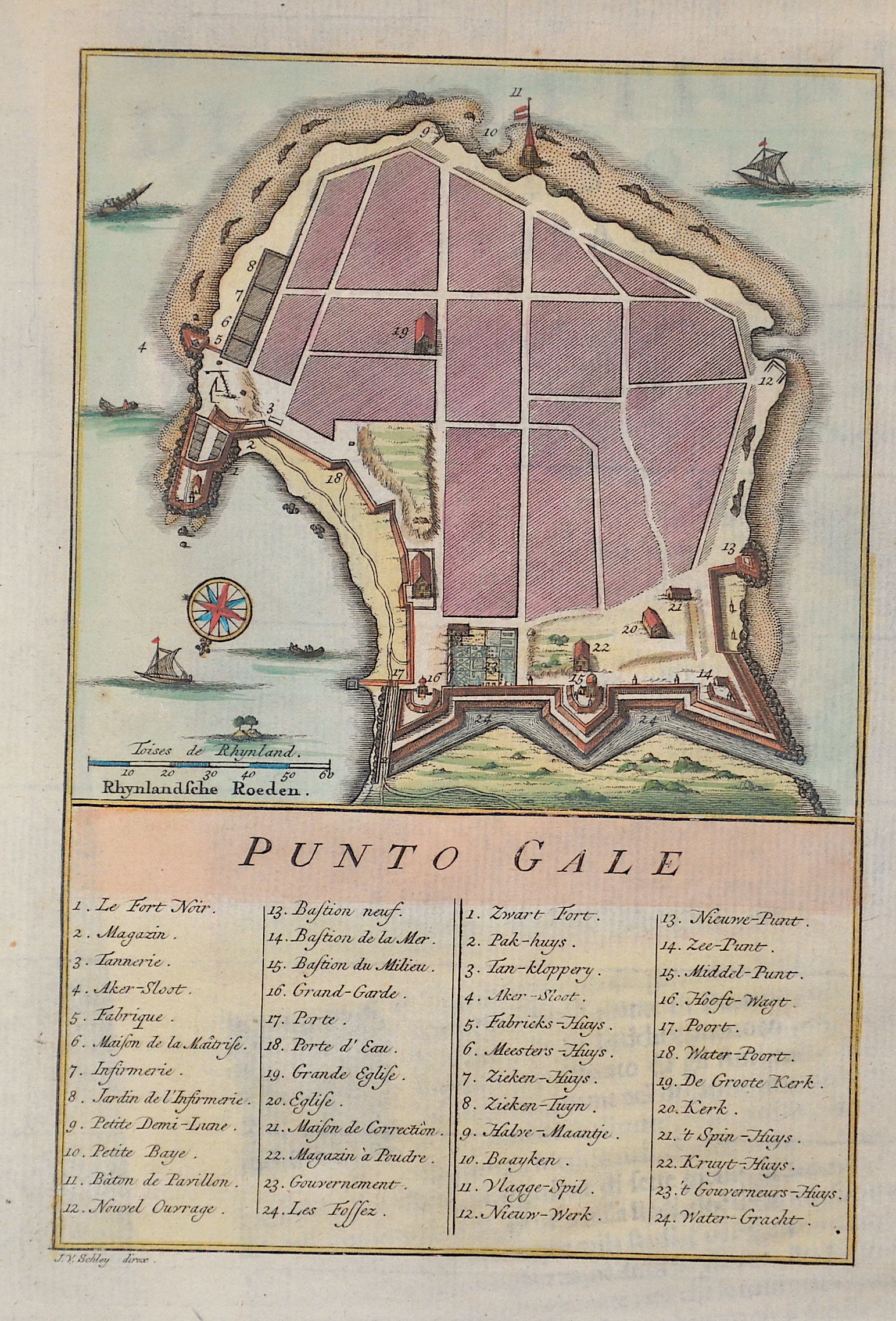
Punto Gale

| Article ID | ASI1338 |
Title | Punto Gale |
Description | City map of Galle on Sri Lanka (Ceylon) with index, a compass rose and ship's staffages. |
| Year | ca. 1770 |
Artist | Bellin (1703-1772) |
Jacques-Nicolas Bellin (1703 Paris -1772 Versailles) was a French cartographer, engineer-geographer, marine hydrographer. As a contributor to the Encyclopédie, he wrote more than a thousand articles on maritime topics. As a cartographer, Bellin distinguished himself primarily in the field of sea cartography. From 1721 he worked for the Dépot des Cartes et Plans de la Marine, from 1741 until his death as an engineer-hydrograph of the Navy. In 1753 his atlas Neptune français, which covered all the coasts of France, was published, and in 1756 the hydrography françoise covering all seas of the earth. In 1764 the five-volume Petit Atlas maritime was published, which Bellin prepared on the orders of the Minister of the Navy, Choiseul. In addition, he wrote a number of geographical works and with Nouvelle méthode pour apprendre la geographie (1769) a geographic textbook for teaching. His maps illustrated, among other things, Bougainville's work Voyage autour du monde, published in 1771. As a co-author of the Encyclopédie edited by Diderot and d'Alembert, Bellin wrote more than a thousand articles in the field of shipping and navy. | |
Historical Description | Galle is a major city in Sri Lanka, it was known as Gimhathiththa before the arrival of the Portuguese in the 16th century, when it was the main port on the island. Galle had been a prominent seaport long before western rule in the country. Persians, Arabs, Greeks, Romans, Malays, Indians, and Chinese were doing business through Galle port. In 1640, the Portuguese were forced to surrender to the Dutch East India Company. The Dutch built the present fort in 1663. They built a fortified solid granite wall and three bastions, known as -Sun,Moon and Star-.After the British took over the country from the Dutch in 1796, the British preserved the fort unchanged and used it as the administrative centre of the district. |
| Place of Publication | Paris |
| Dimensions (cm) | 20 x 13 cm |
| Condition | Perfect condition |
| Coloring | colored |
| Technique | Copper print |
Reproduction:
16.50 €
( A reproduction can be ordered individually on request. )