

Adina Sommer
Antique and Contemporary Art
Winzerer Str. 154
80797 München
telephone
+49 89 304714
business hours:
by appointment
Email
![]()


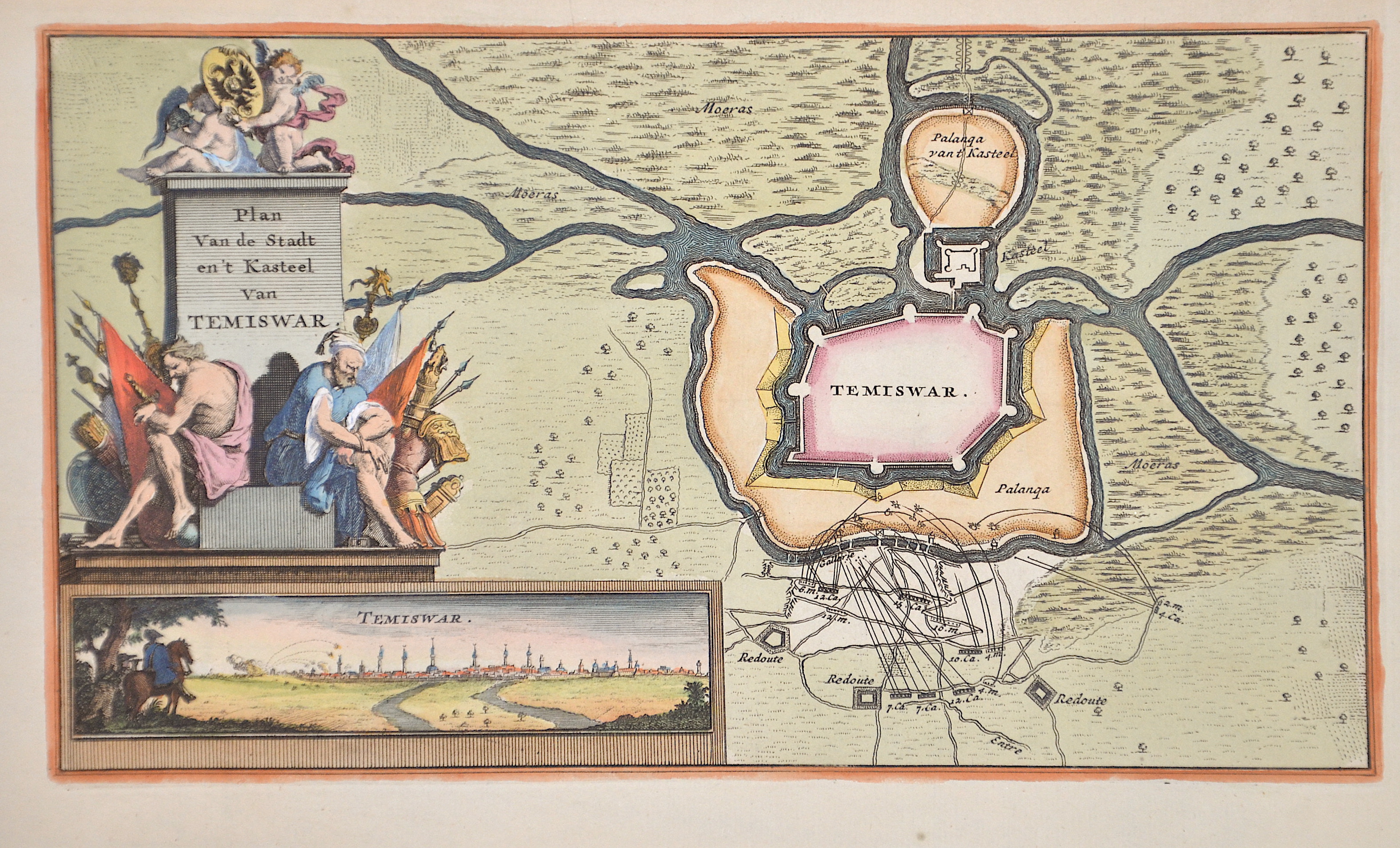
Plan Van de Stadt en’t Kasteel van Temiswar.

| Article ID | EUR4618 |
Title | Plan Van de Stadt en’t Kasteel van Temiswar. |
Description | Map shows a plan of the city of Temiswar in Romania with a general view and a magnificent title cartouche. |
| Year | ca. 1680 |
Artist | Feuille, de la (1640-1709) |
Daniel de la Feulle was a French engraver, bookseller and cartographer. His family exiled to Amsterdam in 1683 on religious grounds. | |
Historical Description | In 1552, a 16,000-strong Ottoman army led by Kara Ahmed Pasha conquered the city and transformed it into a capital city in the region (Temeşvar Eyalet). The local military commander, István Losonczy, and other Christians were massacred on 27 July 1552 while escaping the city through the Azapilor Gate. Timișoara remained under Ottoman rule for nearly 160 years, controlled directly by the Sultan and enjoying a special status, similar to other cities in the region such as Budapest and Belgrade. During this period, Timișoara was home to a large Islamic community and produced famous historical figures such as Osman Aga of Temesvar, until Prince Eugene of Savoy conquered it in 1716. Subsequently, the city came under Habsburg rule, and it remained so until the early 20th century, except for the Ottoman occupation between 1788–1789 during the Ottoman-Habsburg war. The city was defortified starting in 1892 up until 1910 and several major road arteries were built to connect the suburbs with the city centre, paving the way for further expansion of the city. |
| Place of Publication | Amsterdam |
| Dimensions (cm) | 15 x 26 cm |
| Condition | Perfect condition |
| Coloring | original colored |
| Technique | Copper print |