

Adina Sommer
Antique and Contemporary Art
Winzerer Str. 154
80797 München
telephone
+49 89 304714
business hours:
by appointment
Email
![]()


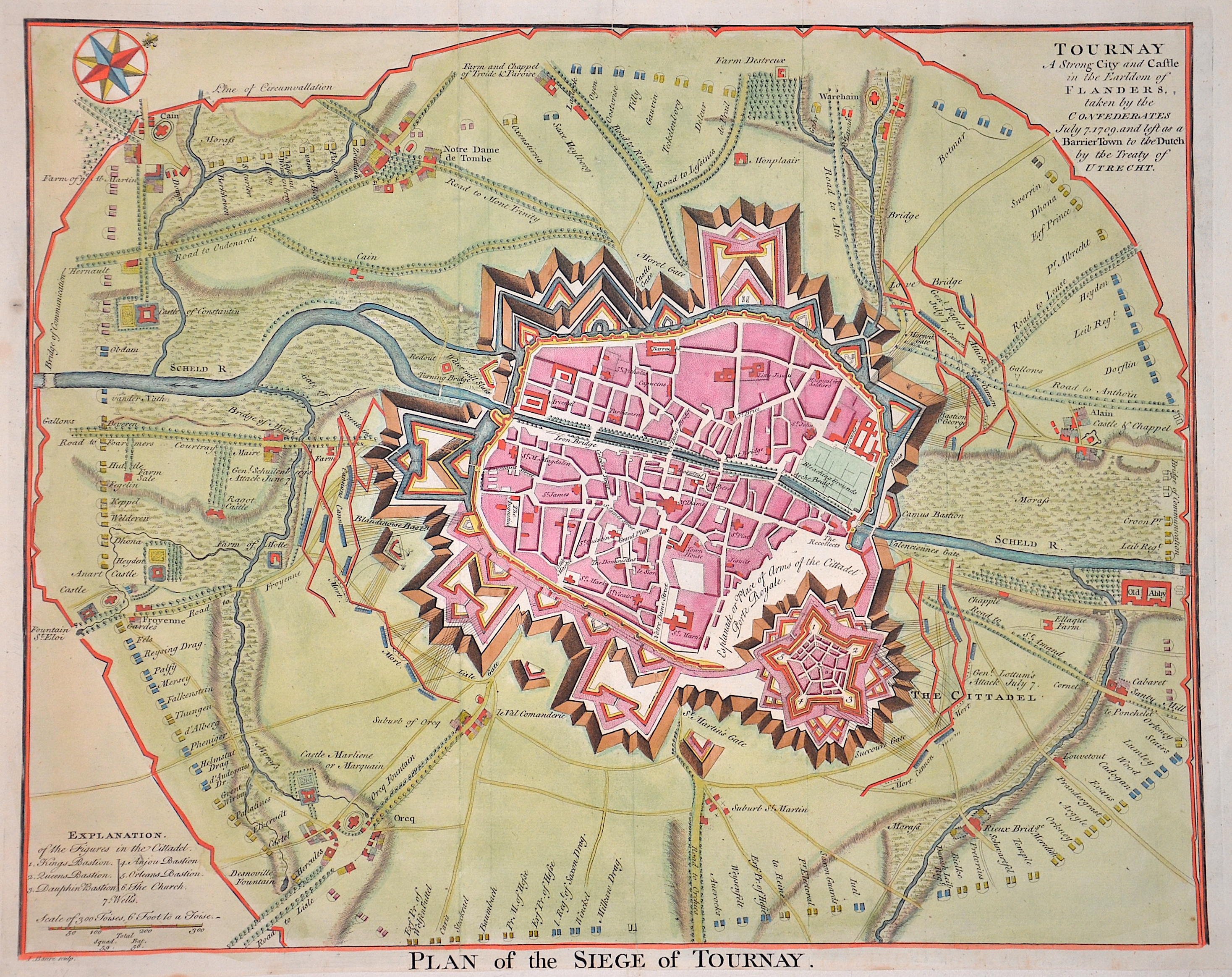
Plan of the Siege of Tournay.

| Article ID | EUB5288 |
Title | Plan of the Siege of Tournay. |
Description | Detailed plan of the siege of Tournay in Belgium with index and compass rose. From ‘For Mr Tindal`s continuation of Mr Rapin`s history of England o. J.’ |
| Year | ca. 1750 |
Artist | Basire (1704-1768) |
Isaac Basire (1704 – 1768) was an engraver and first in a family line of prolific and well-respected engravers. Isaac Basire was known as a map engraver. His most well-known work is the frontispiece to an edition of Bailey's dictionary (1755). | |
Historical Description | Tournai lies on the site of the Roman Turnacum, which was the capital (civitas) of the Menapians from the time of Diocletian as the successor to Castellum Menapiorum. After Tongern, it is the oldest town in Belgium. In the 1950s, the north of Gaul was expanded under Emperor Claudius and the border to Germania was militarily secured. A Roman military camp was built on the site of a vicus at the ford over the Scheldt, where important trade routes crossed and, above all, the connection between Boulogne-sur-Mer and Cologne, which was developed into a fortified Roman road, crossed the Scheldt. This road is known in Belgium as the Chaussée Brunehaut and has recently been renamed the Via Belgica in Germany. The fortifications subsequently proved to be too weak, and in the second century the Chauks plundered the city, followed by the Franks and Alemanni in the third century. The Vandals attacked and plundered the Roman camp and vicus in 406, bringing the Roman period in Tournai to an end. After the Battle of Guinegate, the town was besieged by the English and had to capitulate in 1513. In 1521, the city came into the possession of the Habsburgs and remained with the Spanish Netherlands even after the independence of the Republic of the Seven United Provinces. From 1714, it belonged to the Austrian Netherlands. The Netherlands was conquered by French revolutionary troops in 1794/January 1795; Hainaut and Tournai belonged to the French département of Jemappes from 1795 to 1814. From 181The Netherlands was conquered by French revolutionary troops in 1794/January 1795. Hainaut with Tournai belonged to the French département of Jemappes from 1795 to 1814. From 1815 to 1830 (Belgian independence), the area belonged to the Kingdom of the United Netherlands. |
| Place of Publication | London |
| Dimensions (cm) | 38,5 x 47,5 cm |
| Condition | Lower margin enlarged |
| Coloring | original colored |
| Technique | Copper print |