

Adina Sommer
Antique and Contemporary Art
Winzerer Str. 154
80797 München
telephone
+49 89 304714
business hours:
by appointment
Email
![]()


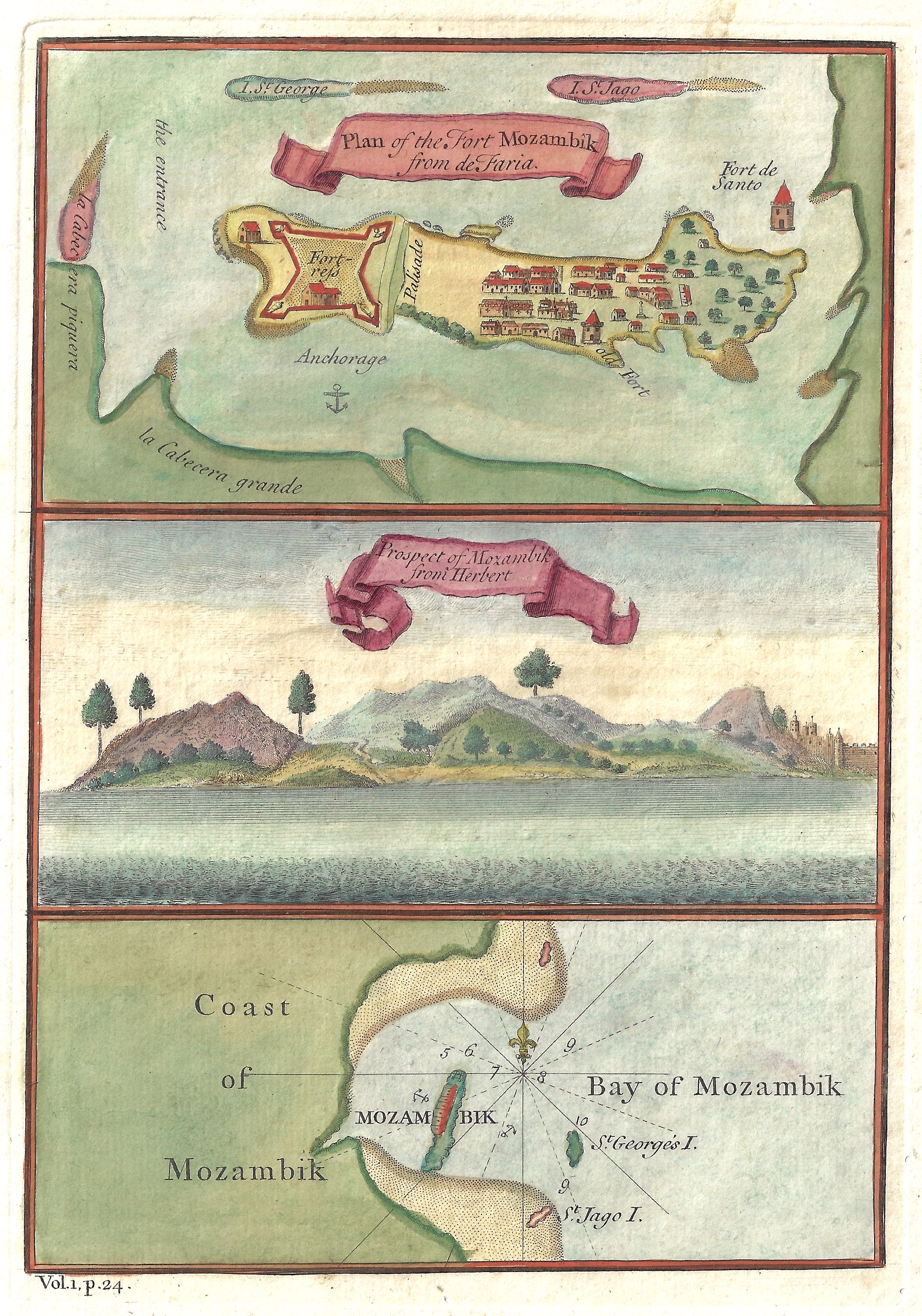
Plan of the Fort Mozambik from de Faria. Prospect of Mozambik Froni Herbert

| Article ID | AF0438 |
Title | Plan of the Fort Mozambik from de Faria. Prospect of Mozambik Froni Herbert |
Description | Detailed map of the island Illha de Mosambique. 3 maps on one sheet showing: 1. The fortress São Sebastião at the northe end of the island. 2. View of the island Illha de Mosambique. 3. Bay of the city Lumbo in the proivince of Nampula. |
| Year | ca. 1745 |
Artist | Anonymus |
Historical Description | Before the great exploratory trips by the Europeans, Arabs had ruled the coast off Africa for centuries. They traded between Africa, the Orient and India in gold, ivory and African slaves. The first Portuguese to land in Sofala in 1497 was Pedro da Covilhã, who was commissioned by the Portuguese king to explore the sea route from Arabia to East Africa. In 1498 Vasco da Gama reached Mozambique on the way to India: On the island of Mozambique he met Sheikh Moussa Ben Mbiki, from whom the name Mozambique is derived. The Portuguese then seized these trading centers and penetrated inland along the Zambezi in search of gold. For centuries the Portuguese were content with trading slaves and cared little about the population. Their rule lasted into the 20th century, and living conditions in the colonies deteriorated considerably as a result of forced labor, exploitative employment contracts and reckless treatment. Until 1898, the city of Ilha de Moçambique was the country's capital. She also gave the country its name. |
| Place of Publication | Paris |
| Dimensions (cm) | 21,5 x 15 cm |
| Condition | Perfect condition |
| Coloring | original colored |
| Technique | Copper print |