

Adina Sommer
Antique and Contemporary Art
Winzerer Str. 154
80797 München
telephone
+49 89 304714
business hours:
by appointment
Email
![]()


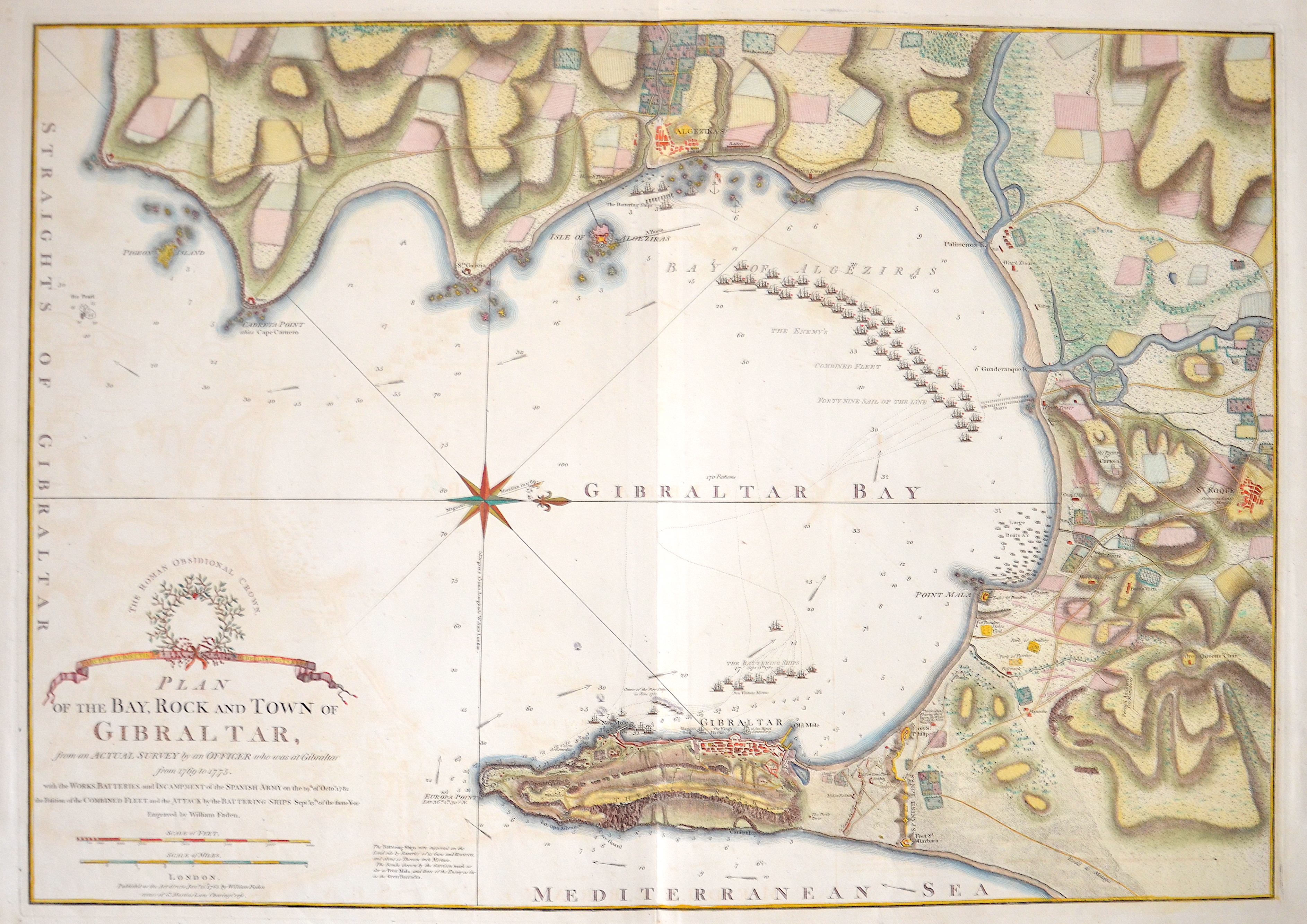
Plan of the Bay, Rock and Town of Gibraltar, from an Actual Survey by an Officer who was at Gibraltar from 1769 to 1775.

| Article ID | EUE4380 |
Title | Plan of the Bay, Rock and Town of Gibraltar, from an Actual Survey by an Officer who was at Gibraltar from 1769 to 1775. |
Description | Map shows the Bay of Gibraltar, the city of Gibraltar and the coast with upstream sailing ships and a wind rose. |
| Year | c. 1783 |
Artist | Faden (1749-1836) |
William Faden (1749 – 1836) was an English cartographer and a publisher of maps. He was the royal geographer to King George III. He replaced Thomas Jeffreys in that role.The title of -geographer to the king- was given to various people in the 18th century, including John Senex, Herman Moll, Emmanuel Bowen and Thomas Jeffreys. All of these men, including William Faden, were engravers and publishers, not scholars or academics. Their part was to publish and supply maps to the crown and parliament. William Faden printed the North American Atlas in 1777, and ""...it became the most important atlas chronicling the Revolution's battles."" There were 29 maps in the atlas, and they included detailed battle maps drawn by eyewitnesses. | |
Historical Description | Gibraltar is a British Overseas Territory located on the southern end of the Iberian Peninsula. In 1704, during the War of the Spanish Succession, a combined Anglo-Dutch fleet, representing the Grand Alliance, captured the town of Gibraltar on behalf of the Archduke Charles of Austria in his campaign to become King of Spain. The occupation of the town by Alliance forces caused the exodus of the population to the surrounding area of the Campo de Gibraltar.As the Alliance's campaign faltered, the 1713 Treaty of Utrecht was negotiated and ceded control of Gibraltar to Britain to secure Britain's withdrawal from the war. Unsuccessful attempts by Spanish monarchs to regain Gibraltar were made with the siege of 1727 and again with the Great Siege of Gibraltar (1779 to 1783), during the American War of Independence. Gibraltar became a key base for the Royal Navy and played an important role prior to the Battle of Trafalgar. |
| Place of Publication | London |
| Dimensions (cm) | 51,5 x 73 cm |
| Condition | Perfect condition |
| Coloring | gouache |
| Technique | Copper print |