

Adina Sommer
Antique and Contemporary Art
Winzerer Str. 154
80797 München
telephone
+49 89 304714
business hours:
by appointment
Email
![]()


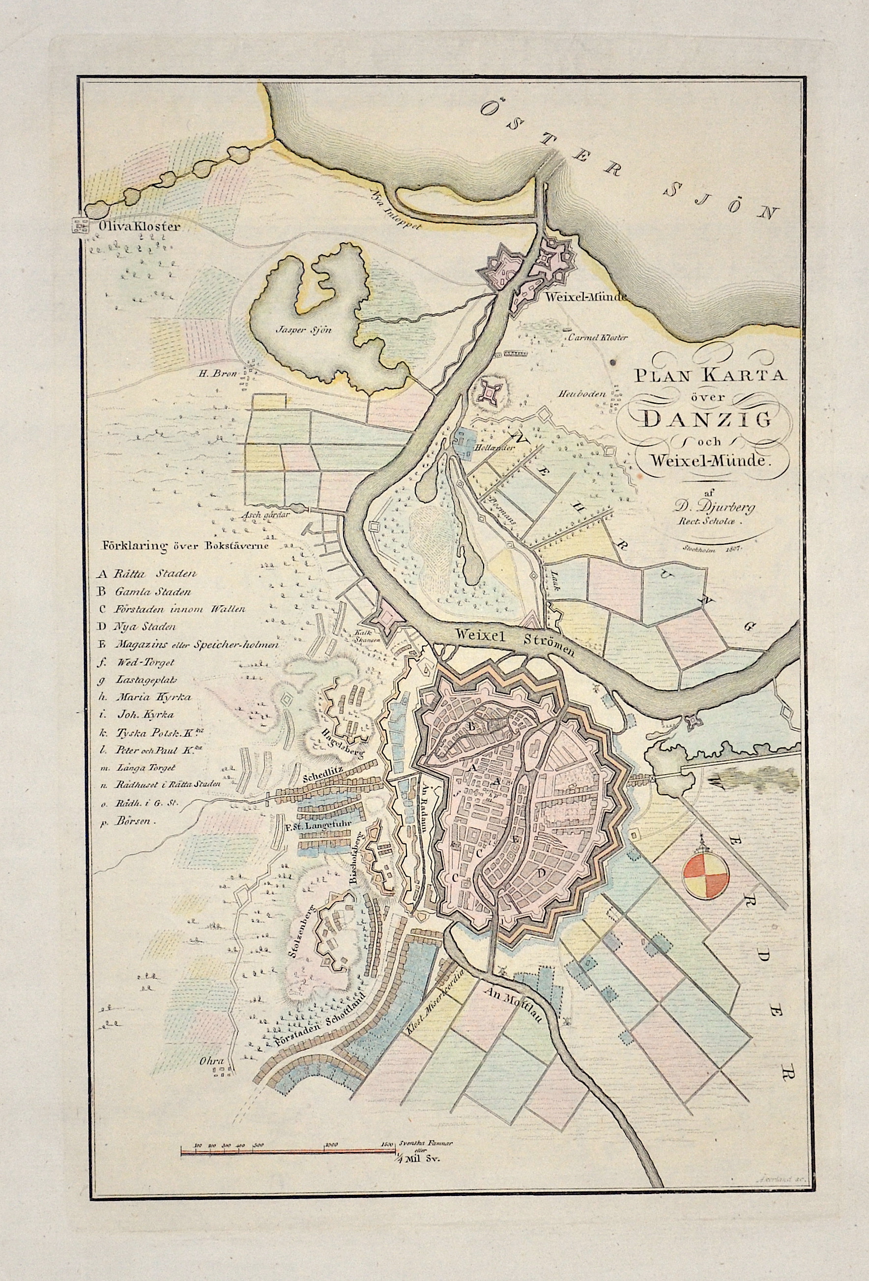
Plan Karta över Danzig och Weixel-Münde.

| Article ID | EUP4057 |
Title | Plan Karta över Danzig och Weixel-Münde. |
Description | Danzig (Gdańsk);is a Polish city on the Baltic coast. |
| Year | ca. 1807 |
Artist | Akerland (1754-1835) |
Erik Åkerland (1754-1835) was a prolific and very skilled cartographer and engraver. Early in his career he worked in Fredrik Akrel´s globe factory in Stockholm. In the 1790s he engraved sea charts for Johan Nordenankars great Sea Atlas. In the early 1800s he took over the publishing of Atlas Juvenilis, which was first issued by Anders Åkerman in 1768. Åkerland also engraved portraits, among them Carl von Linné and Carl XIVJohan. | |
Historical Description | Poland is bordered by the Baltic Sea, Russia's Kaliningrad Oblast and Lithuania to the north, Belarus and Ukraine to the east, Slovakia and Czech Republic, to the south, and Germany to the west. The establishment of the Polish state can be traced back to AD 966, when Mieszko I ruler of the realm coextensive with the territory of present-day Poland, converted to Christianity. The Kingdom of Poland was founded in 1025, and in 1569 it cemented its longstanding political association with the Grand Duchy of Lithuania. This union formed the Polish–Lithuanian Commonwealth, one of the largest at the end of the 18th century. Poland regained its independence in 1918 with the Treaty of Versailles. It was one of the most populous countries of 16th- and 17th-century Europe, with a uniquely liberal political system, which adopted Europe's first written national constitution, the Constitution of 1791. |
| Place of Publication | Stockholm |
| Dimensions (cm) | 29 x 18,5 |
| Condition | Perfect condition |
| Coloring | original colored |
| Technique | Copper print |