

Adina Sommer
Antique and Contemporary Art
Winzerer Str. 154
80797 München
telephone
+49 89 304714
business hours:
by appointment
Email
![]()


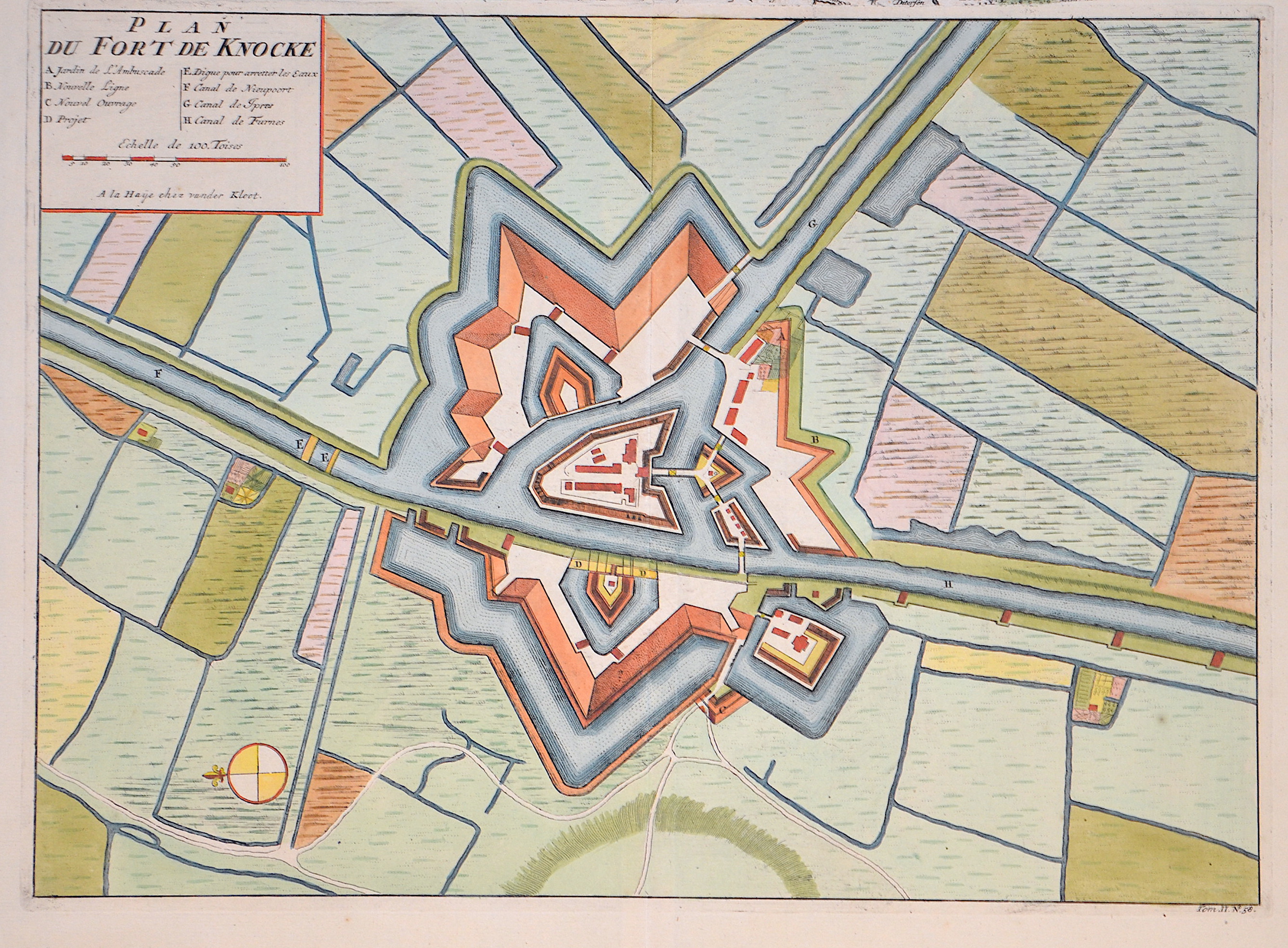
Plan du Fort de Knocke

| Article ID | EUB5432 |
Title | Plan du Fort de Knocke |
Description | Map of the Fortress of Knokke in Belgium during the War of the Spanish Succession around 1729, by Isaac van der Kloot and Jean Dumont. From “Histoire militaire du prince Eugene de Savoye, du Prince et Duc de Marlborough et du Prince de Nassau-Frise ou l’on trouve un detail des principales actions de la derniere guerre et des batailles et sieges commandez par ces trois Generaux.” Top left: title, mileage indicator, and index. |
| Year | ca. 1729 |
Artist | Kloot / Dumont |
Historical Description | The Fort de Knocke is a historic fortress located near Dunkirk (Dunkerque) in northern France. It was built at the end of the 19th century as part of France’s military buildup to protect the strategically important coastal region from possible attacks, especially from the north. It is part of a network of defensive structures designed to secure the harbor and the city. Today, Fort de Knocke is a historic monument that highlights the importance of military fortifications along the French coast and is often used for tours and cultural events. |
| Place of Publication | The Hague |
| Dimensions (cm) | 31,5 x 42,8 cm |
| Condition | Perfect condition |
| Coloring | colored |
| Technique | Copper print |