

Adina Sommer
Antique and Contemporary Art
Winzerer Str. 154
80797 München
telephone
+49 89 304714
business hours:
by appointment
Email
![]()


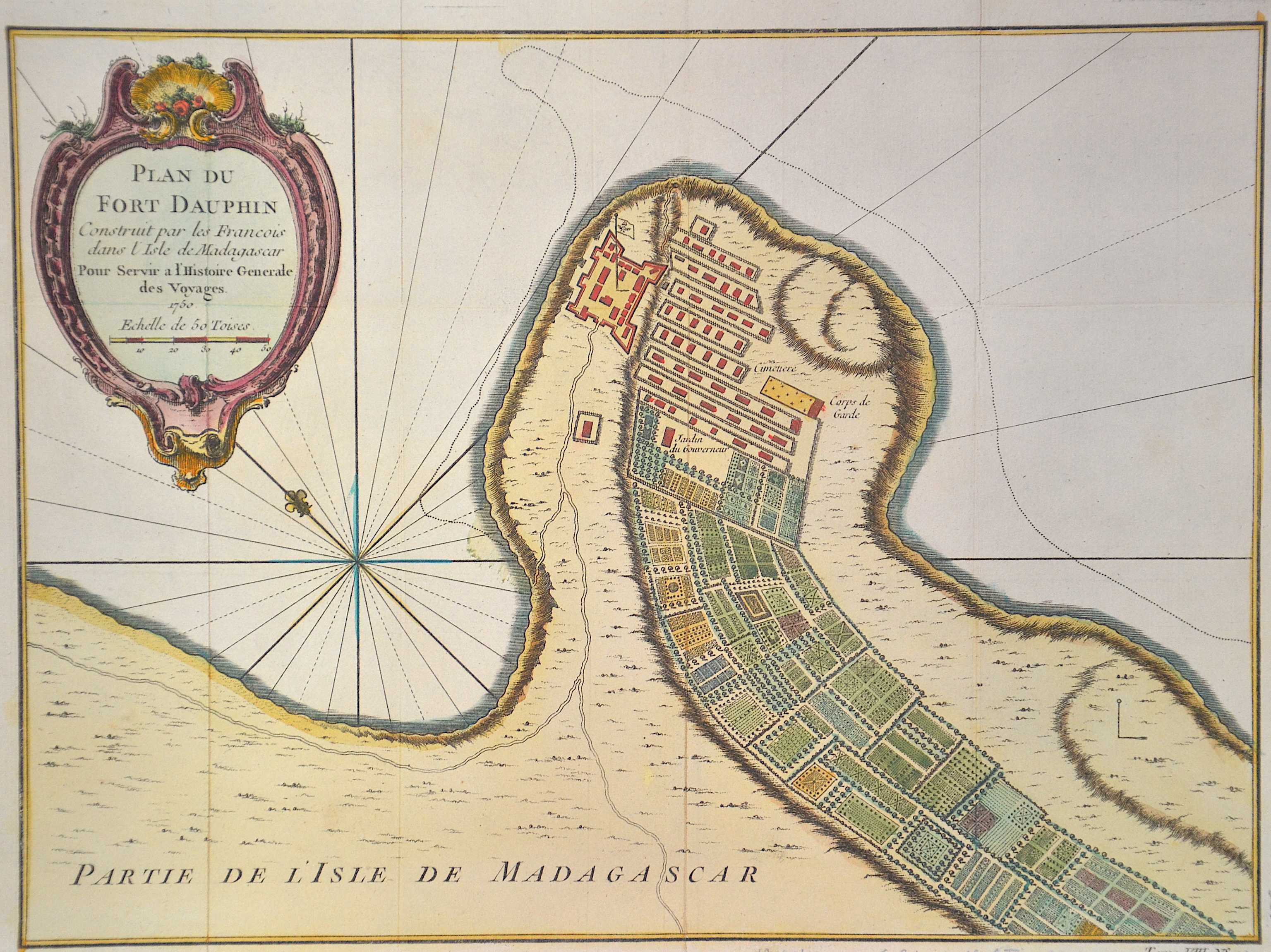
Plan du Fort Dauphin Construit par les Francois dans l’Isle de Madagascar

| Article ID | AF0361 |
Title | Plan du Fort Dauphin Construit par les Francois dans l’Isle de Madagascar |
Description | Map of the bay and city of Tolagnaro or Taolanar ( former Fort- Dauphin) in the Southeast of Madagaskar. Form Histoire générale des voyages, issued 1826–1831. |
| Year | ca. 1830 |
Artist | Walckenaer (1771-1852) |
Historical Description | Madagascar- officially the Republic of Madagascar , and previously known as the Malagasy Republic, is an island country in the Indian Ocean, off the coast of East Africa. Madagascar was an important transoceanic trading hub connecting ports of the Indian Ocean in the early centuries following human settlement. The written history of Madagascar began with the Arabs, who established trading posts along the northwest coast by at least the 10th century. From about 1774 to 1824, Madagascar gained prominence among pirates and European traders, particularly those involved in the trans-Atlantic slave trade. Many European sailors were shipwrecked on the coasts of the island, among them Robert Drury, whose journal is one of the few written depictions of life in southern Madagascar during the 18th century. The wealth generated by maritime trade spurred the rise of organized kingdoms on the island, some of which had grown quite powerful by the 17th century. Among these were the Betsimisaraka alliance of the eastern coast and the Sakalava chiefdoms of Menabe and Boina on the west coast. The Kingdom of Imerina, located in the central highlands with its capital at the royal palace of Antananarivo, emerged at around the same time under the leadership of King Andriamanelo. |
| Place of Publication | Paris |
| Dimensions (cm) | 20,5 x 28 |
| Condition | Some folds |
| Coloring | colored |
| Technique | Copper print |