

Adina Sommer
Antique and Contemporary Art
Winzerer Str. 154
80797 München
telephone
+49 89 304714
business hours:
by appointment
Email
![]()


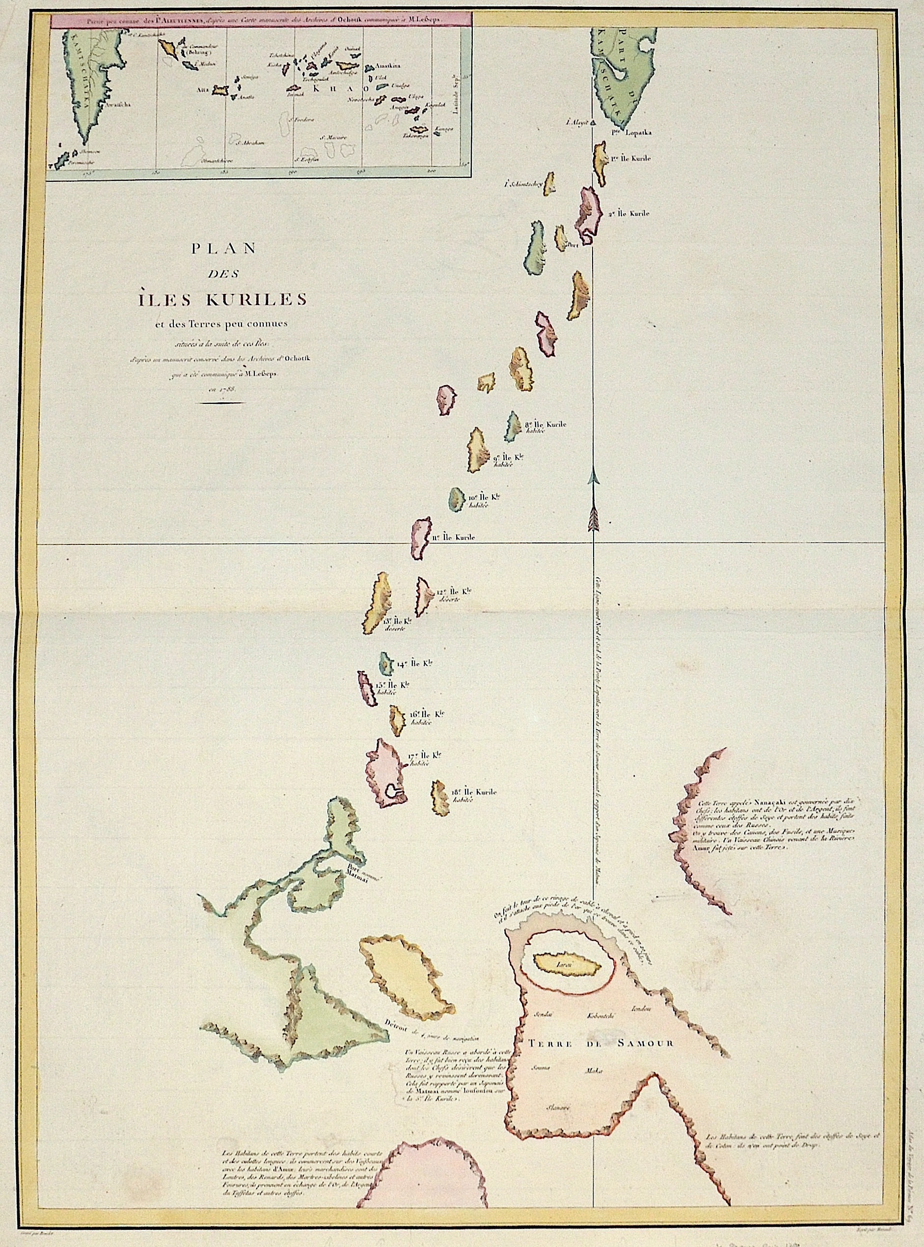
Plan des Isle Kurilles et des Terres peu connues…

| Article ID | ASC0614 |
Title | Plan des Isle Kurilles et des Terres peu connues… |
Description | Map shows the south part of Kamtschatka, the Kurile Islands and the north coast of Japan, on inset map Kamtschatka with the Commadeur Islands and partly the Aleutian Islands (Alaska) |
| Year | dated 1788 |
Artist | Pérouse, la (1741-1788) |
Jean-François de Galaup de La Pérouse (1741 1788) was a French Naval officer and explorer whose expedition vanished in Oceania. La Pérouse crossed the Pacific Ocean in 100 days, arriving at Macau, where he sold the furs acquired in Alaska, dividing the profits among his men. Lapérouse sailed all the way south to the Spanish Las Californias in 1786. He stopped at the Presidio of San Francisco long enough to create an outline map of the Bay Area, Plan du Port du St. Francois, which was reproduced as Map 33 in L. Aubert's 1797 Atlas du Voyage de la Perouse. Laterhe arrived in Monterey Bay and at the Presidio of Monterey. In 1787 after a visit to Manila, he set out for the northeast Asian coasts. He saw the island of Quelpart, present-day Cheju in South Korea, which had been visited by Europeans only once before when a group of Dutchmen shipwrecked there in 1635. He visited the Asian mainland coasts of Korea. | |
Historical Description | The Kamchatka Peninsula was discovered by Cossacks on their forays into eastern Russia in 1697. Since there were mainly a lot of sables here, the area was annexed by Russia shortly after. The indigenous people living there, the Koryaks, Itelmen, Evens, Chukchi and Aleuts (Unangan), were bloodily subjugated by Russian Cossacks and almost exterminated. The Dane Vitus Bering, after whom the strait between Eastern Siberia and Alaska is named, led large expeditions to Kamchatka and north to the Bering Sea from 1725 to 1730 and from 1733 to 1743. Georg Wilhelm Steller, botanist and theologian, wrote extensive notes from the second expedition. |
| Place of Publication | Paris |
| Dimensions (cm) | 68 x 50 |
| Condition | Very good |
| Coloring | original colored |
| Technique | Copper print |