

Adina Sommer
Antique and Contemporary Art
Winzerer Str. 154
80797 München
telephone
+49 89 304714
business hours:
by appointment
Email
![]()


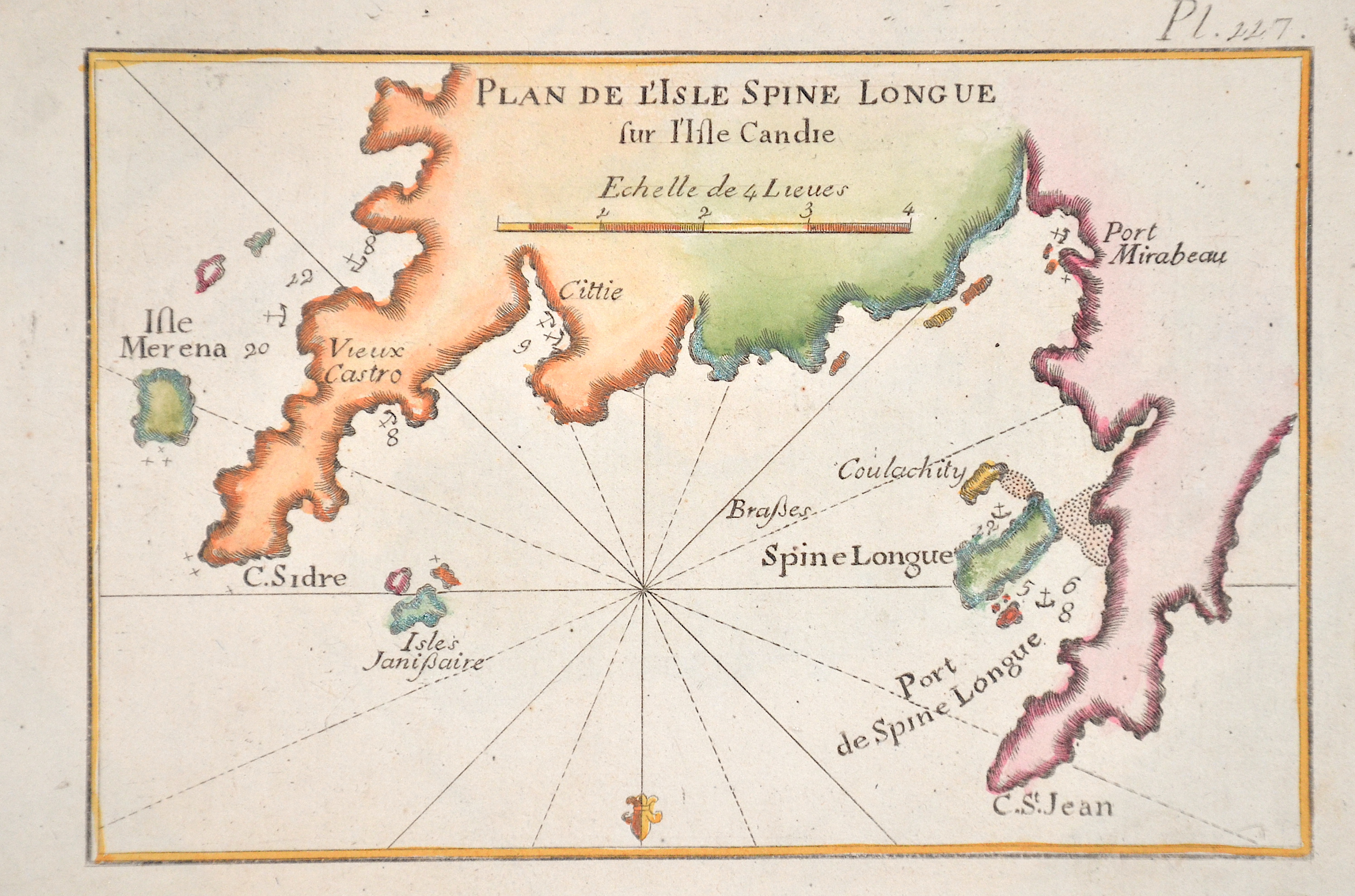
Plan de L’Isle Spine Longue sur I’Isle Candie

| Article ID | EUK5474 |
Title | Plan de L’Isle Spine Longue sur I’Isle Candie |
Description | Map shows the north-eastern part of Crete with the island of Spinalonga and several anchorages. Plate 117. |
| Year | ca. 1754 |
Artist | Roux (1725-1793) |
Joseph Roux (1725–1793), from Marseille, came from a family of hydrographers and marine cartographers. He ran a workshop-boutique at the Vieux-Port of Marseille, which he had taken over from his father. His main focus was the creation of nautical charts and plans of harbors, bays, and coastlines — particularly in the Mediterranean region.bIn 1764, for example, he published a series of twelve large sheets under the title Carte de la Mer Méditerranée en douze feuilles ("Map of the Mediterranean Sea in twelve sheets"). He produced chart sheets with depth soundings (for navigation), anchorages, coastlines, and more — for example: maps like “Isle de Sicile. Mer Méditerranée” from around 1760. Around that time, nautical cartography was entering a phase in which detailed harbor and coastal plans were becoming increasingly important for trade, naval operations, and navigation. Although Roux’s maps were rooted in Marseille, they gained broader significance due to his status as Hydrographe du Roi (Hydrographer to the King) and the widespread distribution of his works. | |
Historical Description | The island of Crete is first referred to as Kaptara in texts from the Syrian city of Mari from the 18th century BC, which are later repeated in Neo-Assyrian records and in the Bible (Caphtor). It was also known in ancient Egypt as Keftiu, strongly suggesting that a similar form to both was the Minoan name for the island. In classical times, Crete lay on the edge of the Greek cultural area, it was regarded as the "island of 100 poleis" and was therefore divided into numerous small city-states. The stone-carved legal text of the then powerful polis of Gortyn is the only completely preserved codex of this type from Greek antiquity. From 1645 to 1648, the Turks conquered almost the entire island and incorporated it into the Ottoman Empire as Girit, with only Candia withstanding a siege until 1669. Numerous uprisings by the population in the 19th century against Ottoman sovereignty were bloodily suppressed. From 1830 to 1840, Crete was formally under the administration of the Vali of Egypt, Muhammad Ali Pasha. In 1898, the intervention of France, Russia and the United Kingdom forced Crete into almost complete autonomy under the sovereignty of the High Porte. The Treaty of London in 1913 finally made Crete part of the Greek state, and a comprehensive population exchange was agreed in the Treaty of Lausanne in 1923. |
| Place of Publication | Marselle |
| Dimensions (cm) | 13 x 18 cm |
| Condition | Perfect condition |
| Coloring | original colored |
| Technique | Copper print |