

Adina Sommer
Antique and Contemporary Art
Winzerer Str. 154
80797 München
telephone
+49 89 304714
business hours:
by appointment
Email
![]()


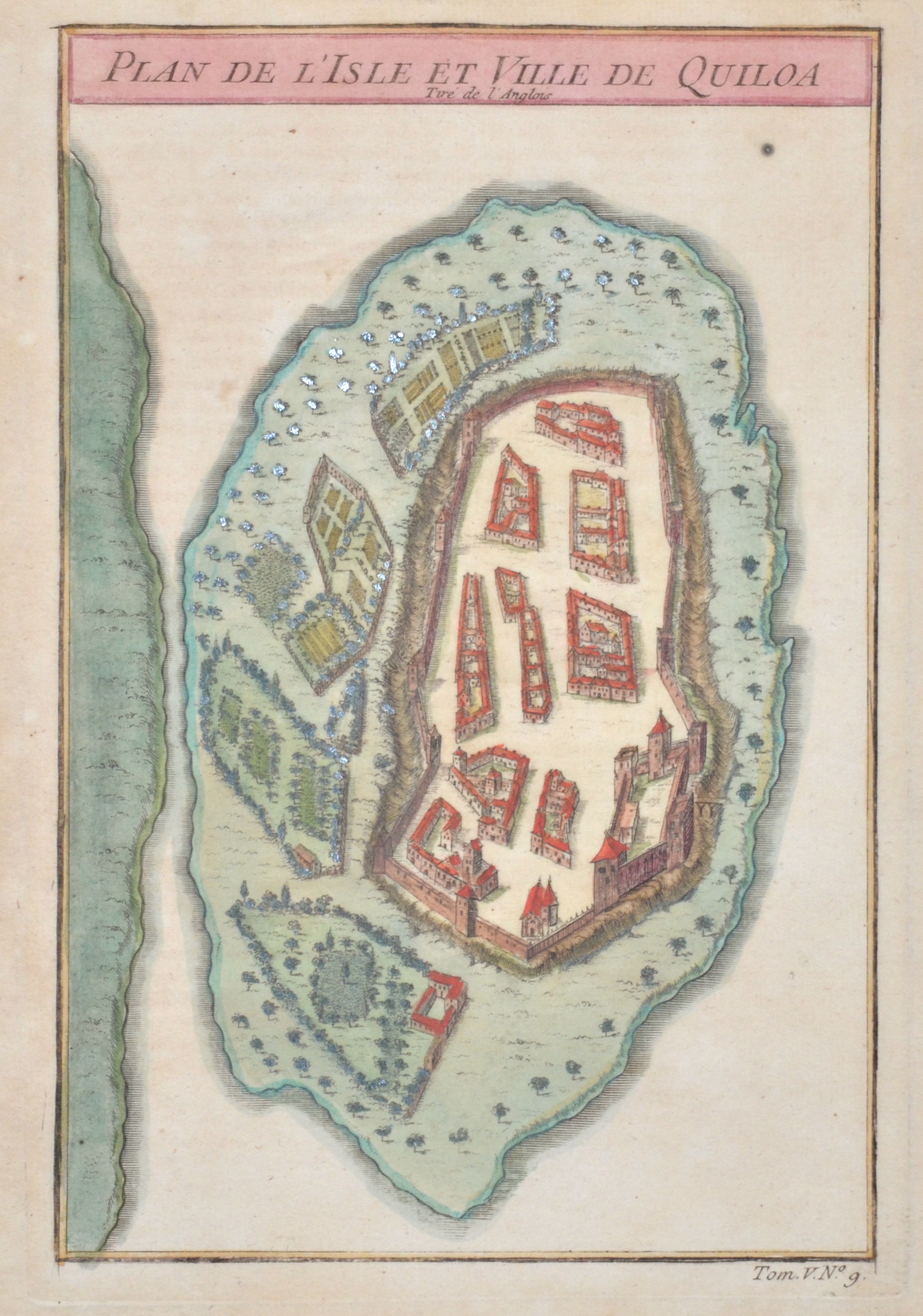
Plan de l’Isle et Ville de Quiloa

| Article ID | AF0425 |
Title | Plan de l’Isle et Ville de Quiloa |
Description | Map shows the Fort and harbour city of Kilwa ( Quiloa,;historicaly wtitten) on an island of Tansania, Africa. |
| Year | ca. 1750 |
Artist | Bellin (1703-1772) |
Jacques-Nicolas Bellin (1703 Paris -1772 Versailles) was a French cartographer, engineer-geographer, marine hydrographer. As a contributor to the Encyclopédie, he wrote more than a thousand articles on maritime topics. As a cartographer, Bellin distinguished himself primarily in the field of sea cartography. From 1721 he worked for the Dépot des Cartes et Plans de la Marine, from 1741 until his death as an engineer-hydrograph of the Navy. In 1753 his atlas Neptune français, which covered all the coasts of France, was published, and in 1756 the hydrography françoise covering all seas of the earth. In 1764 the five-volume Petit Atlas maritime was published, which Bellin prepared on the orders of the Minister of the Navy, Choiseul. In addition, he wrote a number of geographical works and with Nouvelle méthode pour apprendre la geographie (1769) a geographic textbook for teaching. His maps illustrated, among other things, Bougainville's work Voyage autour du monde, published in 1771. As a co-author of the Encyclopédie edited by Diderot and d'Alembert, Bellin wrote more than a thousand articles in the field of shipping and navy. | |
Historical Description | The indigenous populations of eastern Africa are thought to be the linguistically isolated Hadza and Sandawe hunter-gatherers of Tanzania. Travelers and merchants from the Persian Gulf and India have visited the east African coast since early in the first millennium A.D. Islam was practiced by some on the Swahili Coast as early as the eighth or ninth century A.D. The coastal region has been part of a long-distance trade system since the beginning of our era, in which it was connected to the Red Sea by sailing ships. From around the 8th to 9th century, the Swahili culture spread along the coast, which developed from trading posts into a chain of Islamic cities along the coast. On Tanzanian territory, Kilwa Kisiwani was the main town from the 14th to the 16th century. The invasion of the Portuguese from the south, who established stopovers in East Africa on their route to India, caused a considerable disruption to this trade. After the Portuguese were driven out of the Kenyan-Tanzanian coastal region, Oman became the predominant coastal power. From the 18th century, the coastal civilization exerted considerable influence on the interior through the East African caravan trade and the associated slave trade. |
| Place of Publication | Paris |
| Dimensions (cm) | 22 x 14,5 |
| Condition | Perfect condition |
| Coloring | colored |
| Technique | Copper print |