

Adina Sommer
Antique and Contemporary Art
Winzerer Str. 154
80797 München
telephone
+49 89 304714
business hours:
by appointment
Email
![]()


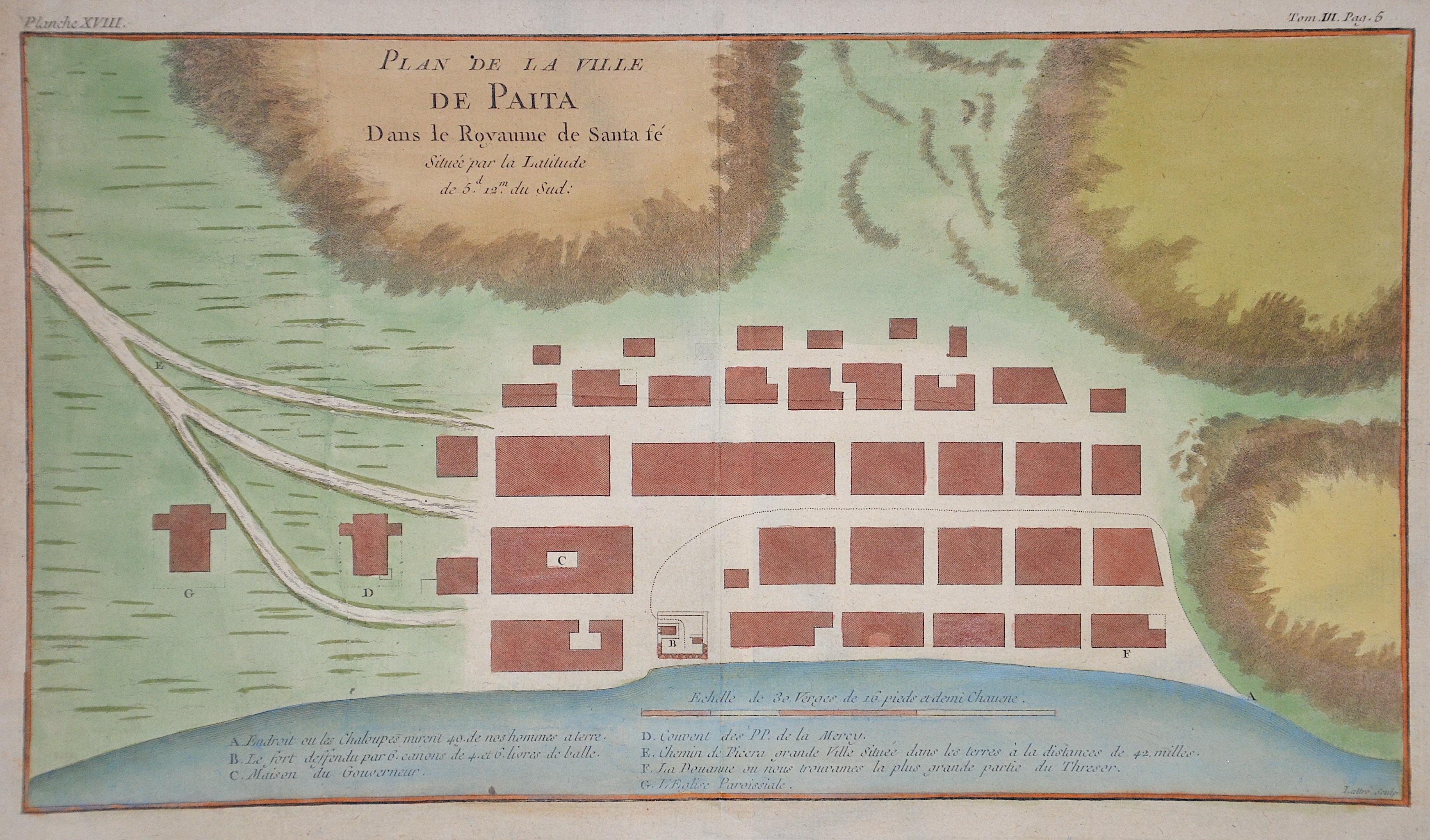
Plan de la Ville de Paita Dans le Royaume de Santa fe

| Article ID | AMS1546 |
Title | Plan de la Ville de Paita Dans le Royaume de Santa fe |
Description | Plan of the peruvian town of Paita on the coast of Stanta Fe. |
| Year | ca. 1757 |
Artist | Bellin (1703-1772) |
Jacques-Nicolas Bellin (1703 Paris -1772 Versailles) was a French cartographer, engineer-geographer, marine hydrographer. As a contributor to the Encyclopédie, he wrote more than a thousand articles on maritime topics. As a cartographer, Bellin distinguished himself primarily in the field of sea cartography. From 1721 he worked for the Dépot des Cartes et Plans de la Marine, from 1741 until his death as an engineer-hydrograph of the Navy. In 1753 his atlas Neptune français, which covered all the coasts of France, was published, and in 1756 the hydrography françoise covering all seas of the earth. In 1764 the five-volume Petit Atlas maritime was published, which Bellin prepared on the orders of the Minister of the Navy, Choiseul. In addition, he wrote a number of geographical works and with Nouvelle méthode pour apprendre la geographie (1769) a geographic textbook for teaching. His maps illustrated, among other things, Bougainville's work Voyage autour du monde, published in 1771. As a co-author of the Encyclopédie edited by Diderot and d'Alembert, Bellin wrote more than a thousand articles in the field of shipping and navy. | |
Historical Description | In April 1532 Francisco Pizarro landed on the Peruvian coast. In November 1533 Pizarro reached the capital Cusco, which was handed over to him without any significant resistance. He appointed the younger brother Huáscars, Manco Cápac II as an Inca, who in 1536 dared a barely failed uprising. Pizarro had thus conquered the Inca Empire for the Spanish crown, and King Charles I, also known as the German-Roman Emperor Charles V, could say of himself: "The sun never sets in my empire." Pizarro founded today's capital in January 1535 Lima. The Spanish founded the Viceroyalty of Peru in 1542 with Lima as the capital, which, with the exception of Venezuela, included all Spanish possessions in South America. In 1572 the Spaniards took Vilcabamba, the last refuge of the Incas. Lima was developed by the Spaniards into a magnificent city and called the city of kings. While independence movements developed in most countries in South America from 1809, the situation in Peru remained relatively stable. The Bolivian dictator Andrés Santa Cruz invaded Lima in the Peruvian-Bolivian Confederation War in 1836 and united the two countries into the Peruvian-Bolivian Confederation. |
| Place of Publication | Paris |
| Dimensions (cm) | 20,5 x 37 cm |
| Condition | Perfect condition |
| Coloring | colored |
| Technique | Copper print |