

Adina Sommer
Antique and Contemporary Art
Winzerer Str. 154
80797 München
telephone
+49 89 304714
business hours:
by appointment
Email
![]()


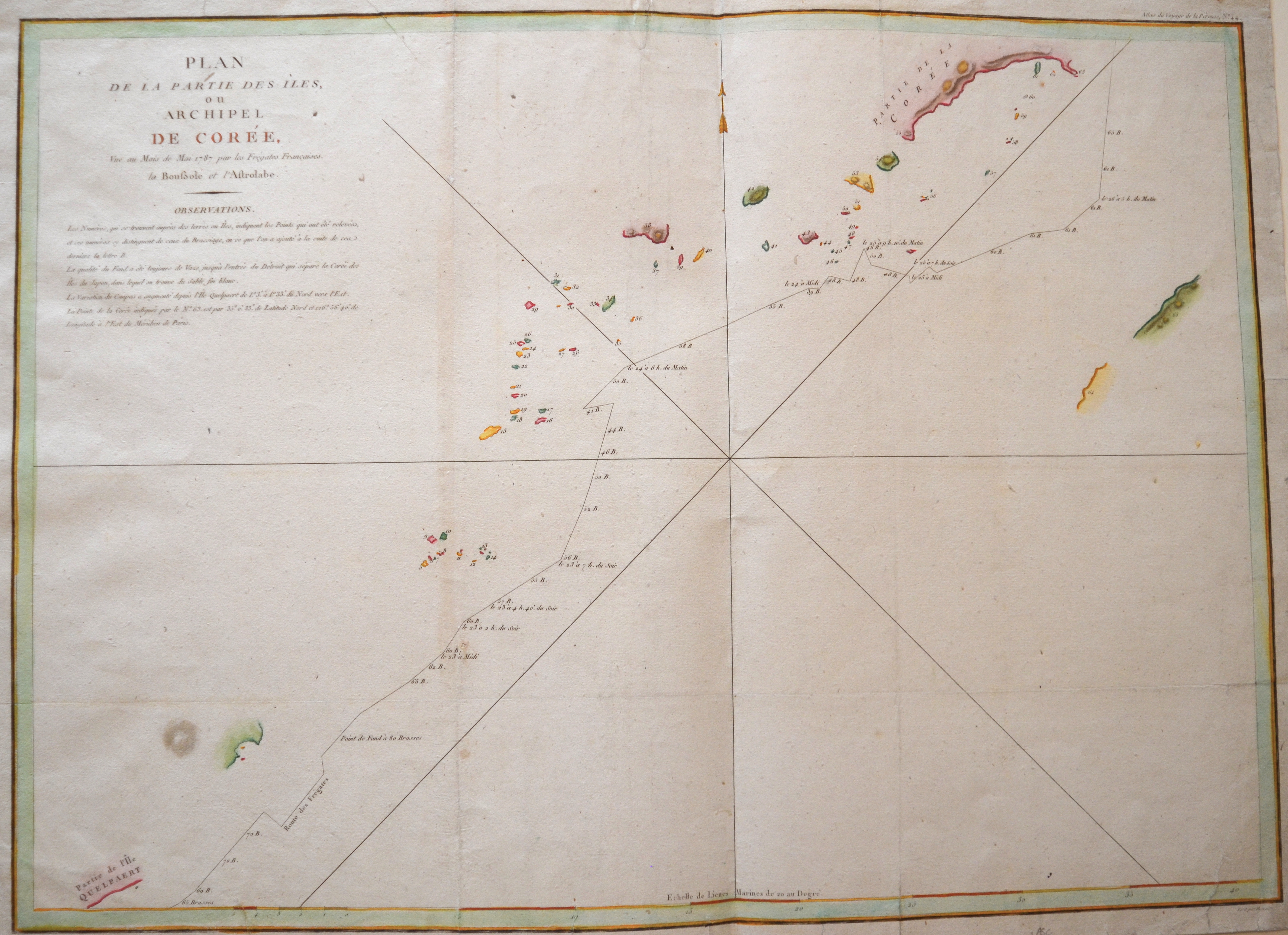
Plan de la Partie des Iles, ou archipel de Corée, Vue au Mois de Mai 1787 par les Frégates Francaises.

| Article ID | ASC1191 |
Title | Plan de la Partie des Iles, ou archipel de Corée, Vue au Mois de Mai 1787 par les Frégates Francaises. |
Description | Detailed seachart showing the track of La Pérouse along the southern most trip of Korea, with Quelpaerts Islands (Jeju, with the vulcano Halla-san in Halla Mountain). This chart is representing the visit of the French Admiral and explorer, le Comte de La Pérouse to Korea in 1786. La Perouse set sail from France in 1785 to continue the discoveries of Captain Cook. He was shipwrecked in 1788 but his narrative, maps, and views survived and were published in 1797. This copy consists of the Atlas only to the First French edition. |
| Year | ca. 1787 |
Artist | Perousse, de La (1741-1788) |
Jean-François de Galaup de La Pérouse was a French navigator, circumnavigator, and geographer of the Enlightenment. He began his naval career at age 15 and added a noble title to his name to improve his prospects. During the Seven Years' War, he sailed to places including Quebec. From 1772 to 1776, he explored the Indian Ocean and participated in the American Revolutionary War. For his achievements, he was ennobled. In 1785, he set out on a major Pacific expedition with the ships Astrolabe and Boussole, accompanied by scientists from various fields. The journey took him through Patagonia, Cape Horn, Easter Island, Hawaii, Alaska, California, Macau, and East Asia, where he mapped seas and coastlines. He was the first European to deliberately refrain from claiming unknown islands. In 1787, his second captain, Paul Fleuriot de Langle, was killed by locals on Samoa. | |
Historical Description | By the 15th century, Beijing had essentially taken its current shape. The Ming city wall continued to serve until modern times, when it was pulled down and the 2nd Ring Road was built in its place. It is generally believed that Beijing was the largest city in the world for most of the 15th, 16th, 17th, and 18th centuries.The first known church was constructed by Catholics in 1652 at the former site of Matteo Ricci's chapel; the modern Nantang Cathedral was later built upon the same site. The capture of Beijing by Li Zicheng's peasant army in 1644 ended the dynasty, but he and his Shun court abandoned the city without a fight when the Manchu army of Prince Dorgon arrived 40 days later. The Forbidden City was the Chinese imperial palace from the Ming dynasty to the end of the Qing dynasty( the years 1420 to 1912). It is located in the center of Beijing, China, and now houses the Palace Museum. When Hongwu Emperor's son Zhu Di became the Yongle Emperor, he moved the capital from Nanjing to Beijing, and construction began in 1406 on what would become the Forbidden City. Construction lasted 14 years and required more than a million workers. It served as the home of emperors and their households as well as the ceremonial and political center of Chinese government for almost 500 years. The palace complex exemplifies traditional Chinese palatial architecture, and has influenced cultural and architectural developments in East Asia and elsewhere. Since 1925 the Forbidden City has been under the charge of the Palace Museum, whose extensive collection of artwork and artifacts were built upon the imperial collections of the Ming and Qing dynasties. |
| Place of Publication | Paris |
| Dimensions (cm) | 50 x 69 |
| Condition | Tears on upper and lower margin perfectly restored |
| Coloring | colored |
| Technique | Copper print |