

Adina Sommer
Antique and Contemporary Art
Winzerer Str. 154
80797 München
telephone
+49 89 304714
business hours:
by appointment
Email
![]()


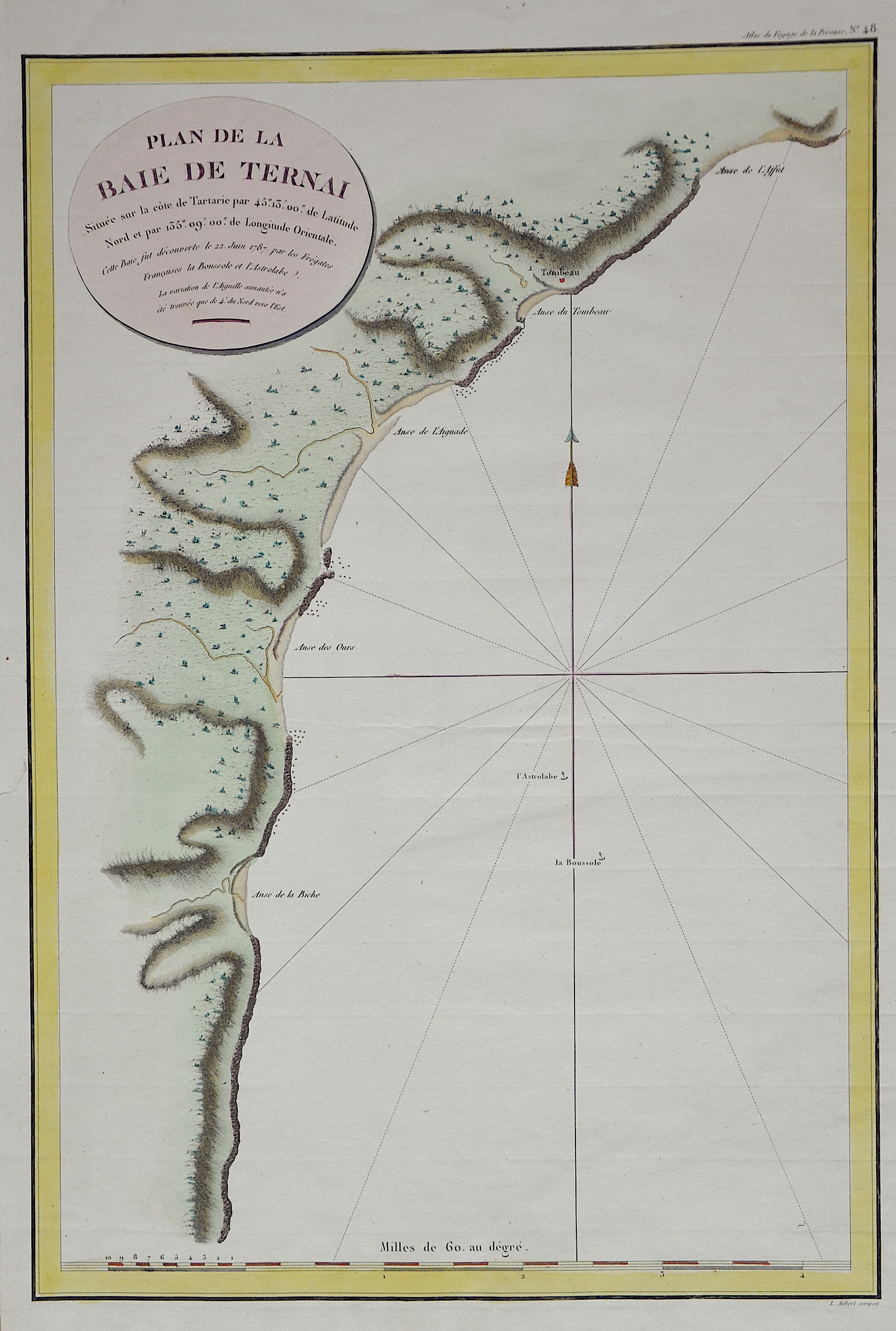
Plan de la Baie de Ternai

| Article ID | EUO2507 |
Title | Plan de la Baie de Ternai |
Description | Map shows the north eastern coast of Russia. |
| Year | ca. 1798 |
Artist | Pérouse, la (1741-1788) |
Jean-François de Galaup de La Pérouse (1741 1788) was a French Naval officer and explorer whose expedition vanished in Oceania. La Pérouse crossed the Pacific Ocean in 100 days, arriving at Macau, where he sold the furs acquired in Alaska, dividing the profits among his men. Lapérouse sailed all the way south to the Spanish Las Californias in 1786. He stopped at the Presidio of San Francisco long enough to create an outline map of the Bay Area, Plan du Port du St. Francois, which was reproduced as Map 33 in L. Aubert's 1797 Atlas du Voyage de la Perouse. Laterhe arrived in Monterey Bay and at the Presidio of Monterey. In 1787 after a visit to Manila, he set out for the northeast Asian coasts. He saw the island of Quelpart, present-day Cheju in South Korea, which had been visited by Europeans only once before when a group of Dutchmen shipwrecked there in 1635. He visited the Asian mainland coasts of Korea. | |
Historical Description | The first European to reach the Bay of the Sea of Japan, now called Serebryanka Bay, was the French navigator Jean-François de La Pérouse in June 1787, who named it Baie de Ternay after the naval officer Charles-Henri-Louis d'Arsac de Ternay (1723-1780). The village was founded in 1908 by Russian resettlers and named Gringmutovka after one of the leaders of the Black Hundreds, Vladimir Gringmuth (1851-1907). In 1922 it was given the name Ternei-Morozovskoye. In May 1932, according to the decision of April 1932, Ternei-Morozovskoye became the administrative seat of a newly created rayon. |
| Place of Publication | Paris |
| Dimensions (cm) | 49 x 33,5 |
| Condition | Very good |
| Coloring | original colored |
| Technique | Copper print |