

Adina Sommer
Antique and Contemporary Art
Winzerer Str. 154
80797 München
telephone
+49 89 304714
business hours:
by appointment
Email
![]()


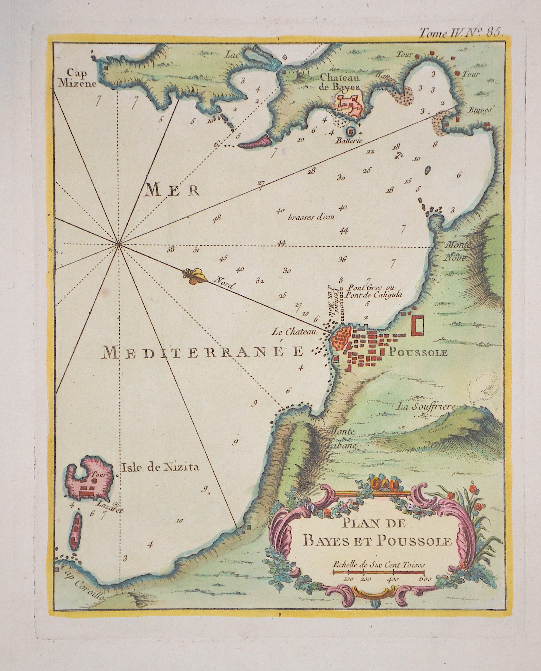
Plan de Bayes et Poussole

| Article ID | EUI4893 |
Title | Plan de Bayes et Poussole |
Description | Map shows the city of Pozzuoli, Cape Miseno, the island of Nisida, the volcano Solfatara, Mount Lebanon and a title cartouche. |
| Year | ca. 1764 |
Artist | Bellin (1703-1772) |
Jacques-Nicolas Bellin (1703 Paris -1772 Versailles) was a French cartographer, engineer-geographer, marine hydrographer. As a contributor to the Encyclopédie, he wrote more than a thousand articles on maritime topics. As a cartographer, Bellin distinguished himself primarily in the field of sea cartography. From 1721 he worked for the Dépot des Cartes et Plans de la Marine, from 1741 until his death as an engineer-hydrograph of the Navy. In 1753 his atlas Neptune français, which covered all the coasts of France, was published, and in 1756 the hydrography françoise covering all seas of the earth. In 1764 the five-volume Petit Atlas maritime was published, which Bellin prepared on the orders of the Minister of the Navy, Choiseul. In addition, he wrote a number of geographical works and with Nouvelle méthode pour apprendre la geographie (1769) a geographic textbook for teaching. His maps illustrated, among other things, Bougainville's work Voyage autour du monde, published in 1771. As a co-author of the Encyclopédie edited by Diderot and d'Alembert, Bellin wrote more than a thousand articles in the field of shipping and navy. | |
Historical Description | Pozzuoli was founded in 531 BC as Dikaiarcheia by a group of Greek colonists from Samos who had fled the tyranny of Polycrates. Dikaiarcheia, which had an excellent natural harbor, served as a trading port for the Greek colony of Kyme and was part of Magna Graecia. When the city became a Roman colony in 194 BC, it was renamed Puteoli. Due to its proximity to Capua and the Via Appia, the port continued to gain importance for trade and passenger traffic and was protected from the dangerous southerly winds by a breakwater at the beginning of the 2nd century BC. The grain supplies for Rome, which came by ship from Egypt via Alexandria, were landed here. Puteoli was Rome's most important port in Republican times and continued to play such an important role after the turn of the century, after the port in Ostia had been expanded by Emperor Claudius. |
| Place of Publication | Paris |
| Dimensions (cm) | 22 x 17,5 cm |
| Condition | Perfect condition |
| Coloring | original colored |
| Technique | Copper print |