

Adina Sommer
Antique and Contemporary Art
Winzerer Str. 154
80797 München
telephone
+49 89 304714
business hours:
by appointment
Email
![]()


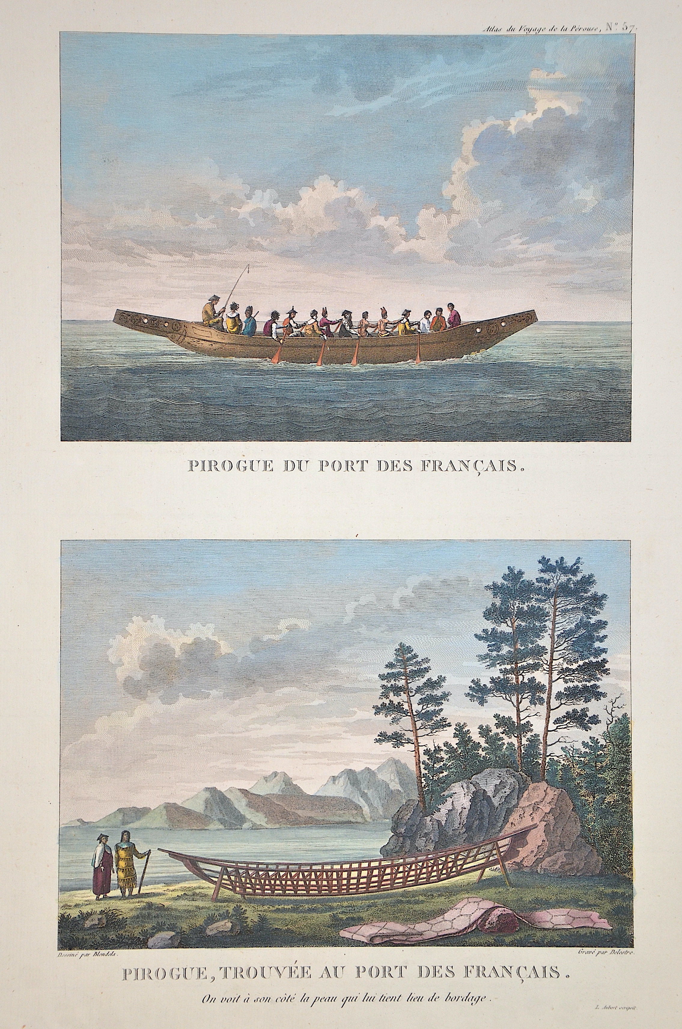
Pirogue du post des Francais/ Pirogue, trouve au post des Francais

| Article ID | AMA0715 |
Title | Pirogue du post des Francais/ Pirogue, trouve au post des Francais |
Description | 2 representation of native ships at Lituya Bay, Alaska. |
| Year | ca. 1797 |
Artist | Pérouse, la (1741-1788) |
Jean-François de Galaup de La Pérouse (1741 1788) was a French Naval officer and explorer whose expedition vanished in Oceania. La Pérouse crossed the Pacific Ocean in 100 days, arriving at Macau, where he sold the furs acquired in Alaska, dividing the profits among his men. Lapérouse sailed all the way south to the Spanish Las Californias in 1786. He stopped at the Presidio of San Francisco long enough to create an outline map of the Bay Area, Plan du Port du St. Francois, which was reproduced as Map 33 in L. Aubert's 1797 Atlas du Voyage de la Perouse. Laterhe arrived in Monterey Bay and at the Presidio of Monterey. In 1787 after a visit to Manila, he set out for the northeast Asian coasts. He saw the island of Quelpart, present-day Cheju in South Korea, which had been visited by Europeans only once before when a group of Dutchmen shipwrecked there in 1635. He visited the Asian mainland coasts of Korea. | |
Historical Description | Alaska was the first part of the American continent to be settled by humans. Coming from Siberia, the first nomads reached the area. Around this time, the American population finally split off from the Asian one. According to the study, all of today's North and South American Indians are said to be descended from these settlers. The first European to sight Alaska may have been the Russian explorer Semyon Deshnyov, who circumnavigated the Chukchi Peninsula in 1648, disproving the thesis that the Americas and Asia were related. In 1728 and 1729, the Dane Vitus Bering, sailing on behalf of the Russian Czar, failed in his attempt to reach Alaska. It was not until 1732 that Mikhail Gvosdev set foot on the mainland at Cape Prince of Wales as part of Afanassi Shestakov's expedition. It was not until 1741 that Alaska was entered again as part of the second Kamchatka expedition. Starting in 1745, the Russians explored their later colony of Russian America in search of sea otters and their valuable furs. Russian expansion was soon opposed by Spain and Great Britain. Spain laid claim to the entire Pacific coast of the Americas based on the 1494 Treaty of Tordesillas. To support this claim, King Charles III sent several expeditions to explore it between 1774 and 1791. One of two ships of the second expedition reached Alaska under Juan Francisco de la Bodega y Quadra in 1775. In 1791, the Italian Alessandro Malaspina, in Spanish service, also succeeded in searching for the Northwest Passage on behalf of the Crown; the Malaspina Glacier is named after him. A Spanish foundation is the village of Valdez. The differing views of the Spanish and British led to the Nootka Sound Crisis in 1790. Spain's interests shifted in the wake of Latin American independence efforts that began in 1810. The border between Russian America, Great Britain and the USA was concretized in treaties in 1824 and 1825, respectively. As early as 1778, the Briton James Cook roughly mapped the course of the Pacific coast from California to the Bering Strait and found Cook Inlet, named after him. George Vancouver continued these ventures in 1791-1795. Increasingly, British and American fur hunters and traders also pushed into Alaska by ship over the next few years. The British Hudson's Bay Company maintained trading posts at Fort Yukon, on the Stikine River, and at Wrangell as late as the 1830s, in part through leases with the Russians. Later, however, these were abandoned in favor of new establishments farther south, particularly in what is now British Columbia. |
| Place of Publication | Paris |
| Dimensions (cm) | 41,5 x 25 cm |
| Condition | Perfect condition |
| Coloring | original colored |
| Technique | Copper print |