

Adina Sommer
Antique and Contemporary Art
Winzerer Str. 154
80797 München
telephone
+49 89 304714
business hours:
by appointment
Email
![]()


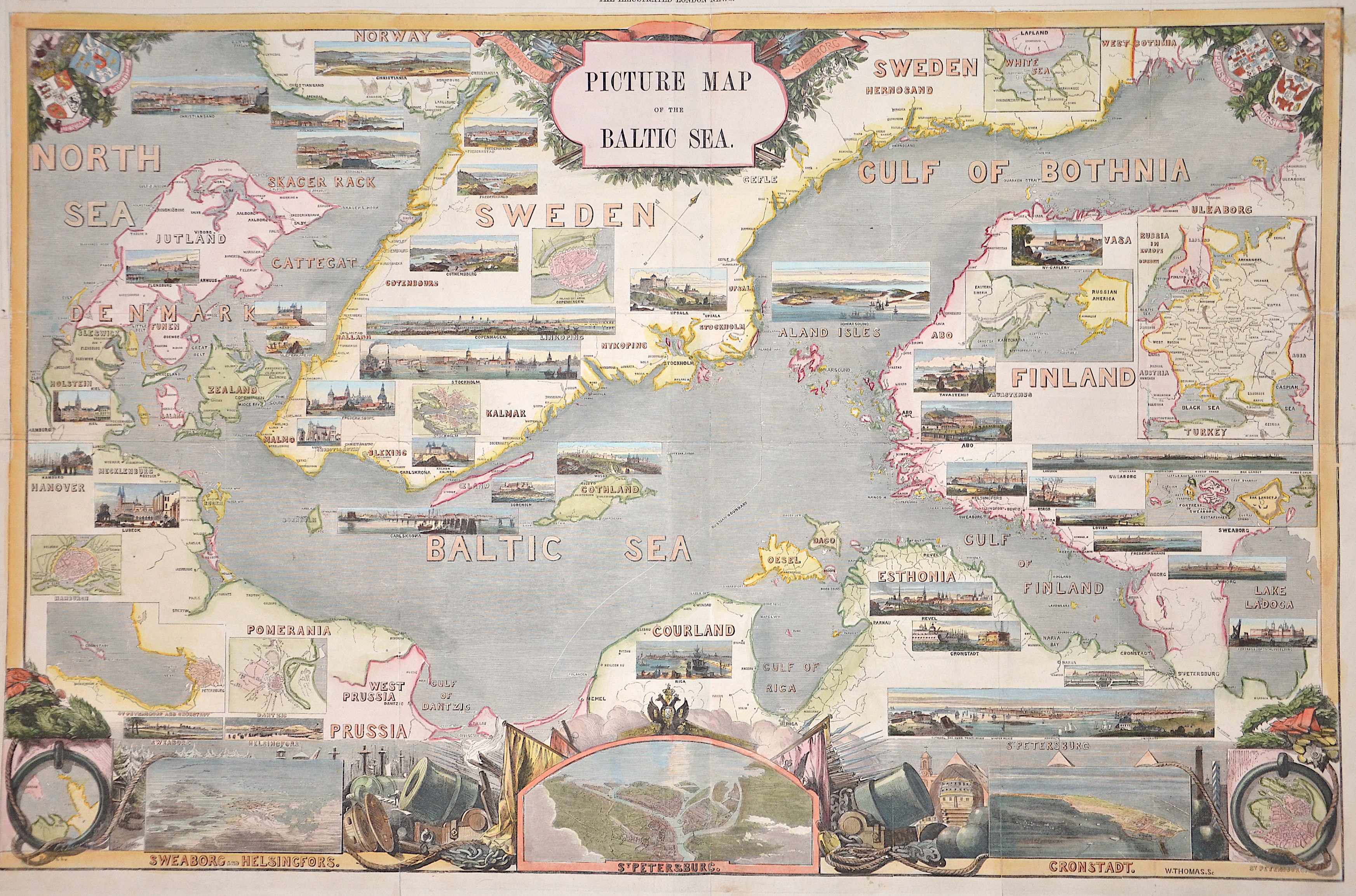
Picure map of the Baltic Sea

| Article ID | EUS1763 |
Title | Picure map of the Baltic Sea |
Description | Map shows the Baltic sea with Denmark, south part of Sweden, Estland, Lettland and St. Petersbourg with 42 city views and 7 maps of all important cities, insert map of White sea and Russia. Reverse with two depictions of sailing ships, one "Duke of Wellington, Flag-Ship of Port Division." and "The Fleet at the Great Naval Revil, at spithead, april 23, 1856" drawn by E. Duncan. |
| Year | dated 1856 |
Artist | Thomas |
Historical Description | Scandinavia characterized by common ethnocultural North Germanic heritage and mutually intelligible North Germanic languages The term Scandinavia in local usage covers the three kingdoms of Denmark, Norway, and Sweden, but in English usage, it also sometimes refers to the Scandinavian Peninsula or to the broader region which includes Finland and Iceland This broader region is usually known locally as the Nordic countries. The remote Norwegian islands of Svalbard and Jan Mayen are usually not seen as a part of Scandinavia, nor is Greenland, a constituent country within the Kingdom of Denmark. The Faroe Islands may be included. For more than 500 years there was a common ground in the field of foreign policy, from the attack by the Danish king Chlochilaicus on Gaul (517) to the unfortunate move by Harald Hardrades against England in 1066, the Vikings carried out their raids and raids on all European coastal areas, but also deep into Russia stretch. For a long time, another commonality was the rejection of Christianity in times when it had been common in Western Europe for centuries. In addition, the great importance of the Jarle, who were initially only leaders of raids, but as such became very rich and powerful, is characteristic of this period. For this reason, fiefdom in Scandinavia developed much more slowly than in core Europe, and serfdom did not become fully established. In addition to these general similarities, there were also times when several of the Scandinavian countries were united under one rule, such as Denmark, Norway and (more relaxed) Sweden as well as England under Knut the Great from 1028 to 1035, as well as England. Denmark and Norway were soon under the common rule of Magnus the Good from 1042 to 1046. But the main time of the common political development lies in the Kalmar Union, which the countries of Denmark, Norway and Sweden were linked from 1397 to 1523. During this period, Norway lost significant political independence, so that after Sweden left the Kalmar Union with the Danish-Norwegian personal union, there was practically Danish dominance until 1814, which was replaced in 1814 by the Swedish-Norwegian union, which continued until 1905. |
| Place of Publication | London |
| Dimensions (cm) | 50 x 76 cm |
| Condition | Some folds perfectly restored |
| Coloring | colored |
| Technique | Wood engraving |