

Adina Sommer
Antique and Contemporary Art
Winzerer Str. 154
80797 München
telephone
+49 89 304714
business hours:
by appointment
Email
![]()


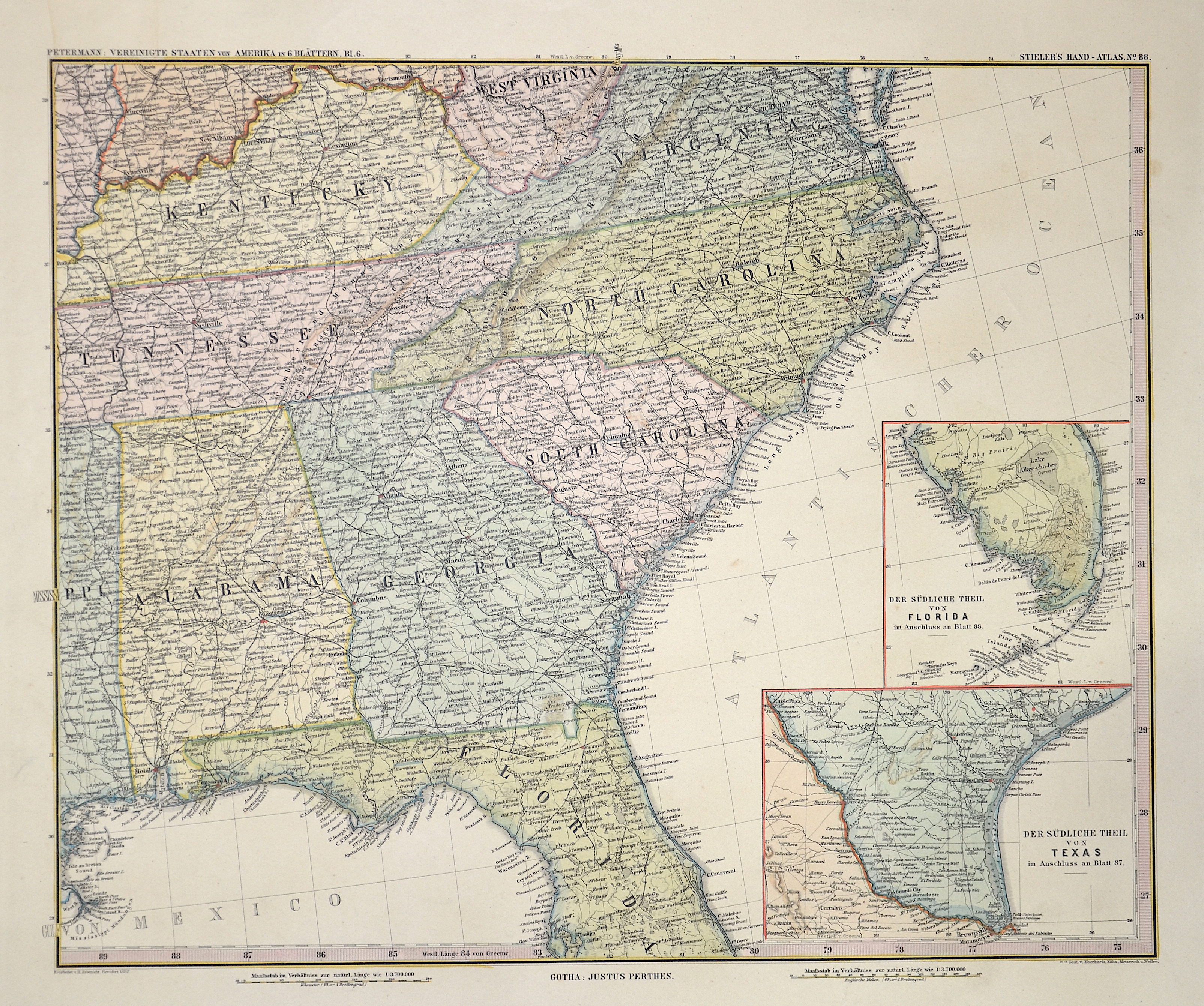
Petermann: Vereinigte Staaten von Nord-Amerika

| Article ID | AMU0979 |
Title | Petermann: Vereinigte Staaten von Nord-Amerika |
Description | Map depicts the eastern coast of the US with Alabama, Florida, Georgia, Tennessee, Nord und Süd Carolina, Kentucky and Virginia. On 2 inset maps the southern part of Florida and Texas. From Stielers Atlas. |
| Year | dated 1875 |
Artist | Perthes (1749-1816) |
Johann Georg Justus Perthes ( 1749- 1816) was a German bookseller and publisher. Justus Perthes was the son of the Rudolstadt court physician Johann Justus Perthes. After training as a merchant, he obtained employment in the bookshop of Carl Wilhelm Ettinger in Gotha. Together with the latter and his later brother-in-law Friedrich Duerfeldt, he founded a company in 1778 to continue Ettinger's bookshop on his own. In September 1785, he founded Justus Perthes' Verlagsbuchhandlung, which from then on produced and distributed the Gothaische Genealogische Hofkalender, first published in 1763 and published by Ettinger, and its French edition, the Almanach de Gotha. Thanks to Perthes, the reference work soon known throughout Europe as "Der Gotha" was transformed from a calendar of the Enlightenment to an encyclopedia of the nobility with a diplomatic-statistical state handbook. In 1815, Perthes, together with the cartographers Adolf Stieler and Christian Gottlieb Reichard, planned the publication of an atlas, which was to be distinguished by "convenient format, the greatest possible accuracy, clarity and completeness, yet practical selection, uniformity of projection and scale, beautiful paper, good printing, careful illumination, and a reasonable price" and expand the publisher's program. In 1816, the year of Perthes' death, the first edition of Stieler's Hand-Atlas was published, which established the worldwide reputation of Justus Perthes' Geographical (Publishing) Institute Gotha - which only came into being after Perthes' death. | |
| Place of Publication | Gotha |
| Dimensions (cm) | 33 x 40,5 cm |
| Condition | Perfect condition |
| Coloring | original colored |
| Technique | Steel engraving |