

Adina Sommer
Antique and Contemporary Art
Winzerer Str. 154
80797 München
telephone
+49 89 304714
business hours:
by appointment
Email
![]()


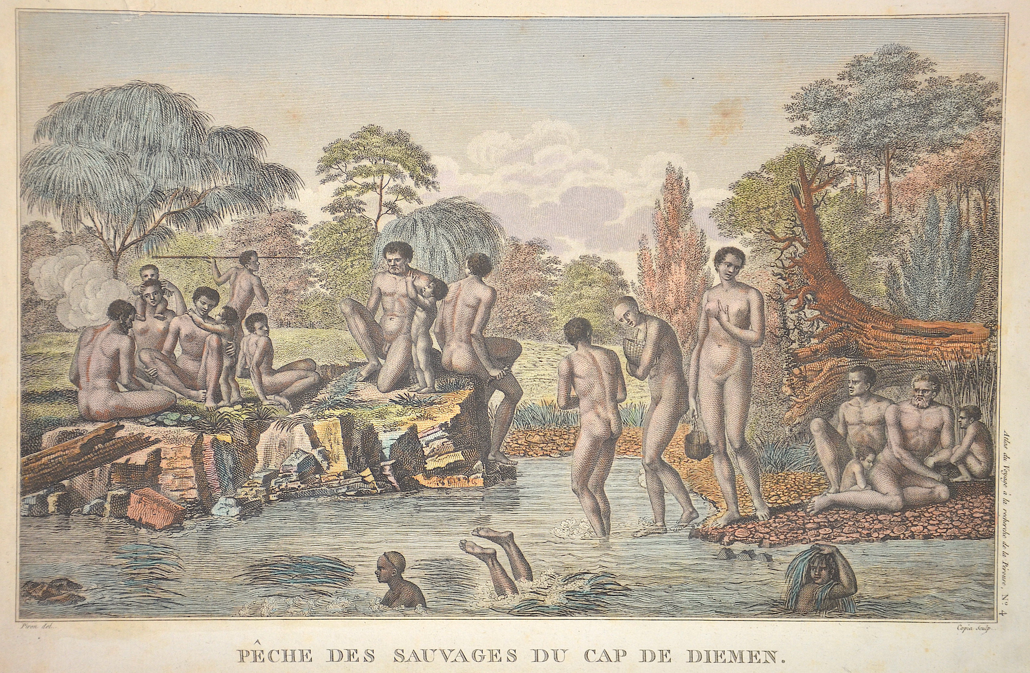
Peche des sauvages du Cap de Diemen.

| Article ID | OZ0503 |
Title | Peche des sauvages du Cap de Diemen. |
Description | View showing the habits of the aborigines in Tasmania (Van-Diemens-Land). From the Atlas du Voyage a la Recherche de la Perouse, No. 4. Engraved by Copia, drawn by Piron. |
| Year | ca. 1750 |
Artist | Pérouse, la (1741-1788) |
Jean-François de Galaup de La Pérouse (1741 1788) was a French Naval officer and explorer whose expedition vanished in Oceania. La Pérouse crossed the Pacific Ocean in 100 days, arriving at Macau, where he sold the furs acquired in Alaska, dividing the profits among his men. Lapérouse sailed all the way south to the Spanish Las Californias in 1786. He stopped at the Presidio of San Francisco long enough to create an outline map of the Bay Area, Plan du Port du St. Francois, which was reproduced as Map 33 in L. Aubert's 1797 Atlas du Voyage de la Perouse. Laterhe arrived in Monterey Bay and at the Presidio of Monterey. In 1787 after a visit to Manila, he set out for the northeast Asian coasts. He saw the island of Quelpart, present-day Cheju in South Korea, which had been visited by Europeans only once before when a group of Dutchmen shipwrecked there in 1635. He visited the Asian mainland coasts of Korea. | |
Historical Description | In 1642, the Dutchman Abel Tasman sailed along the south coast of Australia with the ship Heemskerck and the Fleute Zeehaen and discovered this area as well as New Zealand. The voyage was commissioned by the Governor General of the Dutch Indies, Anton van Diemen, after whom he named the newly discovered land (Van Diemens Land). However, Tasman assumed that it was a peninsula of the Australian continent. In 1772, the British explorer Tobias Furneaux went ashore in the southeast of the island. A year later it was also visited by the French explorer Marc-Joseph Marion du Fresne. In 1798, British Captain Matthew Flinders established that it was an island by discovering Bass Strait. Shortly after the establishment of the British colony of New South Wales on the Australian mainland, a French expedition landed on Tasmania in 1792 to explore the country. In 1803, the British established Risdon Cove on the Derwent River, the first permanent European settlement in what is now Tasmania. A year later, they abandoned it and founded Hobart Town (Hobart) in the south and Port Dalrymple (today George Town) in the north of the island. In 1825, Van Diemens Land became an independent colony from New South Wales. |
| Place of Publication | Paris |
| Dimensions (cm) | 26 x 39 cm |
| Condition | Tear on left upper margin perfectly restored |
| Coloring | original colored |
| Technique | Copper print |