

Adina Sommer
Antique and Contemporary Art
Winzerer Str. 154
80797 München
telephone
+49 89 304714
business hours:
by appointment
Email
![]()


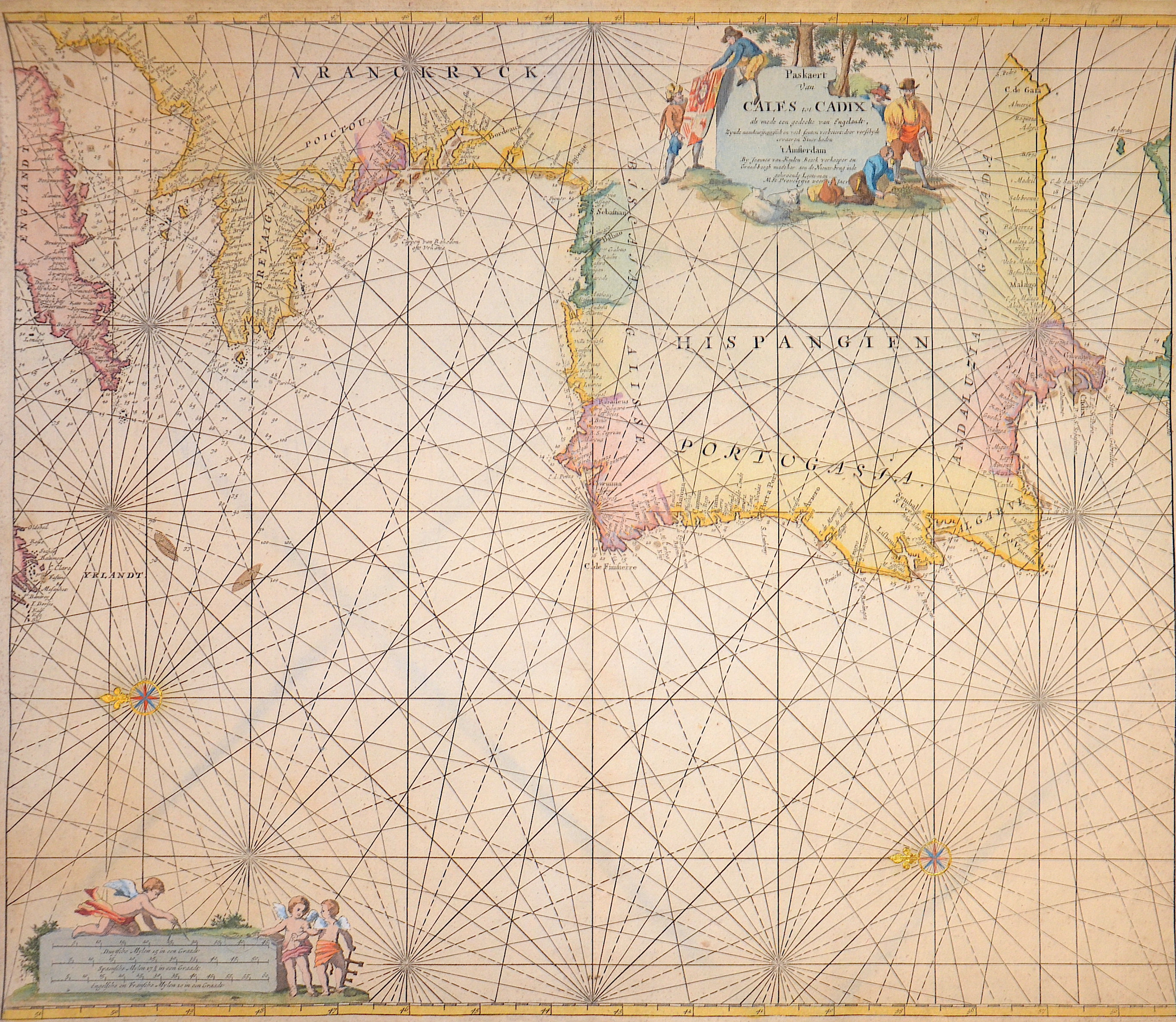
Paskaert Van Cales tot Cadix als mede een gedeelte van Engelandt,..

| Article ID | SE0324 |
Title | Paskaert Van Cales tot Cadix als mede een gedeelte van Engelandt,.. |
Description | Map shows the coast of southern England, northern and western France, Spain, Portugal, and the English Channel as well as the Strait of Gibraltar. In addition, the depths are plotted, two gilded raised compass roses, a mile scale, and a title cartouche are depicted. |
| Year | ca. 1680 |
Artist | Keulen (1654-1715) |
Johannes van Keulen (1654 - 1715) was a 17th-century Dutch cartographer. He published the influential nautical atlas the Zee-Atlas and the pilot guide Zee-Fakkel .In 1678 Johannes van Keulen established himself in Amsterdam and in 1680 he obtained a patent from the States of Holland and West Friesland allowing him to print and publish maritime atlases and shipping guides. These were books of maps and descriptions of itineraries, used by helmsmen for safe navigation. The patent was a kind of protection against illegal copying of produced books and charts. This was especially important for the atlases which were made with extensive initial costs. Van Keulen named his firm ‘In de Gekroonde Lootsman’ ('In the Crowned Pilot'). Soon Van Keulen struck a deal with cartographer Claes Jansz. Vooght. | |
| Place of Publication | Amsterdam |
| Dimensions (cm) | 51,5 x 59 cm |
| Condition | Stains outer margins |
| Coloring | original colored |
| Technique | Copper print |