

Adina Sommer
Antique and Contemporary Art
Winzerer Str. 154
80797 München
telephone
+49 89 304714
business hours:
by appointment
Email
![]()


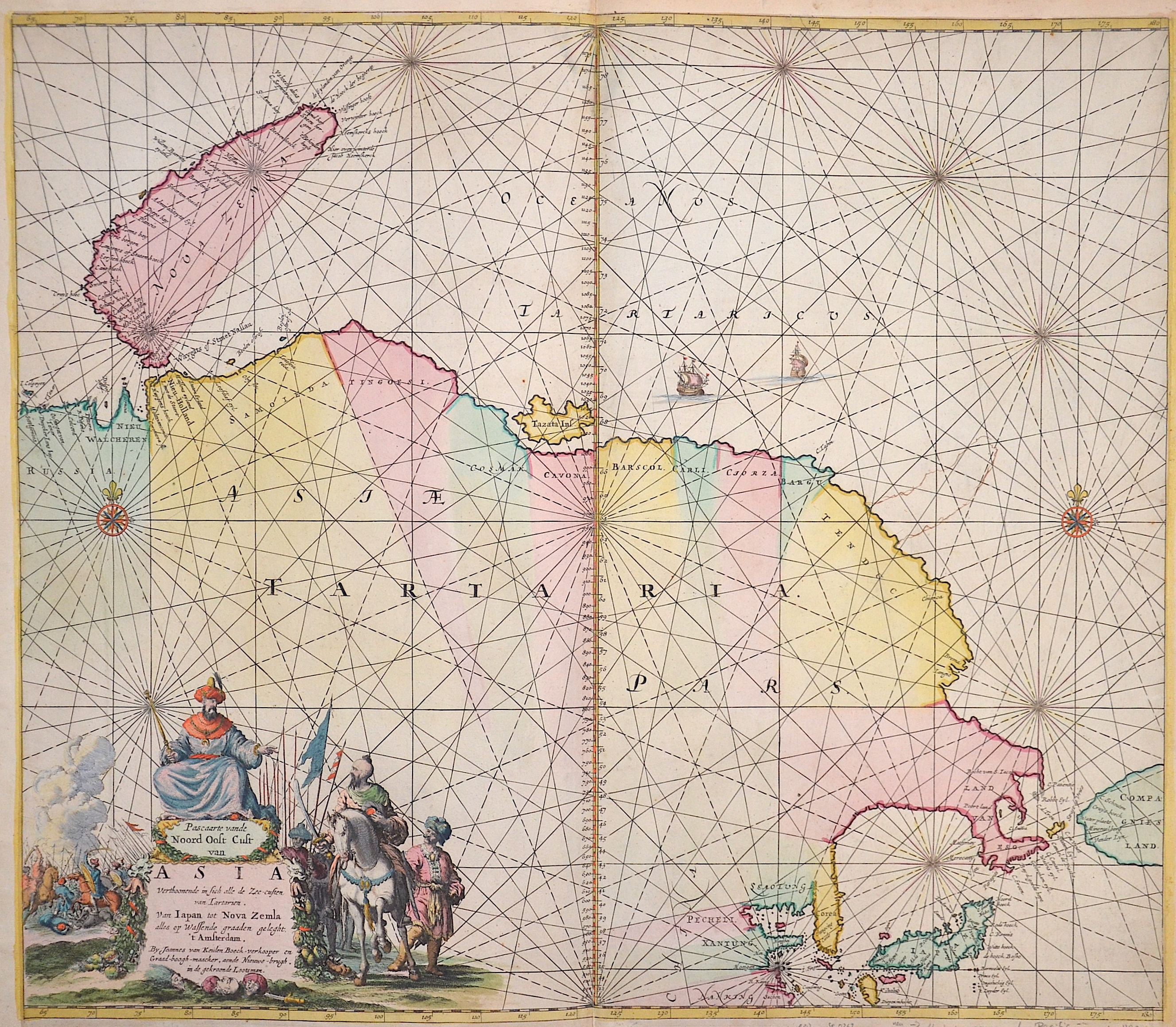
Pascaarte vande Noord Oost Cust van Asia……….van Japan tot nova Zemla

| Article ID | SE0263 |
Title | Pascaarte vande Noord Oost Cust van Asia……….van Japan tot nova Zemla |
Description | Map shows the north part of Asia with Japan and Nowaja-Semljaand the north polar sea. |
| Year | ca. 1680 |
Artist | Keulen (1654-1715) |
Johannes van Keulen (1654 - 1715) was a 17th-century Dutch cartographer. He published the influential nautical atlas the Zee-Atlas and the pilot guide Zee-Fakkel .In 1678 Johannes van Keulen established himself in Amsterdam and in 1680 he obtained a patent from the States of Holland and West Friesland allowing him to print and publish maritime atlases and shipping guides. These were books of maps and descriptions of itineraries, used by helmsmen for safe navigation. The patent was a kind of protection against illegal copying of produced books and charts. This was especially important for the atlases which were made with extensive initial costs. Van Keulen named his firm ‘In de Gekroonde Lootsman’ ('In the Crowned Pilot'). Soon Van Keulen struck a deal with cartographer Claes Jansz. Vooght. | |
Historical Description | The Arctic Ocean, also known as the Arctic Ocean, Arctic Ocean, Arctic Sea or Arctic for short. The Arctic Ocean is located in the Arctic and is covered by sea ice all year round, although the extent of the ice varies seasonally and has decreased massively due to climate change. The four poles of the northern hemisphere are located within the Arctic Ocean or on its islands. The Arctic Ocean, which is located in the extreme north of the Earth's northern hemisphere, lies between the three continents of Asia, Europe and North America. It is therefore also considered to be an intercontinental Mediterranean, although scientifically it is one of the five oceans on earth. Between Greenland and Scandinavia, the Arctic Ocean borders on the Norwegian Sea (the northernmost marginal sea of the Atlantic) and between Alaska and eastern Siberia on the Bering Strait, which leads to the Bering Sea (the northernmost marginal sea of the Pacific). The Greenland Sea and the Norwegian Sea are also marginal seas of the Atlantic because they lead to this ocean. |
| Place of Publication | Amsterdam |
| Dimensions (cm) | 52 x 60 |
| Condition | Left, right and upper margin perfectly replaced |
| Coloring | original colored |
| Technique | Copper print |