

Adina Sommer
Antique and Contemporary Art
Winzerer Str. 154
80797 München
telephone
+49 89 304714
business hours:
by appointment
Email
![]()


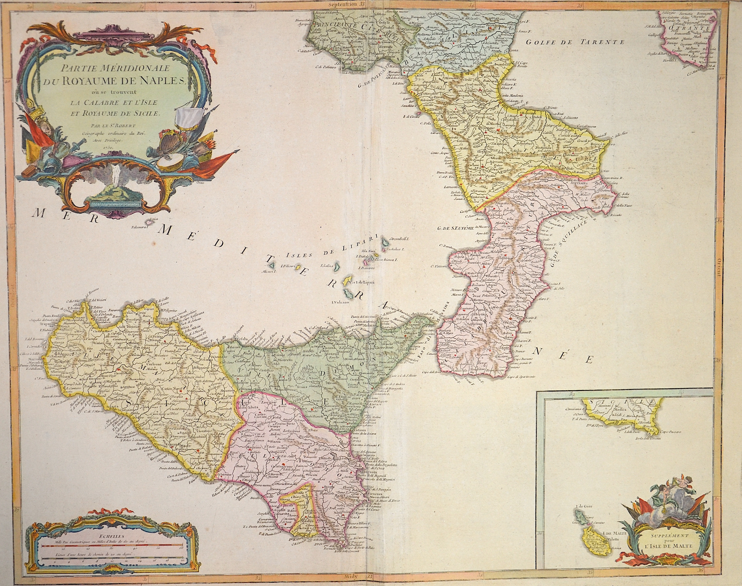
Partie meridionale du Royaume de Naples , au se trouvent la Calabrie et l´isle et Royaume de Sicilie

| Article ID | EUI748 |
Title | Partie meridionale du Royaume de Naples , au se trouvent la Calabrie et l´isle et Royaume de Sicilie |
Description | Map shows southern Italy with Calabria, Sicily, an inset map of Malta, three magnificent cartouches, title cartouche with Vesuvius. |
| Year | dated 1750 |
Artist | Vaugondy, de (1723-1786) |
Didier Robert de Vaugondy (1723 -1786) also known as Le Sieur or Monsieur Robert, and his son, were leading cartographers in France during the 18th century. In 1757, Gilles and Didier Robert De Vaugondy published The Atlas Universel, one of the most important atlases of the 18th century. To produce the atlas, the Vaugondys integrated older sources with more modern surveyed maps. They verified and corrected the latitude and longitude of many regional maps in the atlas with astronomical observations. The older material was revised with the addition of many new place names. In 1760, Didier Robert de Vaugondy was appointed geographer to Louis XV. Gilles and Didier Robert De Vaugondy produced their maps and terrestrial globes working together as father and son. Globes of a variety of sizes were made by gluing copperplate-printed gores on a plaster-finished papier-mache core, a complicated and expensive manufacturing process, employing several specialists. In some cases it is uncertain whether Gilles or Didier made a given map. Gilles often signed maps as M.Robert, while Didier commonly signed his maps as ""Robert de Vaugondy"", or added ""fils"" or ""filio"" after his name. The Robert de Vaugondys were descended from the Nicolas Sanson family through Sanson's grandson, Pierre Moulard-Sanson. From him, they inherited much of Sanson's cartographic material, which they combined with maps and plates acquired after Hubert Jaillot's death in 1712 to form the basis the Atlas Universel. | |
Historical Description | The central location of Sicily in the Mediterranean Sea has shaped the eventful history of this island. As bases for seafaring and trade, the cities of Sicily have always had great importance. Time and again, therefore, new conquerors seized the island, stayed, mixed with the already resident population and left their mark on the culture of Sicily. Only rarely was the island politically independent, mostly it was ruled by empires or states that had their political center elsewhere. From about 800 B.C. began the period of colonization by Phoenicians, mainly from the Phoenician planting city of Carthage, and somewhat later by Greeks, for whom Sicily became part of Greater Greece. In 264 BC, a Roman army crossed into Sicily, triggering a war with the Carthaginians that resulted in heavy losses. By late antiquity, Sicily was largely Romanized. After the fall of the Western Roman Empire in the late 5th century, Sicily was first dominated by the Vandals and Ostrogoths and became part of the Eastern Roman-Byzantine Empire in the mid-6th century. The first attempt at Christian reconquest of the island was still a Byzantine initiative; the imperial commander Georgios Maniakes conquered Messina in 1038 and Syracuse in 1040. Now Sicily experienced another period of prosperity and became an independent kingdom in 1130. A symbiosis of Byzantine, Arab and Norman traditions produced many important works of art. Thereafter, Sicily again fell under the control of other powers: Aragon, Spain, Savoy and Austria followed one another. With the unification of Italy, which began with Garibaldi's invasion of Sicily, Sicily became part of the new Kingdom of Italy in 1861. |
| Place of Publication | Paris |
| Dimensions (cm) | 48 x 59 cm |
| Condition | Perfect condition |
| Coloring | colored |
| Technique | Copper print |