

Adina Sommer
Antique and Contemporary Art
Winzerer Str. 154
80797 München
telephone
+49 89 304714
business hours:
by appointment
Email
![]()


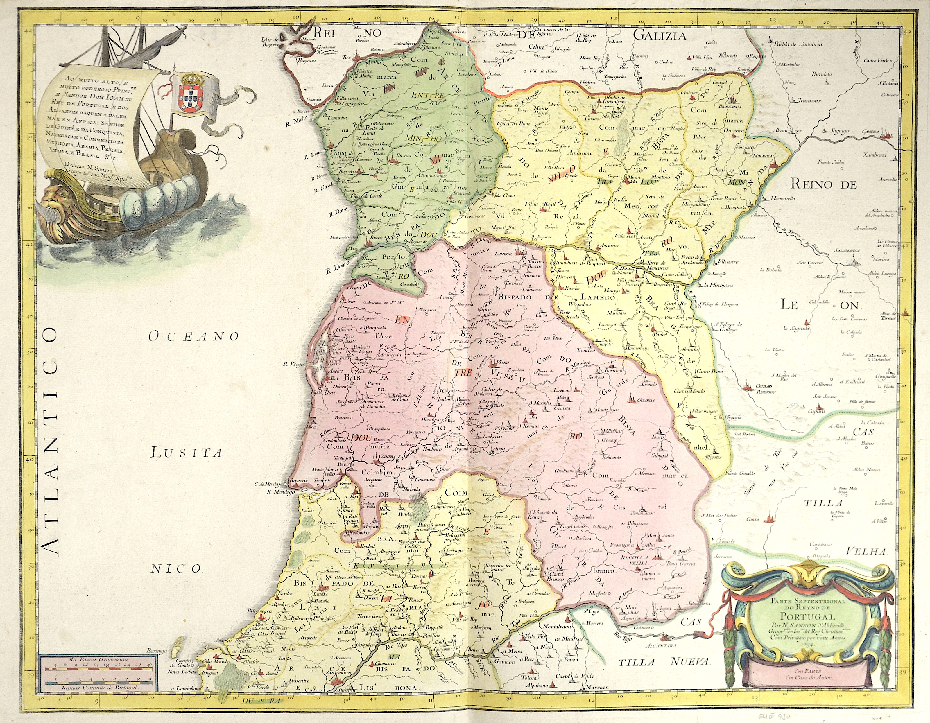
Parte septentrional do Reyno de Portugal

| Article ID | EUE930 |
Title | Parte septentrional do Reyno de Portugal |
Description | Map shows the northern part of Portugal with two magnificent title cartouches and the Portuguese coat of arms. |
| Year | dated 1654 |
Artist | Sanson (1600-1667) |
Nicolas Sanson (1600–1667) was a French cartographer, termed by some the creator of French geography, in which he's been called the father of French cartography. Active from 1627, Sanson issued his first map of importance, the ""Postes de France"", which was published by Melchior Tavernier in 1632. After publishing several general atlases himself he became the associate of Pierre Mariette, a publisher of prints. In 1647 Sanson accused the Jesuit Philippe Labbe of plagiarizing him in his Pharus Galliae Antiquae; in 1648 he lost his eldest son Nicolas, killed during the Fronde. Among the friends of his later years was the great Condé. He died in Paris on 7 July 1667. Two younger sons, Adrien (d. 1708) and Guillaume (d. 1703), succeeded him as geographers to the king. In 1692 Hubert Jaillot collected Sanson's maps in an Atlas nouveau. See also the 18th century editions of some of Sanson's works on Delamarche under the titles of Atlas de géographie ancienne and Atlas britannique; and the Catalogue des cartes et livres de géographie de Sanson (1702). | |
Historical Description | Portugal is the oldest state on the Iberian Peninsula and one of the oldest in Europe, its territory having been continuously settled, invaded and fought over since prehistoric times. The pre-Celtic people, Celts, Carthaginians and Romans were followed by the invasions of the Visigoths and Suebi Germanic peoples. In the 15th and 16th centuries, Portugal established the first global empire, becoming one of the world's major economic, political and military powers. During this period, today referred to as the Age of Discovery, Portuguese explorers pioneered maritime exploration, notably under royal patronage of Prince Henry the Navigator and King John II, with such notable voyages as Bartolomeu Dias' sailing beyond the Cape of Good Hope (1488), Vasco da Gama's discovery of the sea route to India (1497–98) and the European discovery of Brazil (1500). During this time Portugal monopolized the spice trade, divided the world into hemispheres of dominion with Castille, and the empire expanded with military campaigns in Asia. However, events such as the 1755 Lisbon earthquake, the country's occupation during the Napoleonic Wars, the independence of Brazil (1822), and a late industrialization compared to other European powers, erased to a great extent Portugal's prior opulence. |
| Place of Publication | Paris |
| Dimensions (cm) | 41 x 53 cm |
| Condition | Perfect condition |
| Coloring | colored |
| Technique | Copper print |