

Adina Sommer
Antique and Contemporary Art
Winzerer Str. 154
80797 München
telephone
+49 89 304714
business hours:
by appointment
Email
![]()


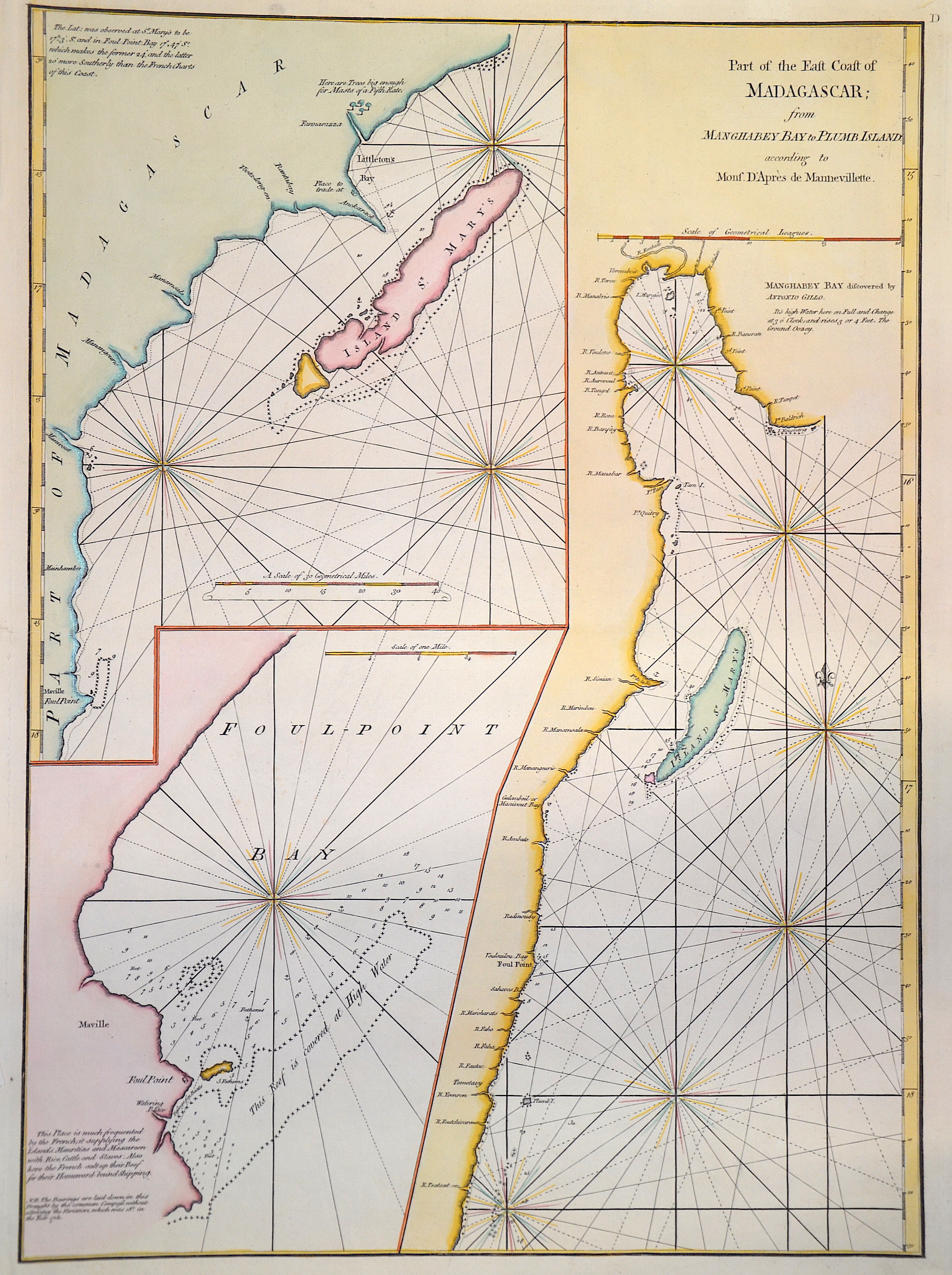
Part of the East Coast of Madagascar, from Manghabey Bay to Plumb Island.

| Article ID | AF0358 |
Title | Part of the East Coast of Madagascar, from Manghabey Bay to Plumb Island. |
Description | Decorativee and detailed seachart of Madagascar. 3 maps on one sheet with Isle Sainte Marie, Foulpointe (Mahavelona), Mangabey (Baie d' Antongil) and Plumb Island. |
| Year | ca. 1775 |
Artist | Mannevillette (1707-1775) |
Jean Babtiste D´Apres de Mannevillette ( 1707-1780) was a sailor, Mathematician and hydrographer. His father captain in the " Camaigne des Indes" or French East India Company. Recognizing the poor quality of charts published for the route to the Far East thus far, Manvillette set out to upgrade them. During the mid 1730´s he collected data and updated charts which culminated in 1745 with the issurance of " Le Neptune Oriental" which comprised of 22 charts. This work was quickly recognized as beeing a great advancement over all earlier works. During the remainder of his life Manevillette continued to update and add new information and in 1775 isued an enlarged edition containing 63 charts. This new edition contained many chrats that were based on information collected by Alexander Darymple, a Scottish geographer and later the first hydrographer of the British Admiralty. | |
Historical Description | Madagascar- officially the Republic of Madagascar , and previously known as the Malagasy Republic, is an island country in the Indian Ocean, off the coast of East Africa. Madagascar was an important transoceanic trading hub connecting ports of the Indian Ocean in the early centuries following human settlement. The written history of Madagascar began with the Arabs, who established trading posts along the northwest coast by at least the 10th century. From about 1774 to 1824, Madagascar gained prominence among pirates and European traders, particularly those involved in the trans-Atlantic slave trade. Many European sailors were shipwrecked on the coasts of the island, among them Robert Drury, whose journal is one of the few written depictions of life in southern Madagascar during the 18th century. The wealth generated by maritime trade spurred the rise of organized kingdoms on the island, some of which had grown quite powerful by the 17th century. Among these were the Betsimisaraka alliance of the eastern coast and the Sakalava chiefdoms of Menabe and Boina on the west coast. The Kingdom of Imerina, located in the central highlands with its capital at the royal palace of Antananarivo, emerged at around the same time under the leadership of King Andriamanelo. |
| Place of Publication | Paris |
| Dimensions (cm) | 57,5 x 42 |
| Condition | Perfect condition |
| Coloring | colored |
| Technique | Copper print |