

Adina Sommer
Antique and Contemporary Art
Winzerer Str. 154
80797 München
telephone
+49 89 304714
business hours:
by appointment
Email
![]()


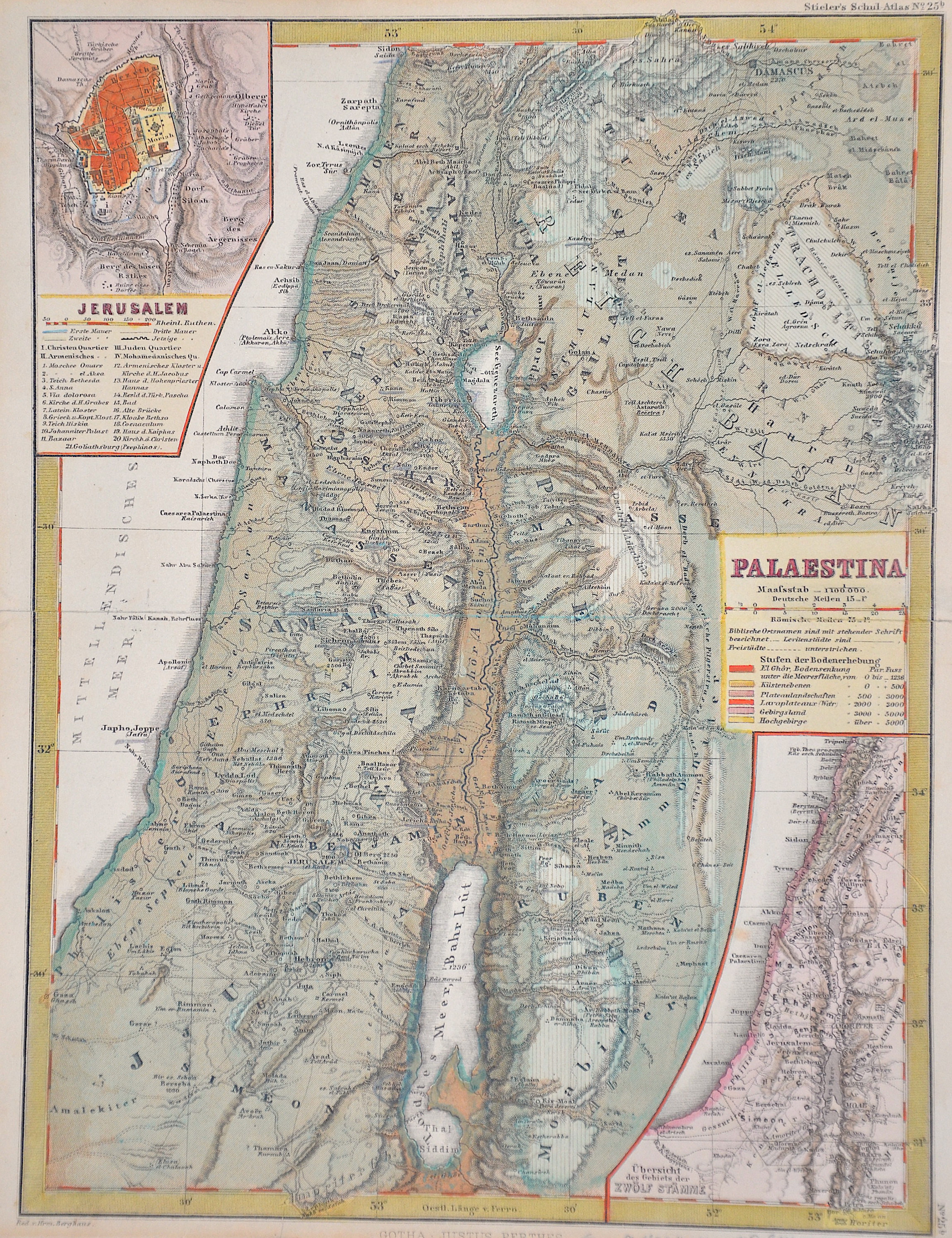
Palaestina

| Article ID | ASP314 |
Title | Palaestina |
Description | Map shows Holy Land and two insert maps showing a city map of Jerusalem and a map of the area of the 12 tribes. |
| Year | ca. 1850 |
Artist | Perthes (1749-1816) |
Johann Georg Justus Perthes ( 1749- 1816) was a German bookseller and publisher. Justus Perthes was the son of the Rudolstadt court physician Johann Justus Perthes. After training as a merchant, he obtained employment in the bookshop of Carl Wilhelm Ettinger in Gotha. Together with the latter and his later brother-in-law Friedrich Duerfeldt, he founded a company in 1778 to continue Ettinger's bookshop on his own. In September 1785, he founded Justus Perthes' Verlagsbuchhandlung, which from then on produced and distributed the Gothaische Genealogische Hofkalender, first published in 1763 and published by Ettinger, and its French edition, the Almanach de Gotha. Thanks to Perthes, the reference work soon known throughout Europe as "Der Gotha" was transformed from a calendar of the Enlightenment to an encyclopedia of the nobility with a diplomatic-statistical state handbook. In 1815, Perthes, together with the cartographers Adolf Stieler and Christian Gottlieb Reichard, planned the publication of an atlas, which was to be distinguished by "convenient format, the greatest possible accuracy, clarity and completeness, yet practical selection, uniformity of projection and scale, beautiful paper, good printing, careful illumination, and a reasonable price" and expand the publisher's program. In 1816, the year of Perthes' death, the first edition of Stieler's Hand-Atlas was published, which established the worldwide reputation of Justus Perthes' Geographical (Publishing) Institute Gotha - which only came into being after Perthes' death. | |
Historical Description | The first archaeologically proven traces of an early or proto-Israelite settlement in the Mashrek region go back to the period between the 12th and 11th centuries BC. BC back. According to biblical tradition, Jerusalem was founded around 1000 BC. Conquered by David from the Jebusites and chosen as the capital of his great empire. The country subsequently became part of the Persian Empire, then the Empire of Alexander the Great, and finally the Empire of the Seleucids. The Maccabees revolt in 165 BC BC brought Israel once more state independence for about 100 years. 63 BC The time of Roman supremacy began. The Romans divided the area into two provinces: Syria in the north, Judea in the south. In the course of the Islamic expansion, the area came under Arab rule in 636. Since then, Palestine has been predominantly inhabited by Arabs. The crusaders ruled from 1099 to 1291 what they called the "Latin Kingdom of Jerusalem". This was followed by the Mamluks from 1291 to 1517 and then the Ottoman rule from 1517 to 1918. None of these authorities had planned their own administration for Palestine or viewed the area as an independent geographical unit. The region was also part of Syria for the Ottomans, probably going back to the Roman name Syria. |
| Place of Publication | Gotha |
| Dimensions (cm) | 29 x 22 cm |
| Condition | Some restoration at centerfold |
| Coloring | colored |
| Technique | Steel engraving |