

Adina Sommer
Antique and Contemporary Art
Winzerer Str. 154
80797 München
telephone
+49 89 304714
business hours:
by appointment
Email
![]()


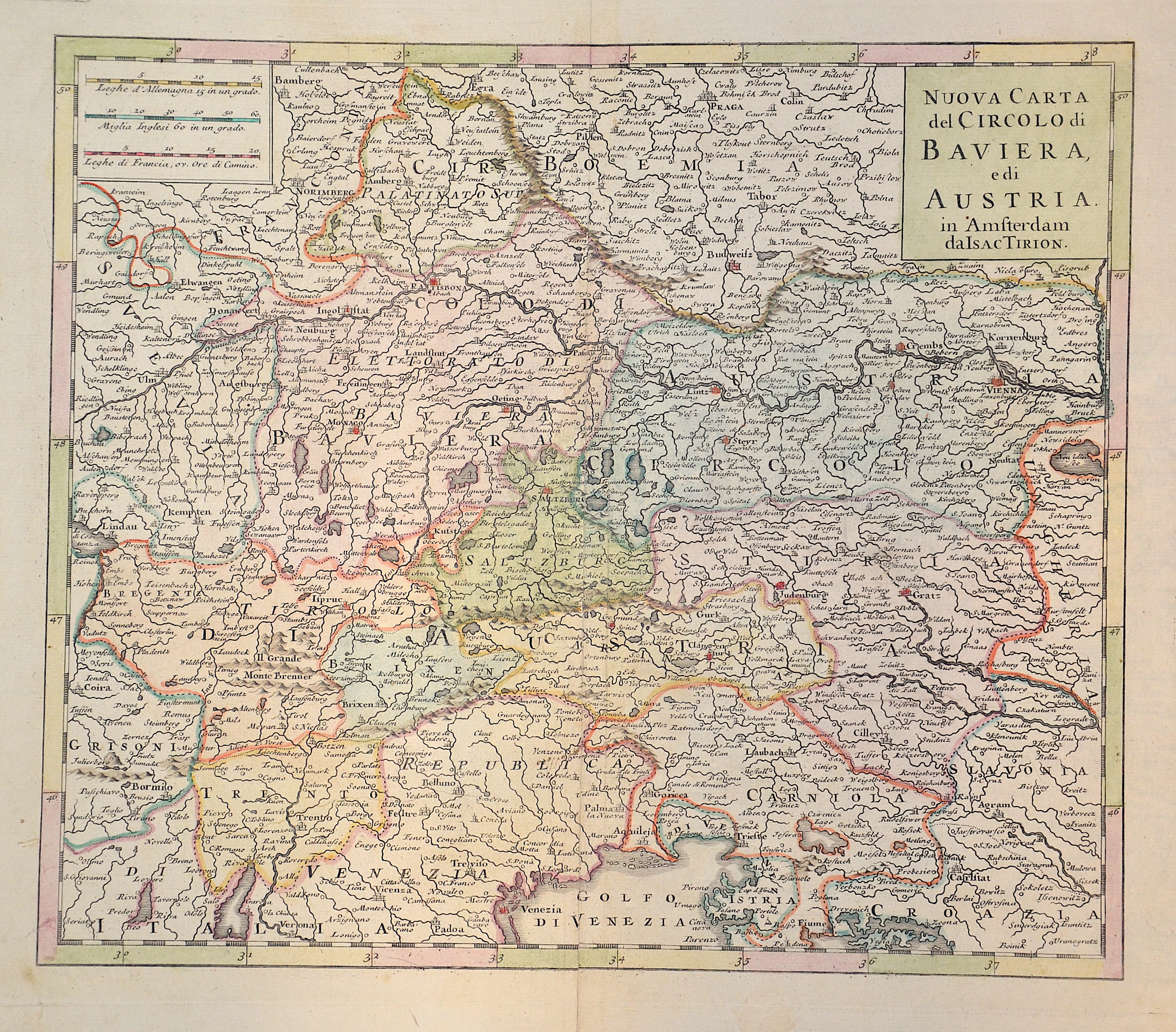
Nuova Carte del Circolo di Baviera, edi Austria.

| Article ID | EUA4702 |
Title | Nuova Carte del Circolo di Baviera, edi Austria. |
Description | Map shows the province of Tyrol, Bressanone, Trento, Carinthia, Styria, the Archduchy of Austria and partly Bavaria with Munich. |
| Year | ca. 1734 |
Artist | Tirion (1705-1765) |
Isaak Tirion (1705 1765) was a Dutch bookseller and publisher. He is known for his Hedendaagsche historie (Modern History) and his Vaderlandse Historie, both historical reference works illustrated with engravings by leading Amsterdam artists. Of particular interest today are his map works, such as the United Netherlands in twelve parts and "Tegenwoordige Staat van alle Volken" ("Present State of All Nations") in 45 parts. Some of his atlases were published after his death, such as the Atlas van Zeeland in 1760, which was published again and again until 1784. | |
Historical Description | The name Austria is first handed down in its Old High German form Ostarrichi from the year 996. The Latin form Austria was also used. In 1156 Austria became an independent duchy in the Holy Roman Empire. After the Babenbergs died out in 1246, the House of Habsburg prevailed in the struggle for rule in Austria. The area designated as Austria later included the entire Habsburg Monarchy and later the Austrian Empire, which was constituted in 1804, and the Austrian half of the Austro-Hungarian Dual Monarchy established in 1867. The present republic came into being in 1918. |
| Place of Publication | Amsterdam |
| Dimensions (cm) | 28 x 32,5 cm |
| Condition | Perfect condition |
| Coloring | colored |
| Technique | Copper print |