

Adina Sommer
Antique and Contemporary Art
Winzerer Str. 154
80797 München
telephone
+49 89 304714
business hours:
by appointment
Email
![]()


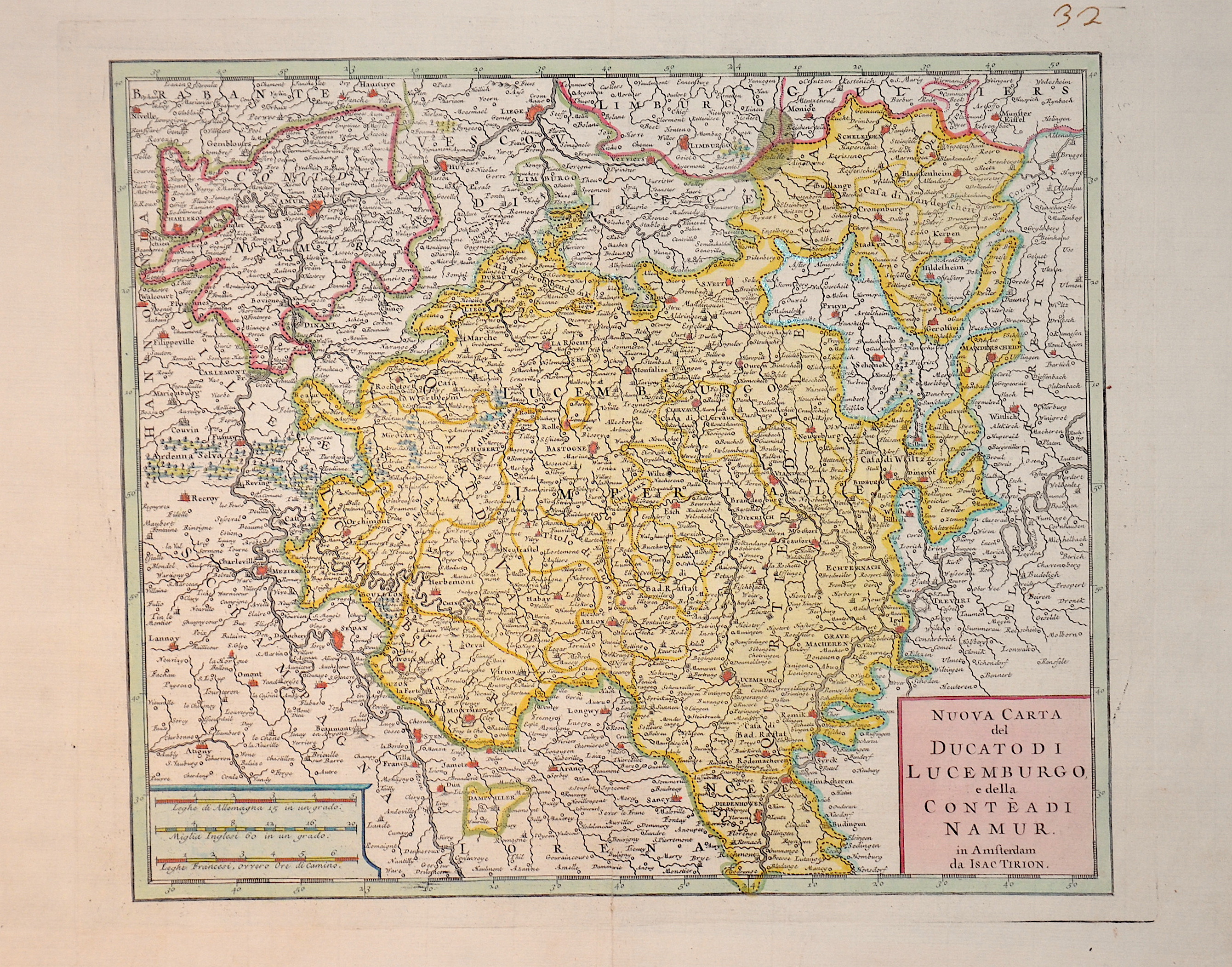
Nuova Carta del Ducato di Lucemburgo e della conteadi Namur.

| Article ID | EUB2252 |
Title | Nuova Carta del Ducato di Lucemburgo e della conteadi Namur. |
Description | Map shows Luxembourg with its bordering countries. |
| Year | ca. 1735 |
Artist | Tirion (1705-1765) |
Isaak Tirion (1705 1765) was a Dutch bookseller and publisher. He is known for his Hedendaagsche historie (Modern History) and his Vaderlandse Historie, both historical reference works illustrated with engravings by leading Amsterdam artists. Of particular interest today are his map works, such as the United Netherlands in twelve parts and "Tegenwoordige Staat van alle Volken" ("Present State of All Nations") in 45 parts. Some of his atlases were published after his death, such as the Atlas van Zeeland in 1760, which was published again and again until 1784. | |
Historical Description | Luxembourg has undergone a remarkable development throughout its history. From a small county in the Middle Ages to a strategically important area during the major wars of Europe, and eventually to a modern, prosperous country within the European Union, Luxembourg has established itself as an independent and stable state. The early history of Luxembourg was strongly shaped by Roman and later Frankish rule. During the Roman period, the area was part of the empire, and in the Middle Ages, it belonged to the Frankish kingdoms. In 1354, the Holy Roman Emperor Charles IV elevated Luxembourg to a duchy, making it an important territorial possession in the Holy Roman Empire. In the 16th century, Luxembourg came under the control of the Habsburgs, who held both the Spanish and Austrian inheritances. Under Spanish rule, Luxembourg was used as a strategic point in the wars between Spain and the Netherlands. In 1795, during the French Revolution, Luxembourg was conquered by the French and incorporated into the French Empire. In 1839, after the Belgian Revolution, Luxembourg was divided between Belgium and the Kingdom of the Netherlands. The western part of the country fell to Belgium, while the eastern part remained with the Netherlands. This division shaped Luxembourg's modern geographical boundaries and gave it its current form. Today, Luxembourg is a constitutional monarchy and one of the wealthiest countries in the world. |
| Place of Publication | Amsterdam |
| Dimensions (cm) | 27,5 x 32 cm |
| Condition | Perfect condition |
| Coloring | original colored |
| Technique | Copper print |