

Adina Sommer
Antique and Contemporary Art
Winzerer Str. 154
80797 München
telephone
+49 89 304714
business hours:
by appointment
Email
![]()


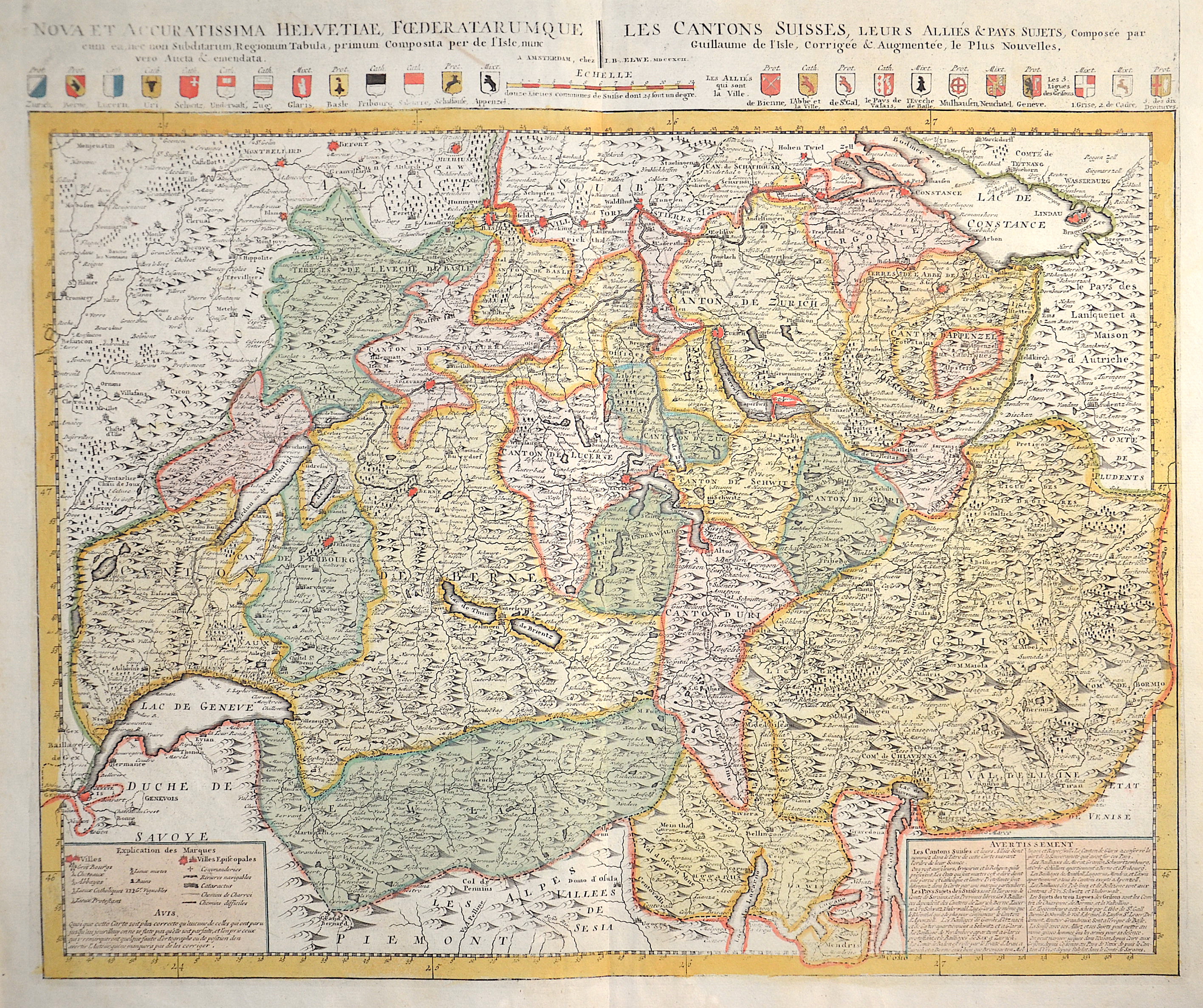
Nova et accuratissima Helvetiae, Foederaturumque.. / Les Cantons Suisses, leurs Allies & Pays Sujets,..

| Article ID | EUC3340 |
Title | Nova et accuratissima Helvetiae, Foederaturumque.. / Les Cantons Suisses, leurs Allies & Pays Sujets,.. |
Description | Map depicts complete Swizzerland with all Kantons and their coat of arms. |
| Year | dated 1792 |
Artist | Elwe (1777-1777) |
Jan Barend Elwe ( 177 - 1815), was a Dutch publisher and book seller who reissued maps by De L´Isle and Ottens and some other cartographers in the late 18th century. His famous map "Amerique Septentrionale Divisee en ses Principales Parties" was derived mainly from Sanson’s and Jaillot’s maps of 1656 and 1676. At this time, California was no longer shown as an island, but as a peninsular, and the Great Lakes to the north are enclosed, which was another feature often shown incorrectly on earlier maps of America. This map has been published in 1792 in an Atlas which included 37 other maps of different countries. | |
Historical Description | Since 1848, the Swiss Confederation has been a federal state of relatively autonomous cantons, some of which have a history of confederacy that goes back more than 700 years, putting them among the world's oldest surviving republics. The early history of the region is tied to that of Alpine culture. Switzerland was inhabited by Gauls and Raetians, and it came under Roman rule in the 1st century BC. Gallo-Roman culture was amalgamated with Germanic influence during Late Antiquity, with the eastern part of Switzerland becoming Alemannic territory. The area of Switzerland was incorporated into the Frankish Empire in the 6th century. In the high medieval period, the eastern part became part of the Duchy of Swabia within the Holy Roman Empire while the western part was part of Burgundy |
| Place of Publication | Amsterdam |
| Dimensions (cm) | 49,5 x 59,5 |
| Condition | Perfect condition |
| Coloring | original colored |
| Technique | Copper print |