

Adina Sommer
Antique and Contemporary Art
Winzerer Str. 154
80797 München
telephone
+49 89 304714
business hours:
by appointment
Email
![]()


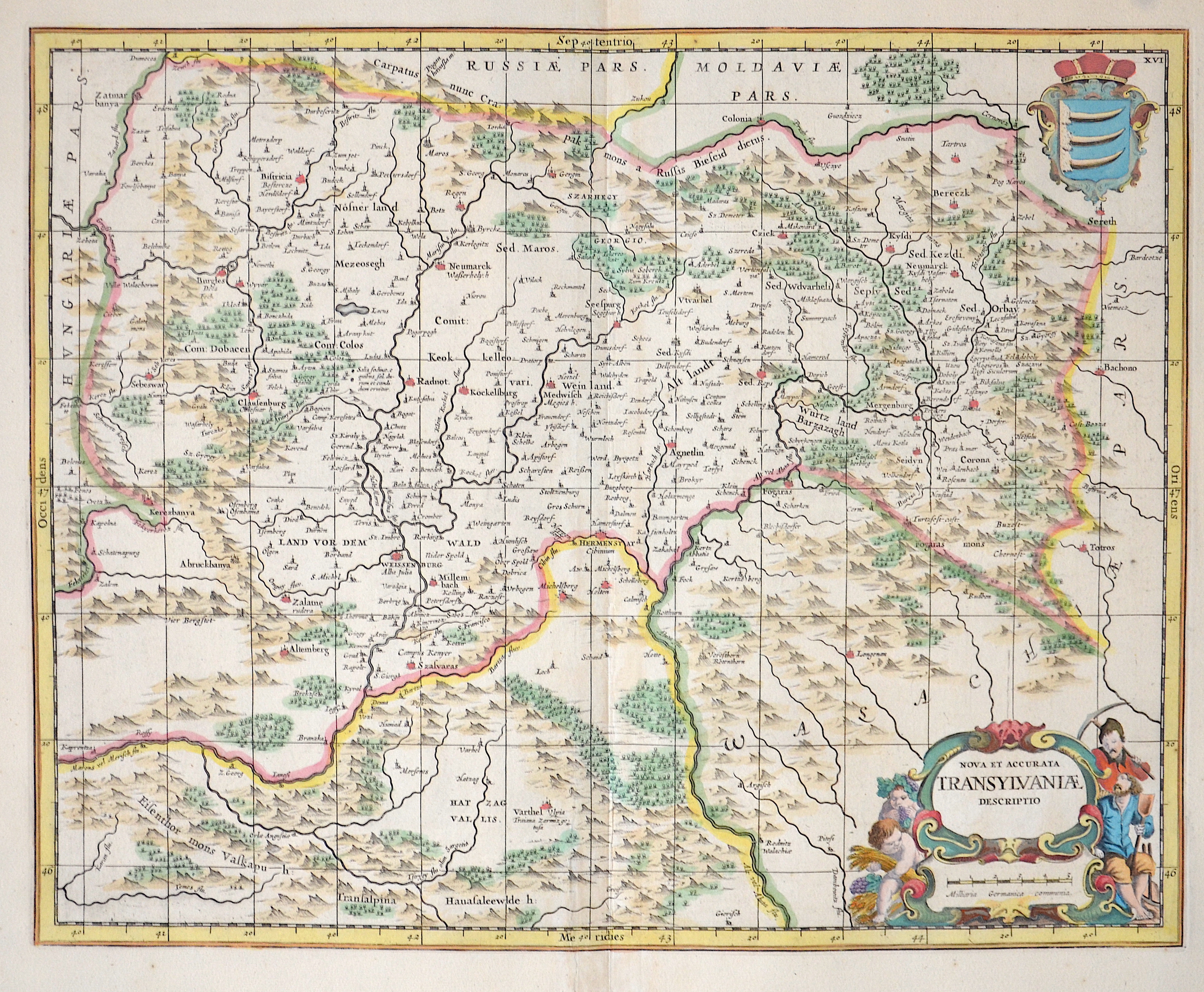
Nova et accurata Transylvaniae descriptio

| Article ID | EUR2708 |
Title | Nova et accurata Transylvaniae descriptio |
Description | The map shows the entire Transylvania (Siebenbürgen) with detailed representations of cities, forests, and mountains. Furthermore, there is a title cartouche and a coat of arms depiction. This coat of arms cannot be precisely attributed. |
| Year | ca. 1665 |
Artist | Janssonius/Mercator-Hondius, H. (1588-1664) |
Johannes Janssonius (Jansson),( 1588- 1664) Amsterdam was born in Arnhem, the son of Jan Janszoon the Elder,a publisher and bookseller. In 1612 he married Elisabeth de Hondt, the daughter of Jodocus Hondius. He produced his first maps in 1616 of France and Italy. In 1623 Janssonius owned a bookstore in Frankfurt am Main, later also in Danzig, Stockholm, Copenhagen, Berlin, Königsberg, Geneva and Lyon. In the 1630s he formed a partnership with his brother in law Henricus Hondius, and together they published atlases as Mercator/Hondius/Janssonius. Under the leadership of Janssonius the Hondius Atlas was steadily enlarged. Renamed Atlas Novus, it had three volumes in 1638, one fully dedicated to Italy. 1646 a fourth volume came out with English County Maps, a year after a similar issue by Willem Blaeu. Janssonius' maps are similar to those of Blaeu, and he is often accused of copying from his rival, but many of his maps predate those of Blaeu and/or covered different regions. By 1660, at which point the atlas bore the appropriate name Atlas Major, there were 11 volumes, containing the work of about a hundred credited authors and engravers. It included a description of most of the cities of the world (Townatlas), of the waterworld (Atlas Maritimus in 33 maps), and of the Ancient World (60 maps). The eleventh volume was the Atlas of the Heavens by Andreas Cellarius. Editions were printed in Dutch, Latin, French, and a few times in German. | |
Historical Description | Transilvania is a historical region located in what is today the central part of Romania. Bound on the east and south by its natural borders, the Carpathian mountain range, historical Transylvania extended westward to the Apuseni Mountains. The region of Transylvania is known for the scenic beauty of its Carpathian landscape and its rich history. It also contains major cities such as Cluj-Napoca, Brașov, Sibiu and Târgu Mureș. The Habsburgs acquired the territory shortly after the Battle of Vienna in 1683. In 1687, the rulers of Transylvania recognized the suzerainty of the Habsburg emperor Leopold I, and the region was officially attached to the Habsburg Empire. |
| Place of Publication | Amsterdam |
| Dimensions (cm) | 39 x 49,5 cm |
| Condition | Very good |
| Coloring | colored |
| Technique | Copper print |