

Adina Sommer
Antique and Contemporary Art
Winzerer Str. 154
80797 München
telephone
+49 89 304714
business hours:
by appointment
Email
![]()


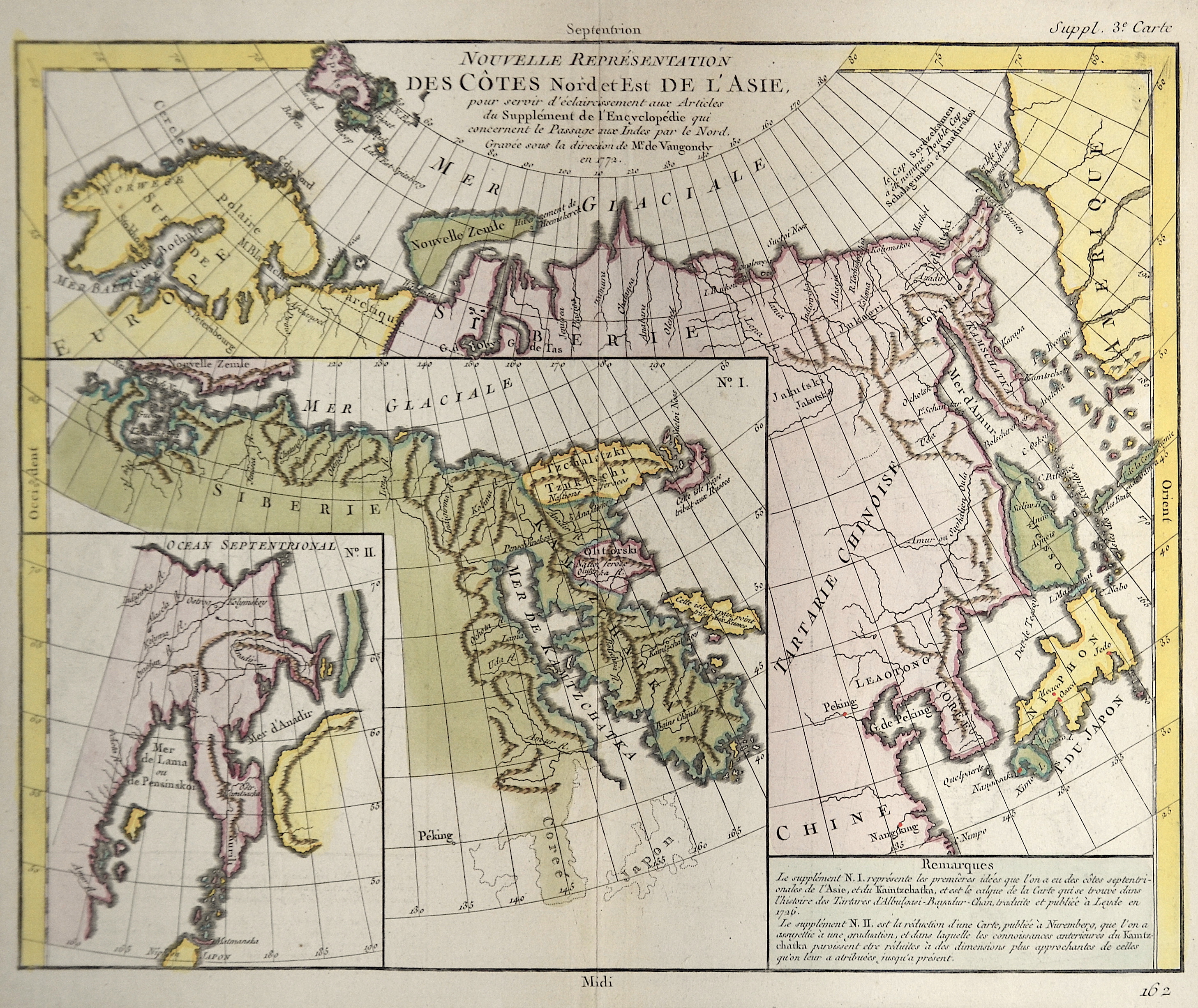
Nouvelle representation des Cotes Nord et ‘Est de L´Asie….

| Article ID | ASC0522 |
Title | Nouvelle representation des Cotes Nord et ‘Est de L´Asie…. |
Description | Map shows 3 insets with Beringsea, Kamtschatka, Sibiria and Japan. |
| Year | dated 1772 |
Artist | Vaugondy,de (1723-1786) |
Didier Robert de Vaugondy (1723 -1786) also known as Le Sieur or Monsieur Robert, and his son, were leading cartographers in France during the 18th century. In 1757, Gilles and Didier Robert De Vaugondy published The Atlas Universel, one of the most important atlases of the 18th century. To produce the atlas, the Vaugondys integrated older sources with more modern surveyed maps. They verified and corrected the latitude and longitude of many regional maps in the atlas with astronomical observations. The older material was revised with the addition of many new place names. In 1760, Didier Robert de Vaugondy was appointed geographer to Louis XV. Gilles and Didier Robert De Vaugondy produced their maps and terrestrial globes working together as father and son. Globes of a variety of sizes were made by gluing copperplate-printed gores on a plaster-finished papier-mache core, a complicated and expensive manufacturing process, employing several specialists. In some cases it is uncertain whether Gilles or Didier made a given map. Gilles often signed maps as M.Robert, while Didier commonly signed his maps as ""Robert de Vaugondy"", or added ""fils"" or ""filio"" after his name. The Robert de Vaugondys were descended from the Nicolas Sanson family through Sanson's grandson, Pierre Moulard-Sanson. From him, they inherited much of Sanson's cartographic material, which they combined with maps and plates acquired after Hubert Jaillot's death in 1712 to form the basis the Atlas Universel. | |
Historical Description | The Kamchatka Peninsula was discovered by Cossacks on their forays into eastern Russia in 1697. Since there were mainly a lot of sables here, the area was annexed by Russia shortly after. The indigenous people living there, the Koryaks, Itelmen, Evens, Chukchi and Aleuts (Unangan), were bloodily subjugated by Russian Cossacks and almost exterminated. The Dane Vitus Bering, after whom the strait between Eastern Siberia and Alaska is named, led large expeditions to Kamchatka and north to the Bering Sea from 1725 to 1730 and from 1733 to 1743. Georg Wilhelm Steller, botanist and theologian, wrote extensive notes from the second expedition. |
| Place of Publication | Paris |
| Dimensions (cm) | 29,5 x 36 |
| Condition | Very good |
| Coloring | original colored |
| Technique | Copper print |