

Adina Sommer
Antique and Contemporary Art
Winzerer Str. 154
80797 München
telephone
+49 89 304714
business hours:
by appointment
Email
![]()


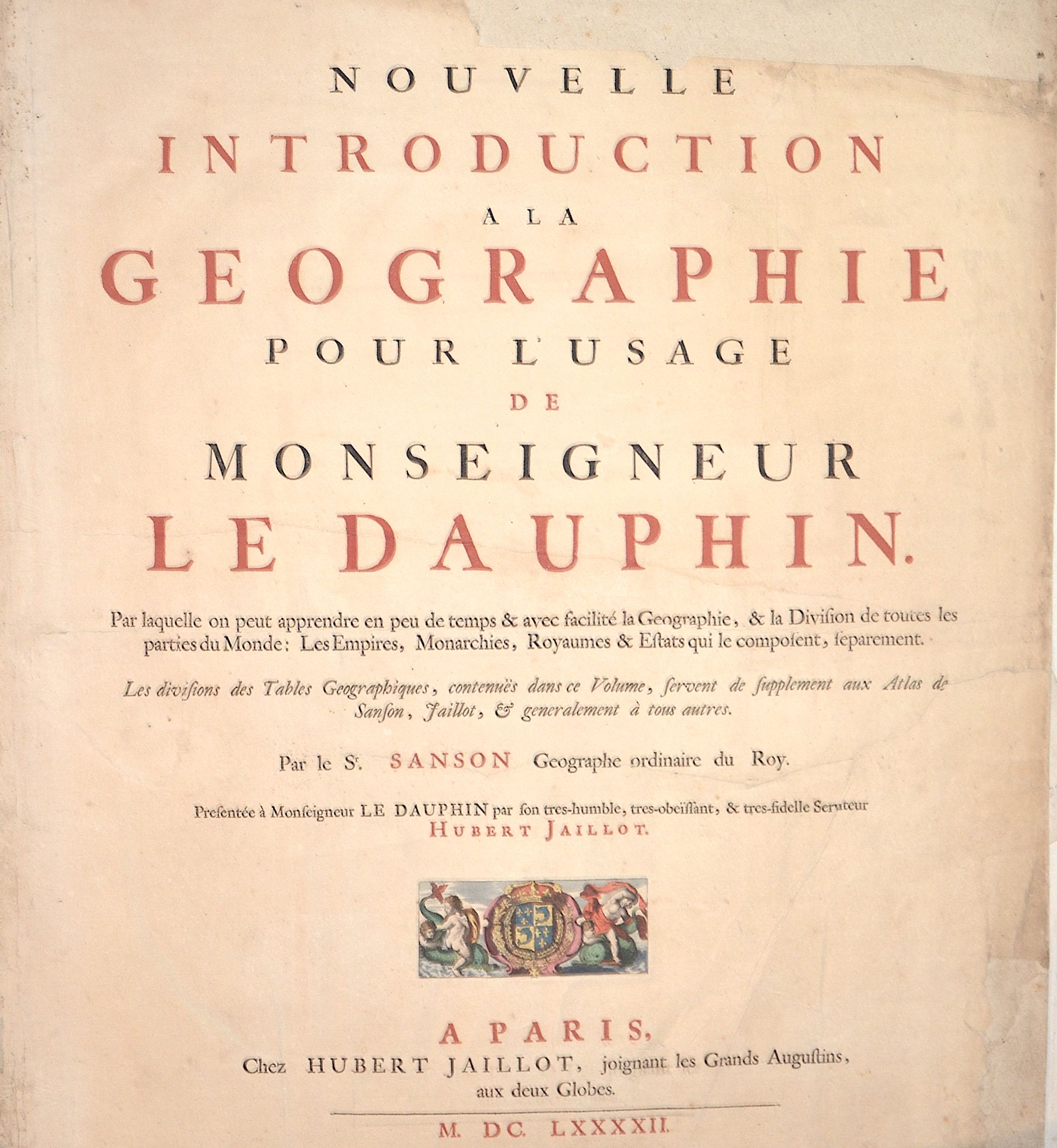
Nouvelle Introduction a la Geographie pour l’usage de Monseigneur Le Dauphin.

| Article ID | T0152 |
Title | Nouvelle Introduction a la Geographie pour l’usage de Monseigneur Le Dauphin. |
Description | Title page by the author Nicolas Sanson "Nouvelle Introduction a la Geographie pour l'usage de Monseigneur Le Dauphin. Par laquelle on peut apprendre en peu de temps & avec facilité la Geographie, & la Division de toutes les parties du Monde: Les Empires, Monarchies, Royaumes & Estats qui le composent, separement." Furthermore, a heraldic representation of the historical landscape of Daufiné in the southeast of France. |
| Year | c. 1692 |
Artist | Sanson/ Jaillot, Charles Hubert (1600-1667) |
Nicolas Sanson (1600–1667) was a French cartographer, termed by some the creator of French geography, in which he's been called the father of French cartography. Active from 1627, Sanson issued his first map of importance, the ""Postes de France"", which was published by Melchior Tavernier in 1632. After publishing several general atlases himself he became the associate of Pierre Mariette, a publisher of prints. In 1647 Sanson accused the Jesuit Philippe Labbe of plagiarizing him in his Pharus Galliae Antiquae; in 1648 he lost his eldest son Nicolas, killed during the Fronde. Among the friends of his later years was the great Condé. He died in Paris on 7 July 1667. Two younger sons, Adrien (d. 1708) and Guillaume (d. 1703), succeeded him as geographers to the king. In 1692 Hubert Jaillot collected Sanson's maps in an Atlas nouveau. See also the 18th century editions of some of Sanson's works on Delamarche under the titles of Atlas de géographie ancienne and Atlas britannique; and the Catalogue des cartes et livres de géographie de Sanson (1702). | |
Historical Description | The title page is one of the most important parts of an atlas or book. It appears at the beginning of the book and describes the actual title and the context or subject of the book or atlas. The title page often shows the title of the work, the person or institution responsible for its intellectual content, and the imprint, which includes the name and address of the publisher as well as the date of publication. Further information about the publication is often printed on the back of the title page.The first printed books or incunabula had no title pages: the text simply began on the first page, and the book was often identified by its opening words – the incipit. Maps were usually published in atlases, and atlases were books with titles. Even here, title pages were individual works of art. A publisher emphasized the importance of a book by introducing it with a spectacular entrée.Usually, the images on an atlas title page referred to the subject matter: measuring instruments, mythological, astronomical, religious, scientific, and allegorical references and facts were combined in a composition that represented the pride of scientific and intellectual progress. An atlas title page is often no more than an outstanding artistic and expressive cartouche. |
| Place of Publication | Paris |
| Dimensions (cm) | 48,5 x 38,5 cm |
| Condition | Tears restored |
| Coloring | original colored |
| Technique | Copper print |