

Adina Sommer
Antique and Contemporary Art
Winzerer Str. 154
80797 München
telephone
+49 89 304714
business hours:
by appointment
Email
![]()


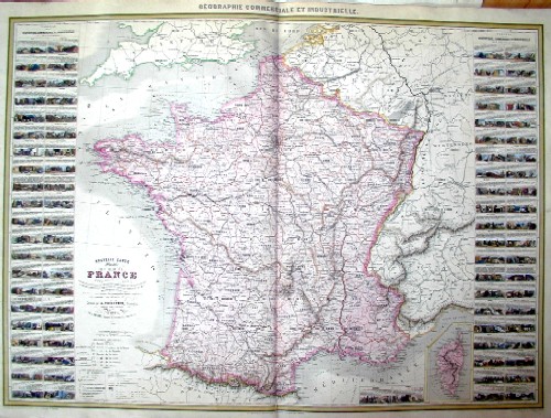
Nouvelle Carte illustre de la France…
| Article ID | EUF1399 |
Title | Nouvelle Carte illustre de la France… |
Map shows total France with 86 views at the border with the former provinces and a description of their structure and population, on a seperate map showing Corsica. | |
| Year | dated 1857 |
Artist | Vuillemin |
| Place of Publication | Paris |
| Dimensions (cm) | 62 x 83 |
| Condition | Very good |
| Coloring | original colored |
| Technique | Steel engraving |
:
70.50 €
( A reproduction can be ordered individually on request. )