

Adina Sommer
Antique and Contemporary Art
Winzerer Str. 154
80797 München
telephone
+49 89 304714
business hours:
by appointment
Email
![]()


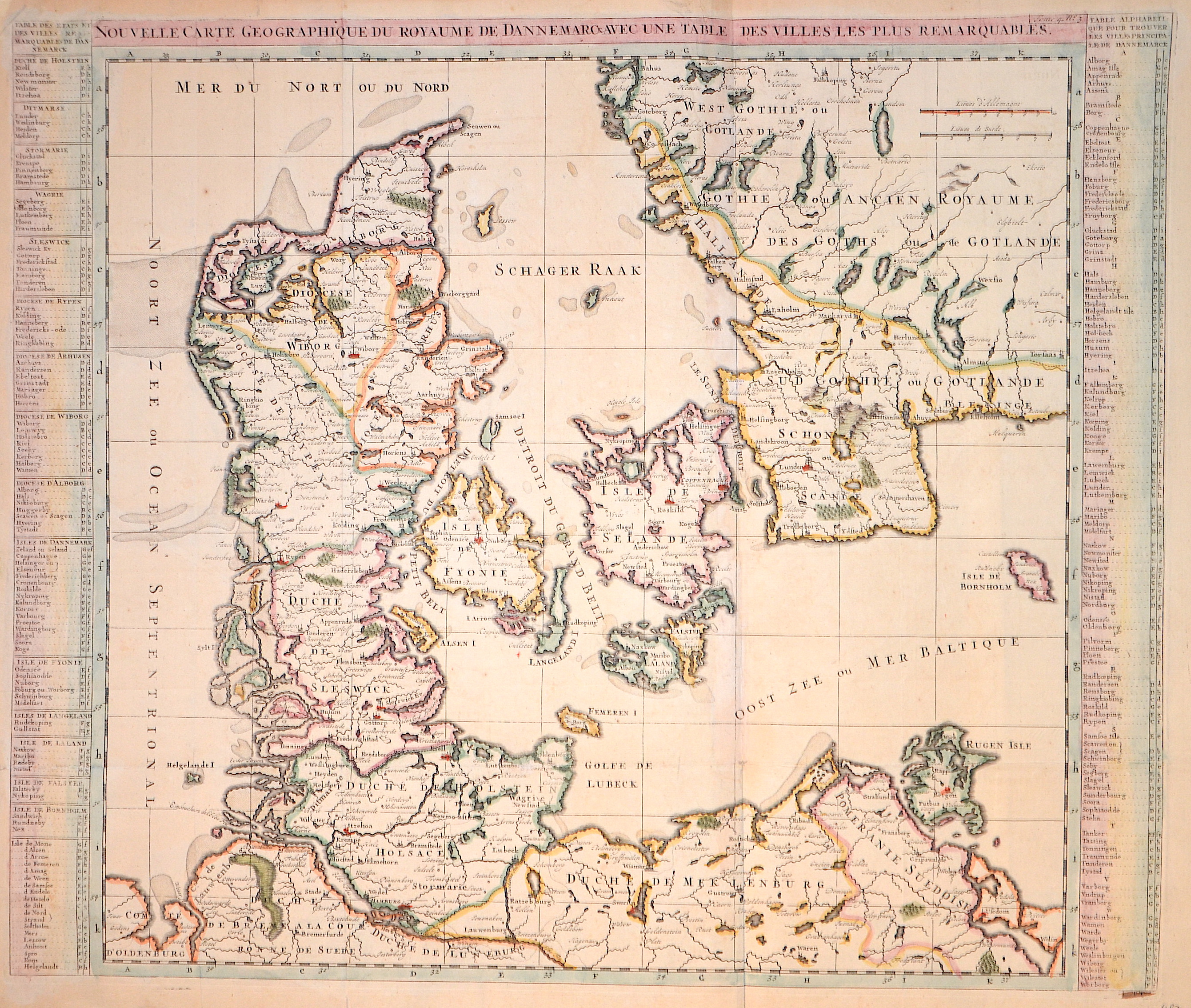
Nouvelle Carte geographique du Royaume de Dannemarck avec une table des villes les plus remarquables.

| Article ID | EUS1034 |
Title | Nouvelle Carte geographique du Royaume de Dannemarck avec une table des villes les plus remarquables. |
Description | Map shows total denmark with the south part of Sweden and the north coast of Germany with the island Rügen. |
| Year | ca. 1720 |
Artist | Chatelain (1684-1743) |
Henri Abraham Chatelain (1684 - 1743) was a Huguenot pastor of Parisian origins. He lived consecutively in Paris, St. Martins, London (c. 1710), The Hague (c. 1721) and Amsterdam (c. 1728). He is best known as a Dutch cartographer and more specifically for his cartographic contribution in the seminal seven volume Atlas Historique, published in Amsterdam between 1705 and 1720. Innovative for its time, the Atlas Historique combined fine engraving and artwork with scholarly studies of geography, history, ethnology, heraldry, and cosmography. Some scholarship suggests that the Atlas Historique was not exclusively compiled by Henri Chatelain, as is commonly believed, but rather was a family enterprise involving Henri, his father Zacharie and his brother, also Zacharie. | |
Historical Description | Denmark is a country and sovereign state in Northern Europe and a parliamentary monarchy. Denmark is officially called the Kingdom of Denmark along with the Faroe Islands, which geographically belong to Northern Europe, like the mother country, and Greenland, which belongs to North America. The Danish people are said to have come from Scania to Jutland and the western Baltic islands in the 6th century, where they displaced other Germanic tribes. In the 10th century, Gorm the Old (around 950) united the individual minor kingdoms under his rule. Until 1035, when Knut the Great died, the Danish kings succeeded in conquering large parts of the British Isles. Until well into the 11th century, the Danes, Swedes and Norwegians, among others, were called Vikings, who founded colonies and traded throughout Europe. The only land border is between Denmark and Germany. A Danish minority lives in the former Danish southern Schleswig. With the Kalmar Union, Halland was suddenly in the center of the Danish Empire and, according to the Union Treaty, Erich of Pomerania should have been crowned in Halmstad. In the period that followed, Halland was not spared the wars of the era. In 1434, the landscape was conquered by the fighters of the Engelbrekt uprising and the Falkenberg castle was burned down. In the course of the Three Crown War, the Battle of Axtorna (also: Battle on the Falkenberger Haide) took place here in 1565, during which the Danish general Rantzau defeated a superior Swedish army. Until 1645 Halland belonged to Denmark and was then awarded in the peace of Brömsebro to Sweden for 30 years. Since the Peace of Roskilde in 1658, Halland has finally belonged to Sweden, although Denmark tried again in the Schoen War (1675–1679) to recapture lost territory. |
| Place of Publication | Amsterdam |
| Dimensions (cm) | 50 x 60 cm |
| Condition | Tear on upper margin perfectly restored |
| Coloring | colored |
| Technique | Copper print |