

Adina Sommer
Antique and Contemporary Art
Winzerer Str. 154
80797 München
telephone
+49 89 304714
business hours:
by appointment
Email
![]()


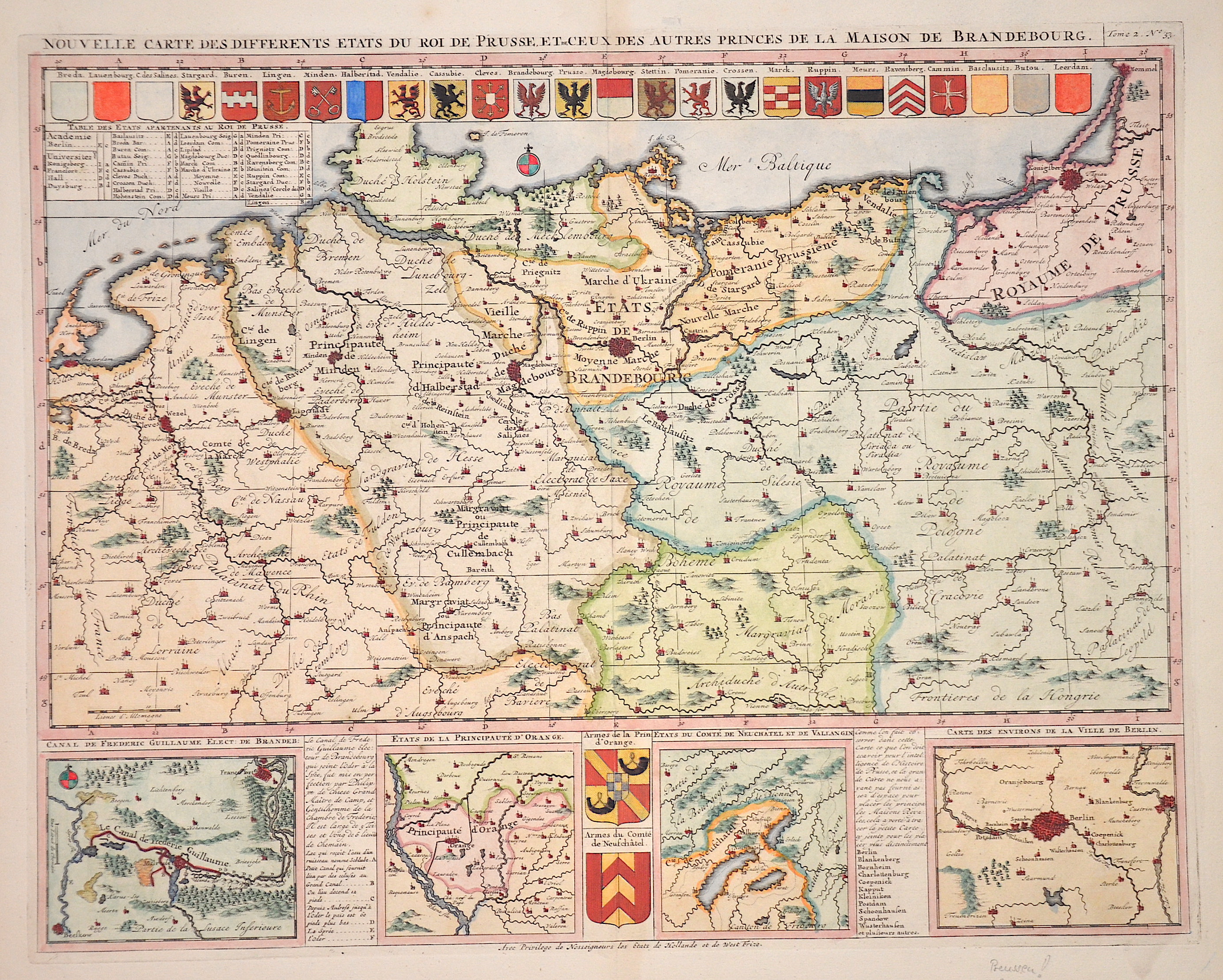
Nouvelle Carte des differents ètats du roi du Prusse et de ceux des autres princes de la maison de Brandebourg

| Article ID | EUD2879 |
Title | Nouvelle Carte des differents ètats du roi du Prusse et de ceux des autres princes de la maison de Brandebourg |
Description | Map shows the whole of Brandenburg with Prussia, 4 partial maps of Berlin, Neuchatel, Orange, Canal F. Guilluame and 27 magnificent coats of arms. |
| Year | ca. 1720 |
Artist | Chatelain (1684-1743) |
Henri Abraham Chatelain (1684 - 1743) was a Huguenot pastor of Parisian origins. He lived consecutively in Paris, St. Martins, London (c. 1710), The Hague (c. 1721) and Amsterdam (c. 1728). He is best known as a Dutch cartographer and more specifically for his cartographic contribution in the seminal seven volume Atlas Historique, published in Amsterdam between 1705 and 1720. Innovative for its time, the Atlas Historique combined fine engraving and artwork with scholarly studies of geography, history, ethnology, heraldry, and cosmography. Some scholarship suggests that the Atlas Historique was not exclusively compiled by Henri Chatelain, as is commonly believed, but rather was a family enterprise involving Henri, his father Zacharie and his brother, also Zacharie. | |
Historical Description | The province of Pomerania, located in the north German lowlands, was the Prussian province formed from the Duchy of Pomerania after the Vienna Congress in 1815. It consisted of western Pomerania and Western Pomerania. Pomerania's capital was Szczecin. Through the Peace of Westphalia in 1648, Hinterpommern came to Brandenburg and Vorpommern became Swedish-Pommern. The Brandenburg Elector Friedrich Wilhelm I succeeded in conquering all of Swedish Pomerania in 1678, but he had to forego the majority of the conquered areas under pressure from France in the Peace of Saint-Germain (1679). After the end of the Great Northern War (1700-1721), the part of Western Pomerania south of the Peene came to Prussia (Old Western Pomerania). During the territorial reorganization of Europe in 1815, the last part of Western Pomerania, which remained Swedish, became Prussian with the island of Rügen (New Western Pomerania). At the same time, Pomerania received the districts of Dramburg and Schivelbein as well as the northern parts of the Arnswalde district with the town of Nörenberg from the Neumark, which otherwise remained with the province of Brandenburg. |
| Place of Publication | Paris |
| Dimensions (cm) | 38 x 48 cm |
| Condition | Perfect condition |
| Coloring | original colored |
| Technique | Copper print |