

Adina Sommer
Antique and Contemporary Art
Winzerer Str. 154
80797 München
telephone
+49 89 304714
business hours:
by appointment
Email
![]()


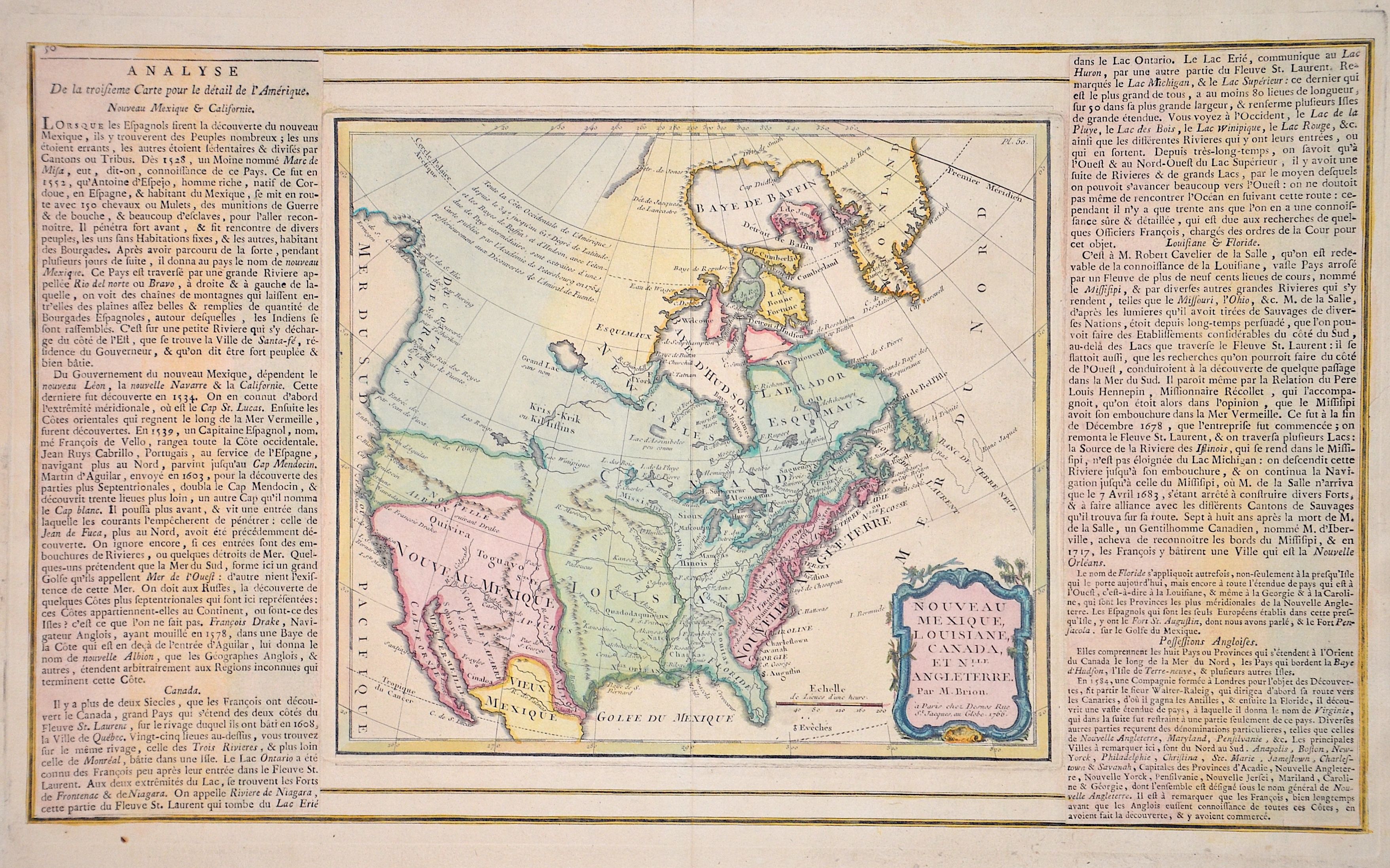
Nouveau Mexique, Louisiane, Canada, et Nlle. Angleterre. Par M. Brion.

| Article ID | AMU1002 |
Title | Nouveau Mexique, Louisiane, Canada, et Nlle. Angleterre. Par M. Brion. |
Description | Map depicts total North America with USA and Canada. On the left and right side, description and anlyse of countiries, rivers and lakes of USA and Canada. |
| Year | dated 1766 |
Artist | Desnos (1725-1805) |
Louis-Charles Desnos (1725 - 1805) was both a globe maker and publisher of maps. In the former capacity he was appointed globe maker to the King of Denmark but spent most of his life working in Paris. Louis Charles Desnos and Claude Buy de Mornas worked together in the same establishments and issued together "La Manniere de Reconnoitre les Principales Etoiles dans le Ciel" (The Manner of Recognizing the Principal Stars in the Sky) in 1761. | |
Historical Description | The discovery of America means the first sighting of the American continent by seafarers. Before Columbus' arrival in 1492, North America may have had more inhabitants than Europe at that time. In 1497 the Genoese John Cabot (actually: Giovanni Caboto) became the first European since the Vikings to set foot on North American soil. However, permanent branches were not established for the time being. St. Augustine in Florida, founded in 1565 by the Spanish, is considered the first city on mainland North America, and is also the oldest city in the USA. Four states stood out in the European conquest of North America, each of which made it easier to take possession: England was under pressure to emigrate, also based on religion, and was thus able to represent the largest group in terms of numbers. France had special skills in dealing with the indigenous peoples, which later led to the only mixed ethnic group, the Métis, and the Netherlands had the financial means to establish colonies in North America. Spain had enormous military potential due to the combat experience. In 1604 the King of England Jacob I divided his North American colonies as follows: The area from the 1st to the 41st degree of latitude is said to be populated by the Virginia Company of London, the area from the 41st to the 45th degree the Plymouth Company. 1607 is considered the year of foundation of the first permanent colony of English settlers on the east coast of America. There was a collision between three cultures: Native Americans, white settlers and slaves from Africa. This year the first settlers from England landed in Jamestown, followed in 1620 by the (better known) pilgrims with the Mayflower in what is now the US state of Massachusetts. These could find shelter directly in the abandoned Indian settlements. The coastal Indians were now ready to cooperate and had Plymouth established the English gateway to North America. |
| Place of Publication | Paris |
| Dimensions (cm) | 28 x 48 cm |
| Condition | Perfect condition |
| Coloring | colored |
| Technique | Copper print |