

Adina Sommer
Antique and Contemporary Art
Winzerer Str. 154
80797 München
telephone
+49 89 304714
business hours:
by appointment
Email
![]()


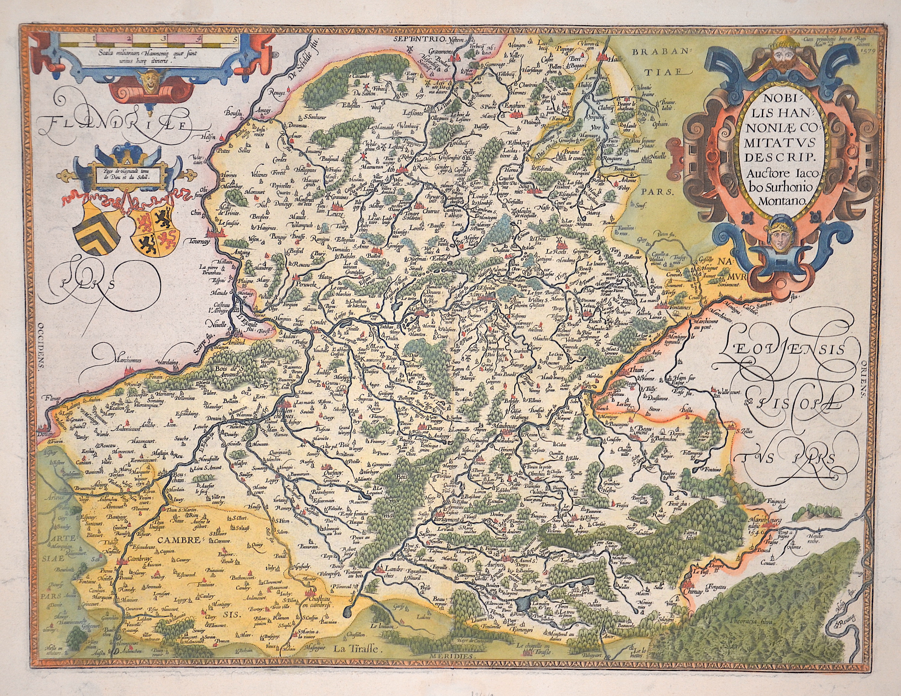
Nobilis Hannoniae comitatus descrip. Auctore Jacobo Surhonio Montano.

| Article ID | EUB4826 |
Title | Nobilis Hannoniae comitatus descrip. Auctore Jacobo Surhonio Montano. |
Description | Map showing the province of Hainaut in Belgium with a title, mileage and coat of arms cartouche. After the very rare first edition of the Hainaut map by Abraham Ortelius.The history of this map is fascinating. It is based on a handwritten map by Jacques Surhon (1548), which was not published for security reasons. In 1572 Ortelius applied for the privilege to publish the map, but it was never granted. The plate was nevertheless engraved, and some prints (perhaps 100) of it appeared in the 1573-1575 editions of the Theatrum. This plate was then destroyed and a new plate engraved in 1579, when Antwerp was independent for a short time, with a privilege in 1579 at the top right. Van den Broecke: 69. |
| Year | ca. 1579 |
Artist | Ortelius (1527-1598) |
Abraham Ortelius (1527–1598) was a Flemish cartographer and publisher from Antwerp. Originally a map colorist, he became a major figure in cartography through his Theatrum Orbis Terrarum (1570), considered the first modern atlas—a uniform collection of reliable maps in book form. Influenced by Gerardus Mercator, Ortelius published several maps before compiling the Theatrum, which clearly showed America as a separate continent. The work was published in 42 editions and 7 languages by 1612. Unlike many of his peers, Ortelius cited his sources, and his atlas became a milestone in mapmaking and geographic knowledge. | |
Historical Description | As the province of Belgica - a name introduced by Caesar - what is now Belgium experienced many rulers. From the High Middle Ages to the early modern period, the cities of Flanders with their cloth industries represented one of the two centers of the European economy. Politically, the individual territories came under the House of Burgundy, which was inherited by the Habsburgs in 1477. In 1579 the Catholic Union of Arras and the Calvinist-Protestant Union of Utrecht were formed. The provinces of the Union of Utrecht broke away from Spain in 1581 and founded the Republic of the Seven United Provinces, whose independence was recognized in the Peace of Westphalia of 1648 after the end of the Eighty Years War. The provinces of the Union of Arras, Flanders and Brabant were administered as the Spanish Netherlands by a Spanish governor. After the extinction of the Spanish Habsburgs (1700) and the resulting War of the Spanish Succession, the Austrian Netherlands came under the rule of the Austrian Habsburgs in 1714. As a result of the absolutist-centralistic efforts of the Austrian ruler Joseph II, the Brabant Revolution came in 1789 and the short-lived United Belgian States. Revolutionary France annexed the Austrian Netherlands between 1792 and 1794, followed by incorporation into the French Republic in 1795. At the Congress of Vienna (1815) the provinces were awarded to the Netherlands. After the Belgian Revolution, the country gained independence in 1830. |
| Place of Publication | Antwerp |
| Dimensions (cm) | 37 x 49 cm |
| Condition | Perfect condition |
| Coloring | original colored |
| Technique | Copper print |