

Adina Sommer
Antique and Contemporary Art
Winzerer Str. 154
80797 München
telephone
+49 89 304714
business hours:
by appointment
Email
![]()


no title
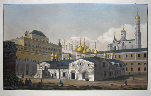
| Article ID | EUO2171 |
Title | no title |
Representation of the Kremel in Moscow - Print before letters | |
| Year | ca. 1780 |
Artist | Anonymus |
| Dimensions (cm) | 32,5 x 55 |
| Condition | Very good |
| Coloring | original colored |
| Technique | Copper print- Aquatinta |
:
346.50 €
( A reproduction can be ordered individually on request. )