

Adina Sommer
Antique and Contemporary Art
Winzerer Str. 154
80797 München
telephone
+49 89 304714
business hours:
by appointment
Email
![]()


No titel
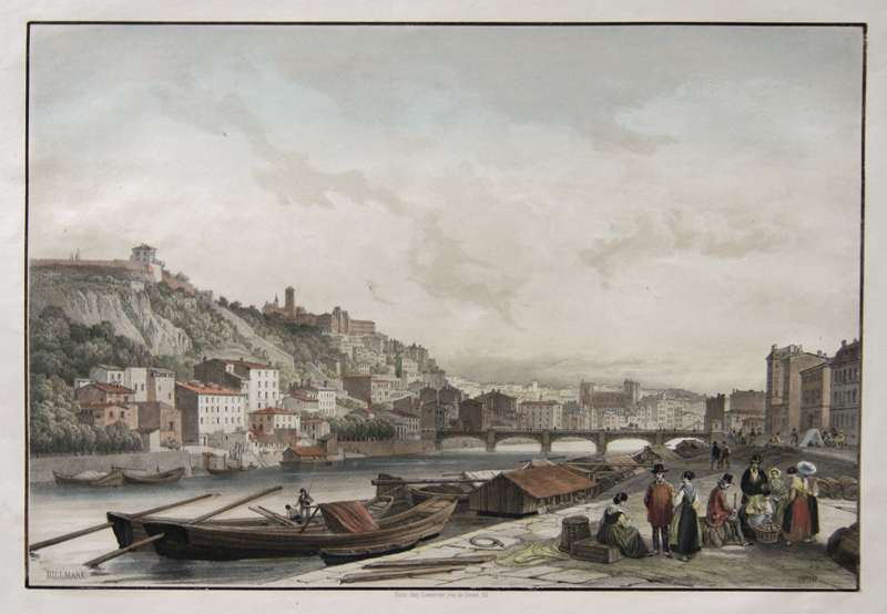
| Article ID | EUF3267 |
Title | No titel |
Decorative complete view of Lyon. | |
| Year | ca. 1860 |
Artist | Lemercier / Levasseur |
| Place of Publication | Paris |
| Dimensions (cm) | 19,5 x 28,5 |
| Condition | Tear at the right outer margin perfecrtly restored |
| Coloring | original colored |
| Technique | Lithography |
:
19.50 €
( A reproduction can be ordered individually on request. )