

Adina Sommer
Antique and Contemporary Art
Winzerer Str. 154
80797 München
telephone
+49 89 304714
business hours:
by appointment
Email
![]()


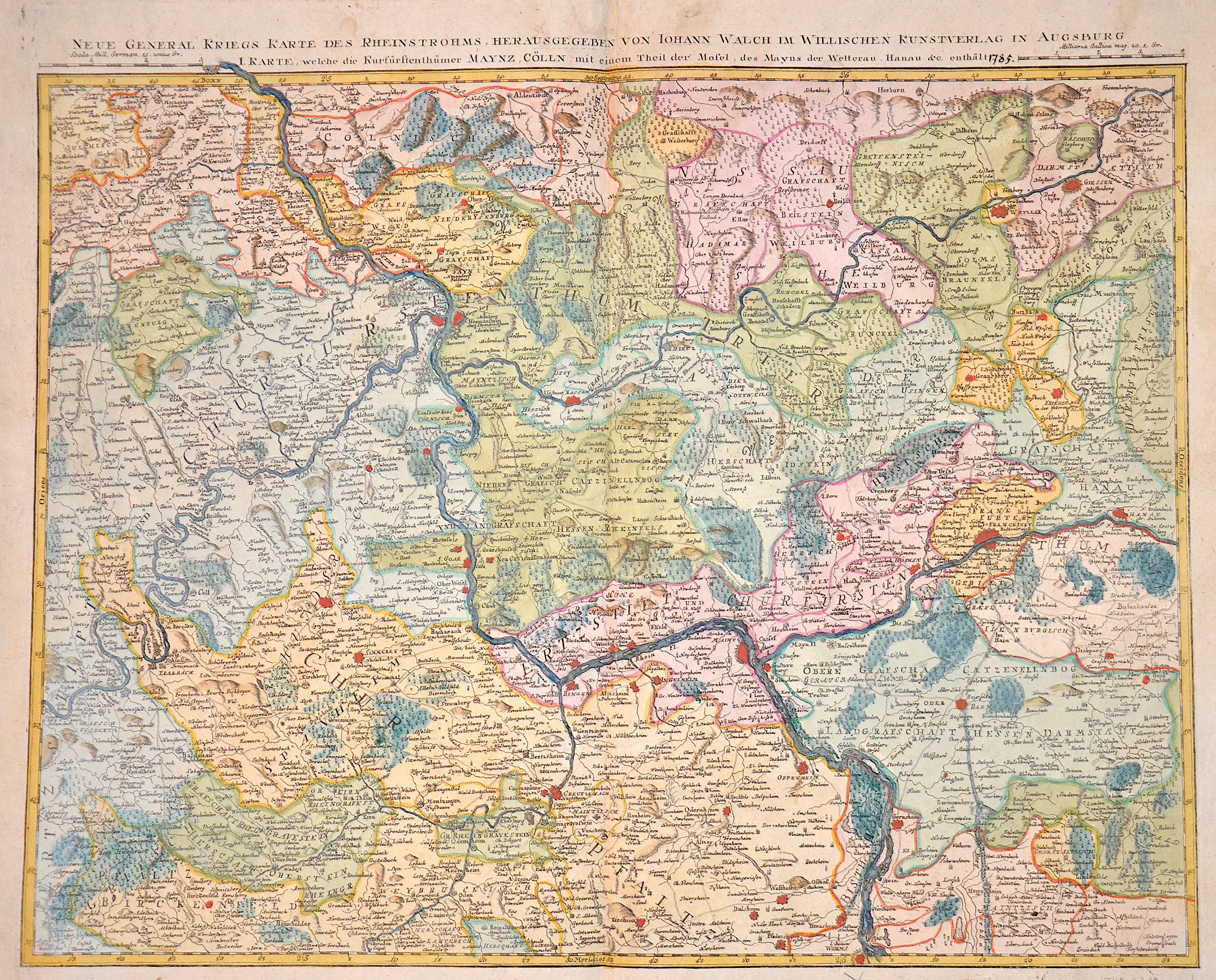
Neue general Kriegs Karte des Rheinstrohms, herraus gegeben von Iohann Walch …….

| Article ID | EUD2368 |
Title | Neue general Kriegs Karte des Rheinstrohms, herraus gegeben von Iohann Walch ……. |
Description | Map shows the course of the Rhine from Worms via Mainz, Koblenz, Andernach to Bonn. It also shows the Rhine-Lahn district with the towns of Nassau, Dietz, Limburg an der Lahn, Runkel, Villmar, Wetzlar, Gießen, etc. as well as the Main with Rüsselsheim, Frankfurt, Hanau and many more. |
| Year | ca. 1790 |
Artist | Walch (1757-1815) |
Johann Walch ( 1757 - 1815 Augsburg )in Kempten-Allgäu was a german painter, drawer, printer and publisher. He was the son of Sebastian Walch and married in 1786 the daughter of the printer and publisher Johann Martin Will and worked with his father in law. In 1789 he was able to pruchase the herritage material of the copper printer and publisher Matthäus Seutter und Tobias Conrad Lotter with 208 copper plates and 25000 maps material. With this material he expanded the company into the famous map publishing company called „Joh. Walch’sche Landkarten Handlung“. Later then, it was called "Druckerei Joh. Walch". | |
Historical Description | The Rhine is one of the most important rivers in Europe and has played a significant role in the history and development of the region. It connects several countries, including Switzerland, Germany, France, and the Netherlands. In ancient Europe, the Rhine was an important border, separating the Roman Empire from the Germanic tribes to the north. The Romans used the Rhine as a trade and transport route and built several fortresses along the river to secure their border, including the well-known Limes (border fortifications). The Rhine played a central role in the spread of Roman culture and civilization in the areas along the river. In the Middle Ages, the Rhine was not only an important trade route but also a strategic political point. Cities like Cologne, Mainz, and Speyer along the Rhine developed into important commercial centers. The river was a central part of the Holy Roman Empire and played a key role in the political power dynamics of the region. In the late 18th and early 19th centuries, the Rhine underwent profound changes. During the French Revolution and the Napoleonic Wars, the Rhineland came under French control, and after Napoleon's downfall, it was controlled by Prussia and other German states, becoming an important part of the newly formed German Confederation. In the 19th century, the Rhine experienced significant economic transformation. With the expansion of the railway network and industrialization, the river became an important trade route for raw materials such as coal and iron. Cities like Düsseldorf, Leverkusen, and Mannheim experienced enormous growth and became industrial centers that directly benefited from access to the Rhine. Thus, the course of the Rhine has not only geographical significance but also a profound political, cultural, and economic impact that spans thousands of years. It has shaped both conflict and cooperation and remains a key resource for the countries through which it flows. |
| Place of Publication | Augsburg |
| Dimensions (cm) | 48 x 59 cm |
| Condition | Very good |
| Coloring | original colored |
| Technique | Copper print |