

Adina Sommer
Antique and Contemporary Art
Winzerer Str. 154
80797 München
telephone
+49 89 304714
business hours:
by appointment
Email
![]()


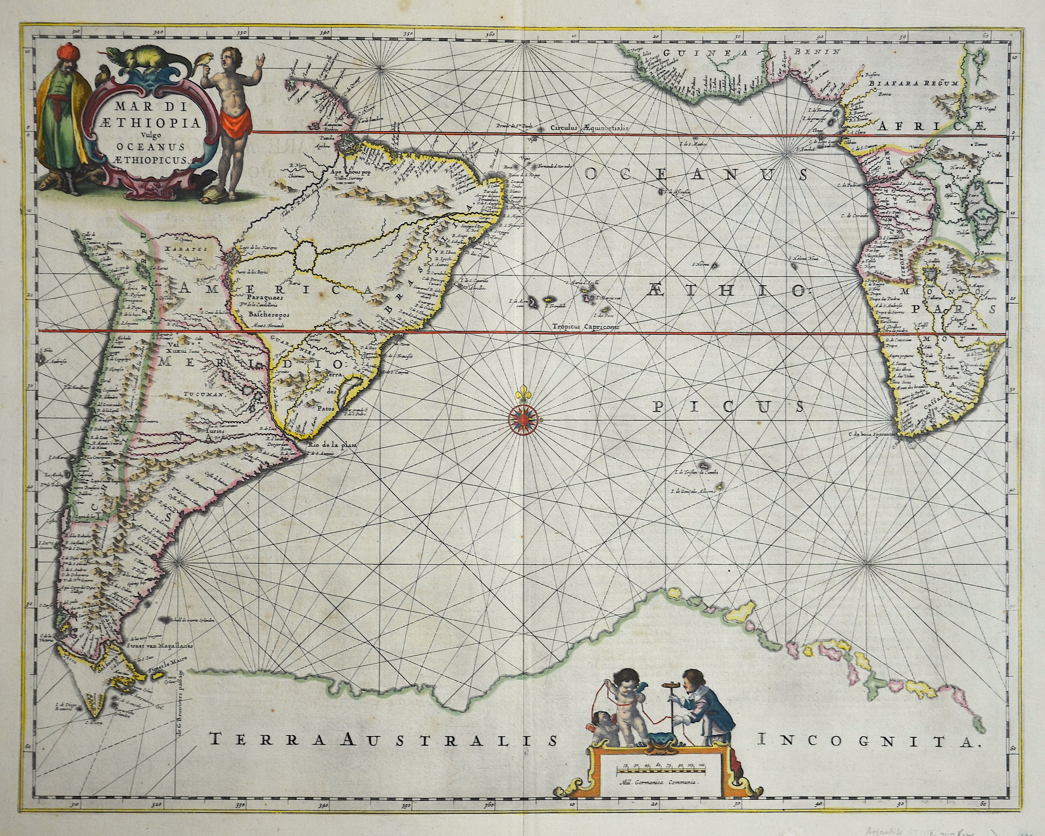
Mare di Aethipia vulgo Oceanus Aethiopicus

| Article ID | SE242 |
Title | Mare di Aethipia vulgo Oceanus Aethiopicus |
Description | Map shows the Atlantik with South West Africa and South America. |
| Year | ca. 1635 |
Artist | Janssonius (1588-1664) |
Johannes Janssonius (Jansson)( 1588- 1664) Amsterdam, was born in Arnhem, the son of Jan Janszoon the Elder, a publisher and bookseller. In 1612 he married Elisabeth de Hondt, the daughter of Jodocus Hondius. He produced his first maps in 1616 of France and Italy. In 1623 Janssonius owned a bookstore in Frankfurt am Main, later also in Danzig, Stockholm, Copenhagen, Berlin, Königsberg, Geneva and Lyon. In the 1630s he formed a partnership with his brother in law Henricus Hondius, and together they published atlases as Mercator/Hondius/Janssonius. Under the leadership of Janssonius the Hondius Atlas was steadily enlarged. Renamed Atlas Novus, it had three volumes in 1638, one fully dedicated to Italy. 1646 a fourth volume came out with ""English County Maps"", a year after a similar issue by Willem Blaeu. Janssonius' maps are similar to those of Blaeu, and he is often accused of copying from his rival, but many of his maps predate those of Blaeu and/or covered different regions. By 1660, at which point the atlas bore the appropriate name ""Atlas Major"", there were 11 volumes, containing the work of about a hundred credited authors and engravers. It included a description of ""most of the cities of the world"" (Townatlas), of the waterworld (Atlas Maritimus in 33 maps), and of the Ancient World (60 maps). The eleventh volume was the Atlas of the Heavens by Andreas Cellarius. Editions were printed in Dutch, Latin, French, and a few times in German. | |
Historical Description | For a long time in human history, the Atlantic was the great body of water that separated the "Old World" from the "New World." Covering an area of about 106 million square kilometers, the Atlantic Ocean makes up roughly one-fifth of the Earth's surface. Due to its vast size, the Atlantic is commonly divided into the North Atlantic and the South Atlantic. In the 17th century, the Atlantic Ocean was a central stage for global trade, colonialism, and naval power politics among the European powers. European countries such as Spain, Portugal, England, France, and the Netherlands used the Atlantic for their colonial ventures. The Americas, West Africa, and the Caribbean were interconnected through the Atlantic—economically, politically, and militarily. The transatlantic triangular trade flourished: European goods were brought to Africa, exchanged for enslaved people, who were then shipped to the Americas. From there, raw materials such as sugar, tobacco, or cotton were transported back to Europe. Thus, the Atlantic was also a major zone of intensive slave trade. The Atlantic routes were dangerous: in addition to natural hazards, there were also pirates and conflicts between rival colonial powers. By around 1680, the Atlantic had become the backbone of the emerging global economic system—shaped by colonialism, the slave trade, and naval power. It connected continents, but also spread violence, exploitation, and power struggles. After Christopher Columbus's first crossing in 1492, regular ocean crossings did not begin until the 19th century. People in Europe wanted to leave behind the poor living conditions of the time and start a new life in the rapidly developing Americas. This led to large waves of emigration.The first transatlantic steamship set sail from Bremerhaven on July 2, 1847. |
| Place of Publication | Amsterdam |
| Dimensions (cm) | 43 x 55 |
| Condition | Very good |
| Coloring | original colored |
| Technique | Copper print |