

Adina Sommer
Antique and Contemporary Art
Winzerer Str. 154
80797 München
telephone
+49 89 304714
business hours:
by appointment
Email
![]()


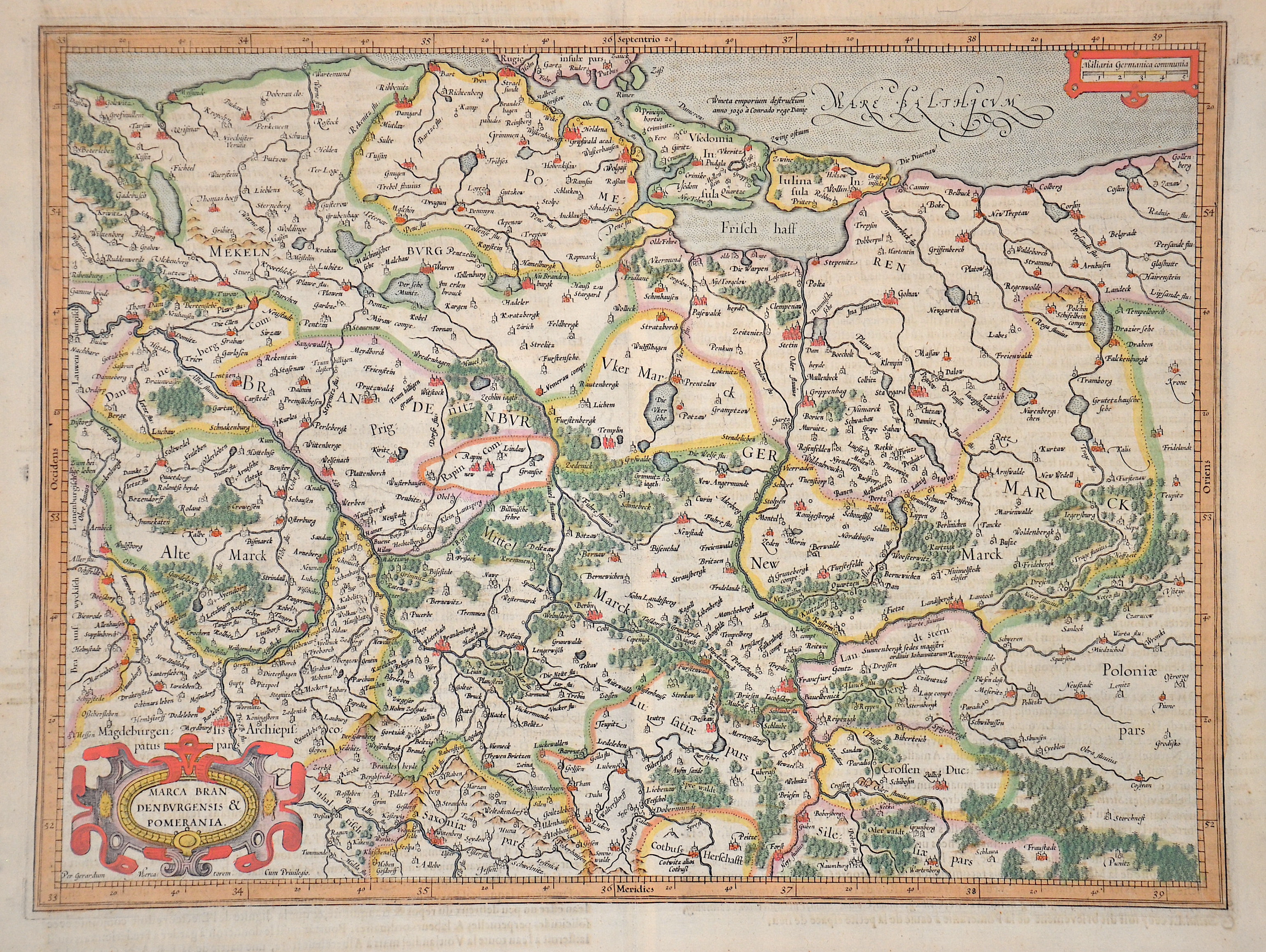
Marca Brandenburgensis und Pomerania.

| Article ID | EUD5345 |
Title | Marca Brandenburgensis und Pomerania. |
Description | Map shows Mark Brandenburg, with the historical regions: Altmarck, Neumarck, Uckermarck and Mecklenburg-Vorpommern with title and mileage cartouche. French text on the reverse. Author Gerhard Mercator, Jodokus Hondius and Hendrik Hondius. Published by Hendrik Hondius, Amsterdam. |
| Year | ca. 1619 |
Artist | Mercator (1512-1594) |
Gerardus Mercator (1512 - 1594). He was a cartographer, philosopher and mathematician. He is best known for his work in cartography, in particular the world map of 1569 based on a new projection which represented sailing courses of constant bearing as straight lines. He is renowned to the present day as the cartographer who created a world map based on a new projection which represented sailing courses of constant bearing as straight lines. In his own day he was the world's most famous geographer but in addition he had interests in theology, philosophy, history, mathematics and magnetism as well as being an accomplished engraver, calligrapher and maker of globes and scientific instruments. He wrote few books but much of his knowledge is to be found in the copious legends on his wall maps and the prefaces that he composed for his atlas ,the first in which the term "atlas" appears and the sections within it. | |
Historical Description | The province of Pomerania, located in the north German lowlands, was the Prussian province formed from the Duchy of Pomerania after the Vienna Congress in 1815. It consisted of western Pomerania and Western Pomerania. Pomerania's capital was Szczecin. Through the Peace of Westphalia in 1648, Hinterpommern came to Brandenburg and Vorpommern became Swedish-Pommern. The Brandenburg Elector Friedrich Wilhelm I succeeded in conquering all of Swedish Pomerania in 1678, but he had to forego the majority of the conquered areas under pressure from France in the Peace of Saint-Germain (1679). After the end of the Great Northern War (1700-1721), the part of Western Pomerania south of the Peene came to Prussia (Old Western Pomerania). During the territorial reorganization of Europe in 1815, the last part of Western Pomerania, which remained Swedish, became Prussian with the island of Rügen (New Western Pomerania). At the same time, Pomerania received the districts of Dramburg and Schivelbein as well as the northern parts of the Arnswalde district with the town of Nörenberg from the Neumark, which otherwise remained with the province of Brandenburg. |
| Place of Publication | Amsterdam |
| Dimensions (cm) | 35 x 47 cm |
| Condition | Some restoration at centerfold |
| Coloring | original colored |
| Technique | Copper print |
Reproduction:
43.50 €
( A reproduction can be ordered individually on request. )