

Adina Sommer
Antique and Contemporary Art
Winzerer Str. 154
80797 München
telephone
+49 89 304714
business hours:
by appointment
Email
![]()


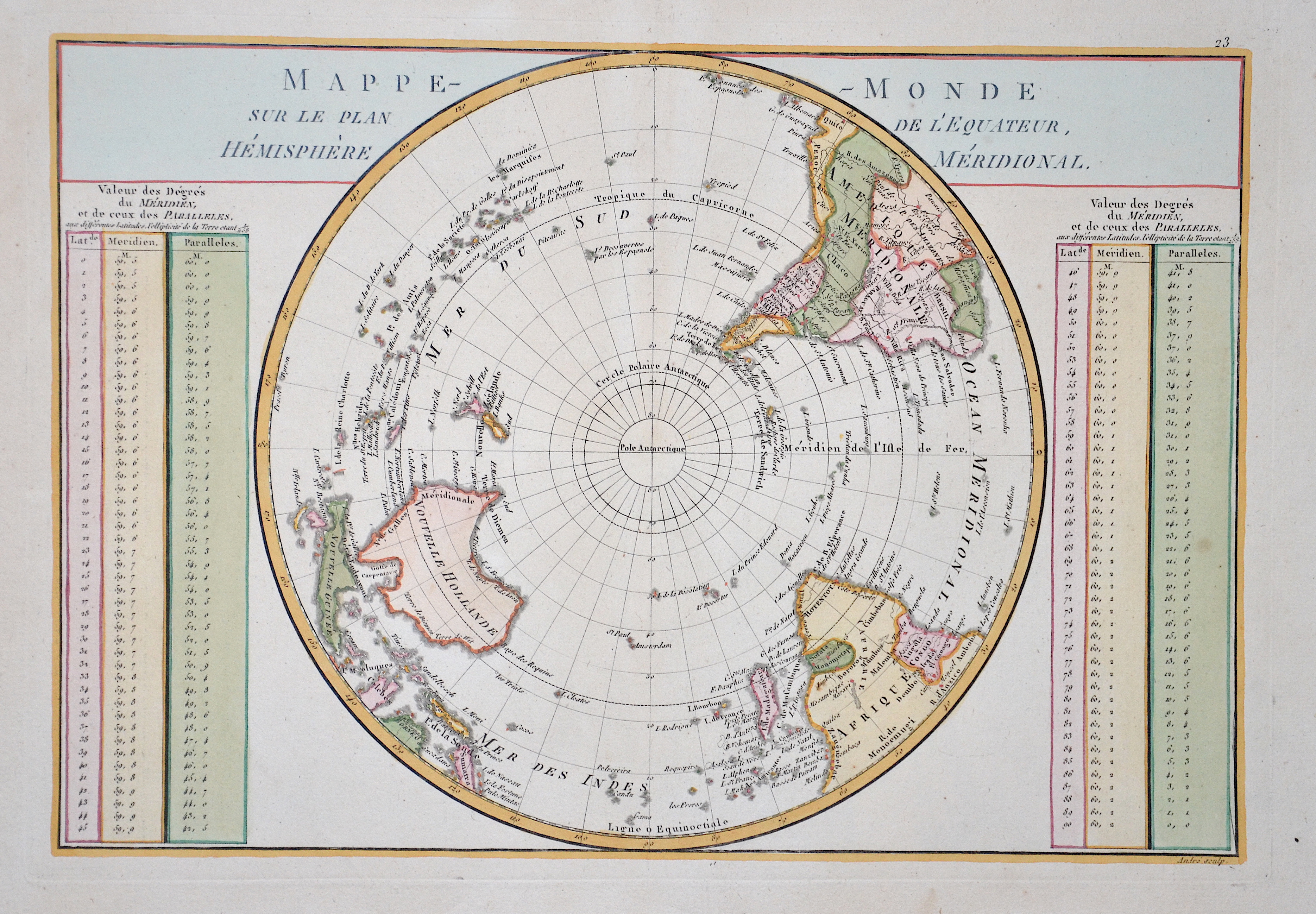
Mappe Monde sur le plan de l´ equateur, Hemisphere meridionale

| Article ID | PO230 |
Title | Mappe Monde sur le plan de l´ equateur, Hemisphere meridionale |
Description | Map shows the sout pole with Australia and New Zeeland. |
| Year | ca. 1750 |
Artist | Anonymus |
Historical Description | Situated on the continent of Antarctica, it is the site of the United States Amundsen–Scott South Pole Station, which was established in 1956 and has been permanently staffed since that year. The Geographic South Pole is distinct from the South Magnetic Pole, the position of which is defined based on Earth's magnetic field. The South Pole is at the center of the Southern Hemisphere. In 1820, several expeditions claimed to have been the first to have sighted Antarctica. The basic geography of the Antarctic coastline was not understood until the mid-to-late 19th century. American naval officer Charles Wilkes claimed correctly that Antarctica was a new continent, basing the claim on his exploration in 1839–40, while James Clark Ross, in his expedition of 1839–43, hoped that he might be able to sail all the way to the South Pole. British explorer Robert Falcon Scott on the Discovery Expedition of 1901–04 was the first to attempt to find a route from the Antarctic coastline to the South Pole. The first men to reach the Geographic South Pole were the Norwegian Roald Amundsen and his party on December 14, 1911. Amundsen named his camp Polheim and the entire plateau surrounding the Pole King Haakon VII Vidde in honour of King Haakon VII of Norway. |
| Dimensions (cm) | 24 x 35 |
| Condition | Very good |
| Coloring | colored |
| Technique | Copper print |