

Adina Sommer
Antique and Contemporary Art
Winzerer Str. 154
80797 München
telephone
+49 89 304714
business hours:
by appointment
Email
![]()


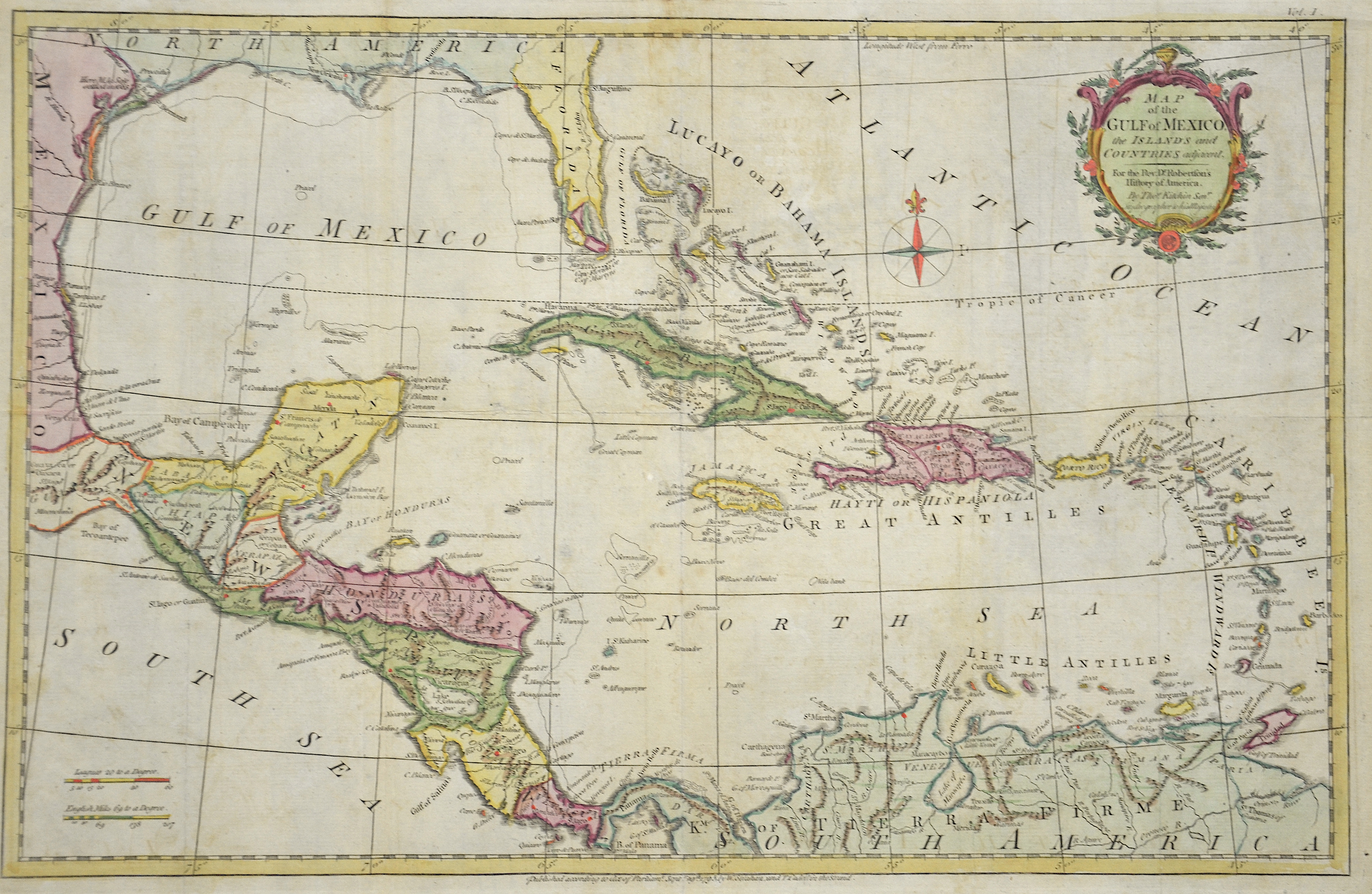
Map of the Gulf of Mexico, the islands and counties…

| Article ID | AMW237 |
Title | Map of the Gulf of Mexico, the islands and counties… |
Description | map of the Caribbean Islands. |
| Year | dated 1777 |
Artist | Kitchin (Kitchen) (1718-1784) |
Thomas Kitchin (or Thomas Kitchen (1718–1784) was an English engraver and cartographer, who became hydrographer to the king. He was also an author, who wrote about the history of the West Indies. He produced John Elphinstone's map of Scotland (1746), Geographia Scotiae (1749), and The Small English Atlas (1749) with Thomas Jefferys. The Large English Atlas (with Bowen 1749–60) was a serious attempt to cover England at large scale. In 1755 Kitchin engraved the Mitchell Map map of North AmericaHe worked for London Magazine. He produced 170 maps for London Magazine (1747–83). Kitchin was the head hydrographer for the King of England. Kitchin frequently stole the works of other cartographers, which is one reason why he created so much work as a cartographer. His book, The Present State of the West-Indies: Containing an Accurate Description of What Parts Are Possessed by the Several Powers in Europe was published in 1778 by R. Baldwin in London. | |
Historical Description | The Caribbean is named after the Caribs people, which the Spanish conquerors found in the Lesser Antilles (lat. Ante ilium, "offshore islands"). It was also called the West Indies because it was believed to have been discovered by sea directly to India. Before the discoveries in the 1st millennium BC Arawak Indians came from Venezuela to the Caribbean Islands. They spread northwards through Trinidad. They were followed around 1500 years later by the warlike Caribs, which the Arawak slowly pushed away from the Lesser Antilles. At the time of Christopher Columbus' voyages of discovery, the Arawak inhabited the islands of Cuba, Hispaniola and the Bahamas, while the Caribs lived in the Lesser Antilles. When Columbus landed in San Salvador (Bahamas) on behalf of the Spanish crown in 1492, he was primarily looking for gold and other riches. But the Arawak did not care what Europeans saw as wealth. So the Caribbean was settled, but the conquistadors soon moved to the American continent. Gradually, English, Dutch and French settled. Even Denmark, Sweden and Courland were owned by some colonies. St. Barthélemy was for excample. almost a century under Swedish rule. Many of the native Indians eventually fell victim to introduced diseases or slavery. The Caribbean was particularly active in the 17th and early 18th centuries for Buccaneers and Pirates (so-called Golden Age of Piracy). The small islands offered the pirates, some of whom were privateers commissioned by a king, numerous shelters, and the Spanish treasure fleets were a good and worthwhile target. Port Royal in Jamaica and the French settlement on Tortuga were real pirate settlements. |
| Dimensions (cm) | 31 x 47 |
| Condition | Very good |
| Coloring | colored |
| Technique | Copper print |