

Adina Sommer
Antique and Contemporary Art
Winzerer Str. 154
80797 München
telephone
+49 89 304714
business hours:
by appointment
Email
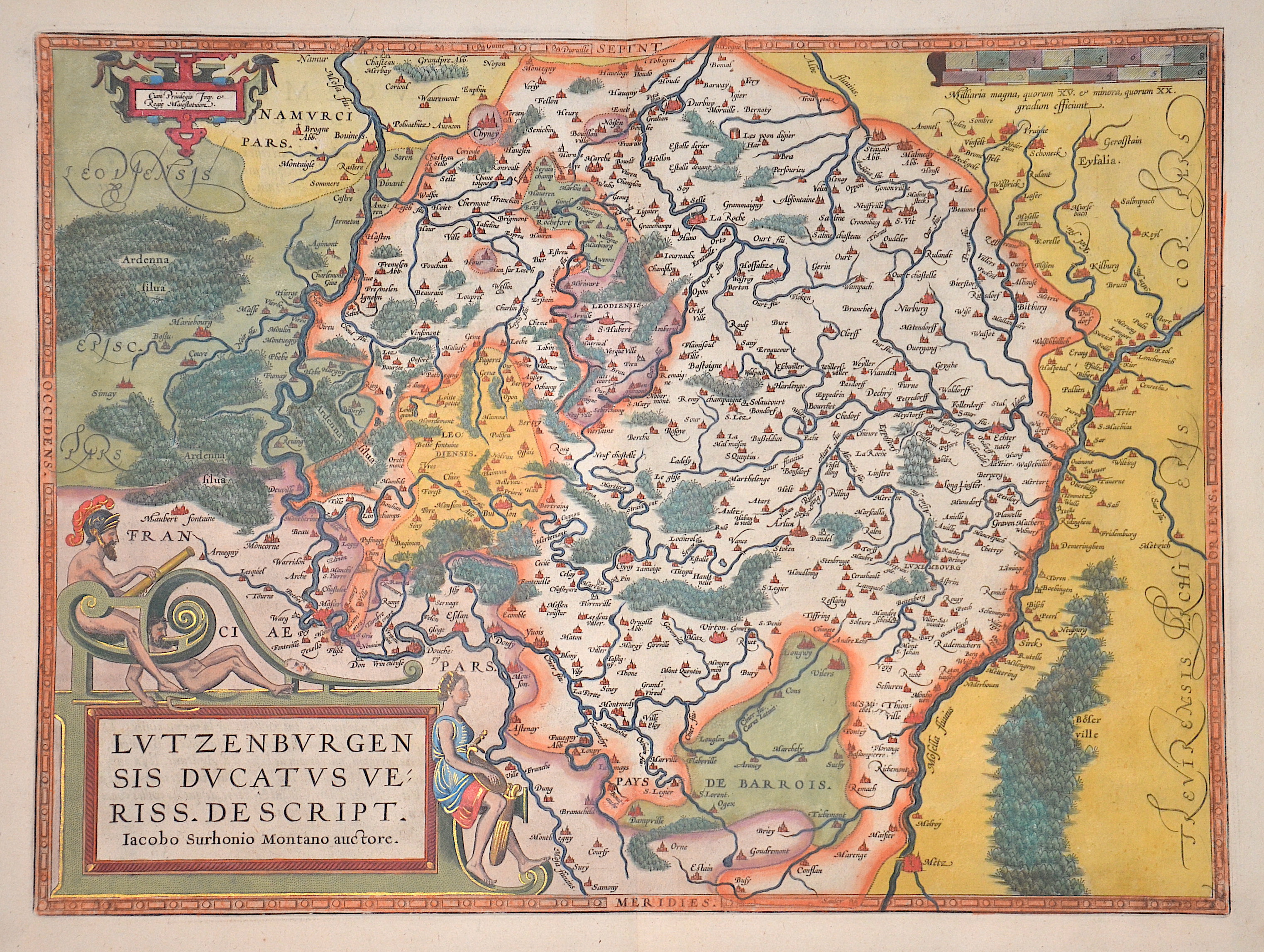
![]()


Lutzenburgensis Ducatus Veriss. Descript.

| Article ID | EUB1501 |
Title | Lutzenburgensis Ducatus Veriss. Descript. |
Description | Map shows the whole of Luxembourg with title cartouche and mileage indicator. French edition from Theatrum Orbis Terrarum. |
| Year | ca. 1587 |
Artist | Ortelius (1527-1598) |
Abraham Ortelius (1527–1598) was a Flemish cartographer and publisher from Antwerp. Originally a map colorist, he became a major figure in cartography through his Theatrum Orbis Terrarum (1570), considered the first modern atlas—a uniform collection of reliable maps in book form. Influenced by Gerardus Mercator, Ortelius published several maps before compiling the Theatrum, which clearly showed America as a separate continent. The work was published in 42 editions and 7 languages by 1612. Unlike many of his peers, Ortelius cited his sources, and his atlas became a milestone in mapmaking and geographic knowledge. | |
Historical Description | Luxembourg has undergone a remarkable development throughout its history. From a small county in the Middle Ages to a strategically important area during the major wars of Europe, and eventually to a modern, prosperous country within the European Union, Luxembourg has established itself as an independent and stable state. The early history of Luxembourg was strongly shaped by Roman and later Frankish rule. During the Roman period, the area was part of the empire, and in the Middle Ages, it belonged to the Frankish kingdoms. In 1354, the Holy Roman Emperor Charles IV elevated Luxembourg to a duchy, making it an important territorial possession in the Holy Roman Empire. In the 16th century, Luxembourg came under the control of the Habsburgs, who held both the Spanish and Austrian inheritances. Under Spanish rule, Luxembourg was used as a strategic point in the wars between Spain and the Netherlands. In 1795, during the French Revolution, Luxembourg was conquered by the French and incorporated into the French Empire. In 1839, after the Belgian Revolution, Luxembourg was divided between Belgium and the Kingdom of the Netherlands. The western part of the country fell to Belgium, while the eastern part remained with the Netherlands. This division shaped Luxembourg's modern geographical boundaries and gave it its current form. Today, Luxembourg is a constitutional monarchy and one of the wealthiest countries in the world. |
| Place of Publication | Antwerp |
| Dimensions (cm) | 36,5 x 49 cm |
| Condition | Very good |
| Coloring | original colored |
| Technique | Copper print |