

- Alsace
- Aquitaine
- Auvergne
- Bourgogne
- Bourgogne-Franche-Comte
- Brittany
- Centre
- Champagne
- Flandre
- France Islands
- Gascogne
- Gironde
- Hauts-de-France
- Ile de France
- Languedoc
- Lothringen
- Midi-Pyrénées
- Nivernais
- Nord-Pas-de-Calais
- Normandie
- Occitanie
- Paris
- Pas-de-Calais
- Pays de la Loire
- Picardie
- Poitou-Charentes
- Provence-Alpes-Cote d Azur
- Pyrénées
- Rhone- Alpes
- Saintonge
- Savoyen
- Tourain
- Westcoast
Adina Sommer
Antique and Contemporary Art
Winzerer Str. 154
80797 München
telephone
+49 89 304714
business hours:
by appointment
Email
![]()


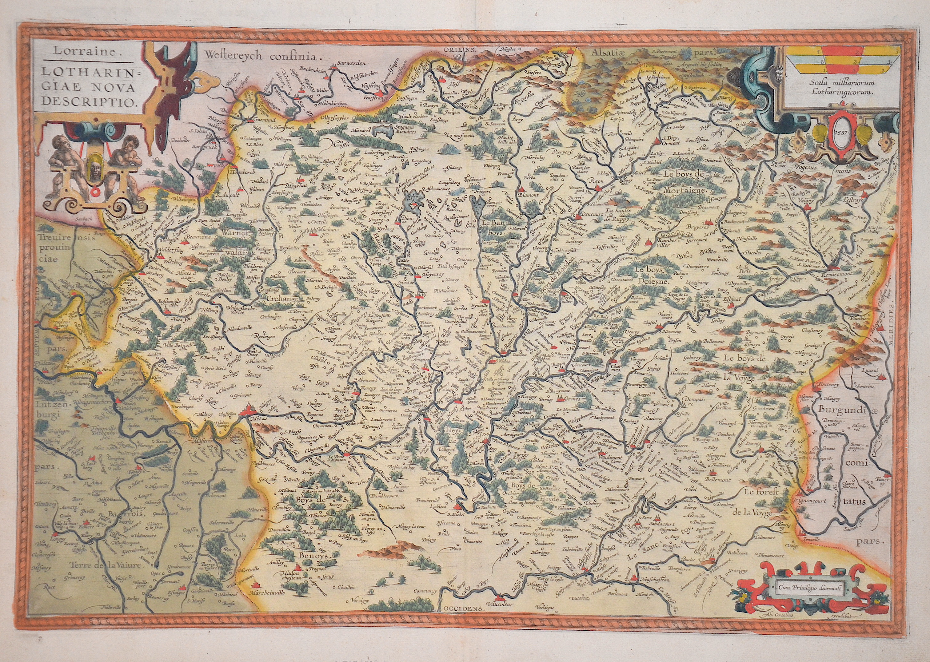
Lorraine. Lotharingiae nova descriptio.
| Article ID | EUF5157 |
Title | Lorraine. Lotharingiae nova descriptio. |
Map shows the former Lorraine region with its capital Metz in France with three cartouches. The cities of Nancy, Èpinal, Remiremont, Vaucoleur, Neuschateau, etc. are also depicted. Description in Latin on the reverse. | |
| Year | ca. 1595 |
Artist | Ortelius |
| Place of Publication | Antwerp |
| Dimensions (cm) | 34 x 50 cm |
| Condition | Perfect condition |
| Coloring | original colored |
| Technique | Copper print |
:
31.50 €
( A reproduction can be ordered individually on request. )